Raymond, Nebraska
| Raymond, Nebraska | |
|---|---|
| Village | |
|
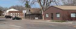
First Street in Raymond | |
 Location of Raymond, Nebraska | |
| Coordinates: 40°57′22″N 96°46′57″W / 40.95611°N 96.78250°WCoordinates: 40°57′22″N 96°46′57″W / 40.95611°N 96.78250°W | |
| Country | United States |
| State | Nebraska |
| County | Lancaster |
| Area[1] | |
| • Total | 0.13 sq mi (0.34 km2) |
| • Land | 0.13 sq mi (0.34 km2) |
| • Water | 0 sq mi (0 km2) |
| Elevation | 1,224 ft (373 m) |
| Population (2010)[2] | |
| • Total | 167 |
| • Estimate (2012[3]) | 178 |
| • Density | 1,284.6/sq mi (496.0/km2) |
| Time zone | Central (CST) (UTC-6) |
| • Summer (DST) | CDT (UTC-5) |
| ZIP code | 68428 |
| Area code(s) | 402 |
| FIPS code | 31-40780[4] |
| GNIS feature ID | 0832478[5] |
Raymond is a village in Lancaster County, Nebraska. It is part of the Lincoln, Nebraska Metropolitan Statistical Area. The population was 167 at the 2010 census.
History
Raymond was platted in 1880 when the railroad was extended to that point.[6][7] It was named for I. M. Raymond, a railroad official.[7][8][9]
Geography
Raymond is located at 40°57′22″N 96°46′57″W / 40.95611°N 96.78250°W (40.956247, -96.782490).[10]
According to the United States Census Bureau, the village has a total area of 0.13 square miles (0.34 km2), all of it land.[1]
Demographics
| Historical population | |||
|---|---|---|---|
| Census | Pop. | %± | |
| 1900 | 200 | — | |
| 1910 | 236 | 18.0% | |
| 1920 | 249 | 5.5% | |
| 1930 | 205 | −17.7% | |
| 1940 | 199 | −2.9% | |
| 1950 | 196 | −1.5% | |
| 1960 | 223 | 13.8% | |
| 1970 | 187 | −16.1% | |
| 1980 | 179 | −4.3% | |
| 1990 | 167 | −6.7% | |
| 2000 | 186 | 11.4% | |
| 2010 | 167 | −10.2% | |
| Est. 2015 | 185 | [11] | 10.8% |
2010 census
As of the census[2] of 2010, there were 167 people, 71 households, and 45 families residing in the village. The population density was 1,284.6 inhabitants per square mile (496.0/km2). There were 76 housing units at an average density of 584.6 per square mile (225.7/km2). The racial makeup of the village was 95.8% White, 0.6% African American, 1.2% Asian, and 2.4% from two or more races.
There were 71 households of which 28.2% had children under the age of 18 living with them, 54.9% were married couples living together, 4.2% had a female householder with no husband present, 4.2% had a male householder with no wife present, and 36.6% were non-families. 28.2% of all households were made up of individuals and 11.2% had someone living alone who was 65 years of age or older. The average household size was 2.35 and the average family size was 2.93.
The median age in the village was 45.2 years. 21.6% of residents were under the age of 18; 7.2% were between the ages of 18 and 24; 21% were from 25 to 44; 42% were from 45 to 64; and 8.4% were 65 years of age or older. The gender makeup of the village was 54.5% male and 45.5% female.
2000 census
As of the census[4] of 2000, there were 186 people, 73 households, and 51 families residing in the village. The population density was 1,450.0 people per square mile (552.4/km²). There were 75 housing units at an average density of 584.7 per square mile (222.8/km²). The racial makeup of the village was 97.85% White, 0.54% African American, and 1.61% from two or more races.
There were 73 households out of which 39.7% had children under the age of 18 living with them, 58.9% were married couples living together, 8.2% had a female householder with no husband present, and 28.8% were non-families. 26.0% of all households were made up of individuals and 11.0% had someone living alone who was 65 years of age or older. The average household size was 2.55 and the average family size was 3.04.
In the village the population was spread out with 28.5% under the age of 18, 8.6% from 18 to 24, 32.8% from 25 to 44, 21.5% from 45 to 64, and 8.6% who were 65 years of age or older. The median age was 36 years. For every 100 females there were 97.9 males. For every 100 females age 18 and over, there were 104.6 males.
As of 2000 the median income for a household in the village was $53,750, and the median income for a family was $57,188. Males had a median income of $41,250 versus $24,083 for females. The per capita income for the village was $21,672. None of the families and 2.9% of the population were living below the poverty line, including no under eighteens and 14.3% of those over 64.
References
- 1 2 "US Gazetteer files 2010". United States Census Bureau. Retrieved 2012-06-24.
- 1 2 "American FactFinder". United States Census Bureau. Retrieved 2012-06-24.
- ↑ "Population Estimates". United States Census Bureau. Retrieved 2013-05-29.
- 1 2 "American FactFinder". United States Census Bureau. Retrieved 2008-01-31.
- ↑ "US Board on Geographic Names". United States Geological Survey. 2007-10-25. Retrieved 2008-01-31.
- ↑ Burr, George L. (1921). History of Hamilton and Clay Counties, Nebraska, Volume 1. S.J. Clarke Publishing Company. p. 126.
- 1 2 "Raymond, Lancaster County". Center for Advanced Land Management Information Technologies. University of Nebraska. Retrieved 19 August 2014.
- ↑ "Profile for Raymond, NE". ePodunk. Retrieved 19 August 2014.
- ↑ Fitzpatrick, Lillian L. (1960). Nebraska Place-Names. University of Nebraska Press. p. 93. ISBN 0-8032-5060-6. A 1925 edition is available for download at University of Nebraska—Lincoln Digital Commons.
- ↑ "US Gazetteer files: 2010, 2000, and 1990". United States Census Bureau. 2011-02-12. Retrieved 2011-04-23.
- ↑ "Annual Estimates of the Resident Population for Incorporated Places: April 1, 2010 to July 1, 2015". Retrieved July 2, 2016.
- ↑ "Census of Population and Housing". Census.gov. Retrieved June 4, 2015.
Municipalities and communities of Lancaster County, Nebraska, United States | ||
|---|---|---|
| Cities | ||
| Villages | ||
| CDPs |
| |
| Other unincorporated communities | ||
| Footnotes | ‡This populated place also has portions in an adjacent county or counties | |