Reisterstown Historic District
|
Reisterstown Historic District | |
|
Reisterstown Rd, Reisterstown Historic District, December 2009 | |
  | |
| Location | U.S. 140 and MD 30, Reisterstown, Maryland |
|---|---|
| Coordinates | 39°27′49″N 76°49′32″W / 39.46361°N 76.82556°WCoordinates: 39°27′49″N 76°49′32″W / 39.46361°N 76.82556°W |
| Area | 154 acres (62 ha) |
| Built | 1758 |
| Architectural style | Late Victorian |
| NRHP Reference # | 79001118[1] |
| Added to NRHP | November 15, 1979 |
Reisterstown Historic District is a national historic district in Reisterstown, Baltimore County, Maryland, United States. Its development is inseparably identified with the roads that converge to form Main Street. They are Maryland Route 30 and Maryland Route 140. The earliest structures, including several of log, date to the late 18th century, although the town was founded in 1758. It developed as a convenient stopping place for weary travelers from the outer reaches of Western Maryland or Pennsylvania and many businesses catered to the traveler: including taverns and inns, smithshops, saddleries, stables, waggoners.[2]
It was added to the National Register of Historic Places in 1979.[1]

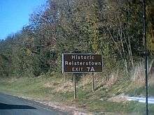
Exit Sign on I-795 (7a)
References
- 1 2 National Park Service (2009-03-13). "National Register Information System". National Register of Historic Places. National Park Service.
- ↑ James T. Wollon; Cornelia Ives & Carol Pollack (May 2005). "National Register of Historic Places Registration: Reisterstown Historic District" (PDF). Maryland Historical Trust. Retrieved 2016-03-01.
External links
- Reisterstown Historic District, Baltimore County, including photo from 2006, at Maryland Historical Trust
- Boundary Map of the Reisterstown Historic District, Baltimore County, at Maryland Historical Trust
This article is issued from Wikipedia - version of the 11/28/2016. The text is available under the Creative Commons Attribution/Share Alike but additional terms may apply for the media files.

