| [3] |
Name on the Register[4] |
Image |
Date listed[5] |
Location |
City or town |
Description |
|---|
| 1 |
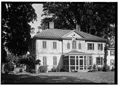
Bohemia Farm |
|
000000001973-04-11-0000April 11, 1973
(#73000912) |
4920 Augustine Herman Highway; 1 mile south of the Bohemia River off Maryland Route 213
39°27′01″N 75°51′44″W / 39.450278°N 75.862222°W / 39.450278; -75.862222 (Bohemia Farm) |
Earleville |
|
| 2 |
Jeremiah Brown House and Mill Site |
|
000000001987-11-02-0000November 2, 1987
(#87001391) |
1416 Telegraph Rd.
39°42′13″N 76°00′15″W / 39.703611°N 76.004167°W / 39.703611; -76.004167 (Jeremiah Brown House and Mill Site) |
Rising Sun |
|
| 3 |
Mercer Brown House |
|
000000001987-05-29-0000May 29, 1987
(#87000815) |
1270 England Creamery Rd.
39°41′28″N 75°59′52″W / 39.691111°N 75.997778°W / 39.691111; -75.997778 (Mercer Brown House) |
Rising Sun |
|
| 4 |
Bumpstead Archeological Site |
|
000000001983-12-16-0000December 16, 1983
(#83003745) |
Address Restricted
|
Elkton |
|
| 5 |
Charlestown Historic District |
|
000000001975-04-14-0000April 14, 1975
(#75000880) |
Bounded by Tasker and Ogle Sts., Louisa Lane, and the North East River
39°34′26″N 75°58′32″W / 39.573889°N 75.975556°W / 39.573889; -75.975556 (Charlestown Historic District) |
Charlestown |
|
| 6 |
John Churchman House |
|
000000001986-09-11-0000September 11, 1986
(#86002337) |
115 Churchman Ln.
39°42′46″N 75°58′36″W / 39.712778°N 75.976667°W / 39.712778; -75.976667 (John Churchman House) |
Calvert |
|
| 7 |
Colora Meetinghouse |
|
000000001977-08-22-0000August 22, 1977
(#77000689) |
Corncake Row; North of Colora on Lipencott Rd.
39°40′32″N 76°05′56″W / 39.675556°N 76.098889°W / 39.675556; -76.098889 (Colora Meetinghouse) |
Colora |
|
| 8 |
East Nottingham Friends Meetinghouse |
|
000000001977-08-19-0000August 19, 1977
(#77000691) |
East of Rising Sun at the junction of Maryland Routes 272 and 273
39°42′04″N 75°59′00″W / 39.701111°N 75.983333°W / 39.701111; -75.983333 (East Nottingham Friends Meetinghouse) |
Rising Sun |
|
| 9 |
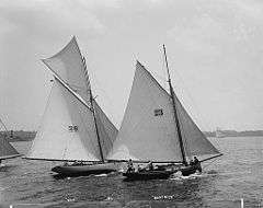
THE ELF (yacht) |
|
000000001980-03-26-0000March 26, 1980
(#80001807) |
Sassafras River
39°21′43″N 75°53′13″W / 39.361944°N 75.886944°W / 39.361944; -75.886944 (THE ELF (yacht)) |
Fredericktown |
|
| 10 |
Elk Landing |
|
000000001984-09-07-0000September 7, 1984
(#84001596) |
Landing Lane
39°35′45″N 75°50′28″W / 39.595833°N 75.841111°W / 39.595833; -75.841111 (Elk Landing) |
Elkton |
|
| 11 |
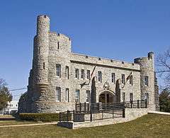
Elkton Armory |
|
000000001985-09-25-0000September 25, 1985
(#85002670) |
Railroad Ave. and Bow St.
39°36′41″N 75°49′52″W / 39.61141°N 75.83122°W / 39.61141; -75.83122 (Elkton Armory) |
Elkton |
|
| 12 |
Isaac England House |
|
000000001980-03-20-0000March 20, 1980
(#80001808) |
1000 Crothers Road; 1 mile west of Zion on England Creamery Rd.
39°40′29″N 75°59′08″W / 39.674722°N 75.985556°W / 39.674722; -75.985556 (Isaac England House) |
Zion |
|
| 13 |
Gilpin's Falls Covered Bridge |
|
000000002008-12-03-0000December 3, 2008
(#08001125) |
Maryland Route 272
39°38′56″N 75°57′20″W / 39.648833°N 75.955583°W / 39.648833; -75.955583 (Gilpin's Falls Covered Bridge) |
North East |
|
| 14 |
Grear Prehistoric Village Site |
|
000000001975-07-30-0000July 30, 1975
(#75000882) |
Address Restricted
|
White Crystal Beach |
|
| 15 |
Great House |
|
000000001984-06-07-0000June 7, 1984
(#84001598) |
284 Great House Farm Rd.
39°27′56″N 75°49′37″W / 39.465556°N 75.826944°W / 39.465556; -75.826944 (Great House) |
St. Augustine |
|
| 16 |
Greenfields |
|
000000001972-02-11-0000February 11, 1972
(#72000574) |
South of Cecilton at 6840 Augustine Herman Highway on Maryland Route 213
39°23′21″N 75°51′54″W / 39.389167°N 75.865°W / 39.389167; -75.865 (Greenfields) |
Cecilton |
|
| 17 |
Nathan and Susannah Harris House |
|
000000001984-03-22-0000March 22, 1984
(#84001602) |
541 Rising Sun Rd.
39°41′45″N 76°04′53″W / 39.695833°N 76.081389°W / 39.695833; -76.081389 (Nathan and Susannah Harris House) |
Harrisville |
|
| 18 |
Edward W. Haviland House |
|
000000002000-12-07-0000December 7, 2000
(#00001480) |
2464 Frenchtown Rd.
39°36′22″N 76°06′06″W / 39.606111°N 76.101667°W / 39.606111; -76.101667 (Edward W. Haviland House) |
Port Deposit |
|
| 19 |
Heath Farm Camp Archeological Site |
|
000000001983-12-16-0000December 16, 1983
(#83003747) |
Address Restricted
|
Elkton |
|
| 20 |
Heath Farm Jasper Quarry Archeological Site |
|
000000001983-12-16-0000December 16, 1983
(#83003753) |
Address Restricted
|
Elkton |
|
| 21 |
Holly Hall |
|
000000001976-10-08-0000October 8, 1976
(#76000986) |
259 S. Bridge St.
39°36′08″N 75°49′41″W / 39.602222°N 75.828056°W / 39.602222; -75.828056 (Holly Hall) |
Elkton |
|
| 22 |
Hopewell |
|
000000001979-05-09-0000May 9, 1979
(#79001120) |
Northwest of Providence at 594 Little Elk Creek Road
39°42′49″N 75°54′08″W / 39.713611°N 75.902222°W / 39.713611; -75.902222 (Hopewell) |
Providence |
|
| 23 |
Indian Queen Tavern and Black's Store |
|
000000001975-02-20-0000February 20, 1975
(#75000881) |
Market St. between Bladen and Cecil Sts.
39°34′27″N 75°58′39″W / 39.574167°N 75.9775°W / 39.574167; -75.9775 (Indian Queen Tavern and Black's Store) |
Charlestown |
|
| 24 |
Iron Hill Cut Jasper Quarry Archeological Site |
|
000000001983-12-16-0000December 16, 1983
(#83003754) |
Address Restricted
|
Elkton |
|
| 25 |
Elisha Kirk House |
|
000000001982-07-21-0000July 21, 1982
(#82002809) |
18 Cross Keys Road
39°41′55″N 75°59′04″W / 39.698611°N 75.984444°W / 39.698611; -75.984444 (Elisha Kirk House) |
Calvert |
|
| 26 |
Little Elk Farm |
|
000000001979-05-09-0000May 9, 1979
(#79001121) |
Northwest of Providence at 392 Little Elk Creek Road
39°42′29″N 75°54′07″W / 39.708056°N 75.901944°W / 39.708056; -75.901944 (Little Elk Farm) |
Providence |
|
| 27 |
Joshua Lowe House |
|
000000002001-04-05-0000April 5, 2001
(#01000337) |
35 New Bridge Rd.
39°42′54″N 76°09′29″W / 39.715°N 76.158056°W / 39.715; -76.158056 (Joshua Lowe House) |
Rising Sun |
|
| 28 |
McCandless Archeological Site |
|
000000001983-12-16-0000December 16, 1983
(#83003775) |
Address Restricted
|
Elkton |
|
| 29 |
Mitchell House |
|
000000001980-04-11-0000April 11, 1980
(#80001806) |
3370 Singerly Road (213)
39°42′08″N 75°52′06″W / 39.702222°N 75.868333°W / 39.702222; -75.868333 (Mitchell House) |
Fair Hill |
|
| 30 |
Mitchell House |
|
000000001976-05-13-0000May 13, 1976
(#76000987) |
131 E. Main St.
39°36′31″N 75°49′41″W / 39.60866°N 75.82817°W / 39.60866; -75.82817 (Mitchell House) |
Elkton |
|
| 31 |
Mount Harmon |
|
000000001974-06-05-0000June 5, 1974
(#74000945) |
Southwest of Earleville at 600 Grove Neck Rd.
39°23′02″N 75°56′29″W / 39.383889°N 75.941389°W / 39.383889; -75.941389 (Mount Harmon) |
Earleville |
|
| 32 |
New Castle and Frenchtown Railroad Right-of-Way |
|
000000001976-09-01-0000September 1, 1976
(#76002290) |
Off U.S. Route 40 between Porter, Delaware and Frenchtown
39°35′37″N 75°45′54″W / 39.593611°N 75.765°W / 39.593611; -75.765 (New Castle and Frenchtown Railroad Right-of-Way) |
Frenchtown |
|
| 33 |
Octorara Farm |
|
000000001980-05-07-0000May 7, 1980
(#80001805) |
South of Conowing on Rowlandsville Road
39°40′19″N 76°09′04″W / 39.671944°N 76.151111°W / 39.671944; -76.151111 (Octorara Farm) |
Conowingo |
|
| 34 |
Old Lock Pump House, Chesapeake and Delaware Canal |
|
000000001966-10-15-0000October 15, 1966
(#66000390) |
Maryland Route 213
39°31′32″N 75°48′39″W / 39.525556°N 75.810833°W / 39.525556; -75.810833 (Old Lock Pump House, Chesapeake and Delaware Canal) |
Chesapeake City |
|
| 35 |
Paw Paw Building |
|
000000001977-11-28-0000November 28, 1977
(#77000690) |
98 N. Main St.
39°36′28″N 76°07′07″W / 39.607778°N 76.118611°W / 39.607778; -76.118611 (Paw Paw Building) |
Port Deposit |
|
| 36 |
Perry Point Mansion House and Mill |
|
000000001975-07-02-0000July 2, 1975
(#75000883) |
Veterans Administration Hospital grounds
39°32′58″N 76°04′15″W / 39.549444°N 76.070833°W / 39.549444; -76.070833 (Perry Point Mansion House and Mill) |
Perryville |
|
| 37 |
Port Deposit |
|
000000001978-05-23-0000May 23, 1978
(#78001452) |
Eastern bank of the Susquehanna River, 10 miles (16 km) south of the Mason–Dixon line
39°36′32″N 76°07′09″W / 39.608889°N 76.119167°W / 39.608889; -76.119167 (Port Deposit) |
Port Deposit |
|
| 38 |
Principio Furnace |
|
000000001972-02-11-0000February 11, 1972
(#72000575) |
Address Restricted
39°34′38″N 76°02′11″W / 39.5772141°N 76.0364843°W / 39.5772141; -76.0364843 (Principio Furnace) |
Perryville |
|
| 39 |
Thomas Richards House |
|
000000001979-12-19-0000December 19, 1979
(#79001122) |
3 miles west of Rising Sun on U.S. Route 1
39°41′34″N 76°06′41″W / 39.692778°N 76.111389°W / 39.692778; -76.111389 (Thomas Richards House) |
Rising Sun |
|
| 40 |
Rock United Presbyterian Church |
|
000000001983-12-01-0000December 1, 1983
(#83003776) |
Maryland Route 273 at Rock Church Rd.
39°42′07″N 75°53′09″W / 39.701944°N 75.885833°W / 39.701944; -75.885833 (Rock United Presbyterian Church) |
Elkton |
|
| 41 |
Rodgers Tavern |
|
000000001972-04-26-0000April 26, 1972
(#72000576) |
W. Main St.
39°33′26″N 76°04′42″W / 39.557222°N 76.078333°W / 39.557222; -76.078333 (Rodgers Tavern) |
Perryville |
|
| 42 |
Rose Hill |
|
000000001974-11-05-0000November 5, 1974
(#74000946) |
1100 Grove Neck Rd.
39°23′23″N 75°57′18″W / 39.389722°N 75.955°W / 39.389722; -75.955 (Rose Hill) |
Earleville |
|
| 43 |
Snow Hill Site |
|
000000001984-04-27-0000April 27, 1984
(#84001758) |
Address Restricted
|
Port Deposit |
|
| 44 |
South Chesapeake City Historic District |
|
000000001974-07-15-0000July 15, 1974
(#74000944) |
East of Maryland Route 213, south of the Chesapeake and Delaware Canal
39°31′37″N 75°48′51″W / 39.526944°N 75.814167°W / 39.526944; -75.814167 (South Chesapeake City Historic District) |
Chesapeake City |
|
| 45 |
St. Francis Xavier Church |
|
000000001975-10-10-0000October 10, 1975
(#75000884) |
1445 Bohemia Church Road
39°26′16″N 75°48′12″W / 39.437778°N 75.803333°W / 39.437778; -75.803333 (St. Francis Xavier Church) |
Warwick |
|
| 46 |
St. Stephen's Episcopal Church |
|
000000001982-04-29-0000April 29, 1982
(#82002810) |
North of Earleville on Maryland Route 282
39°25′31″N 75°55′06″W / 39.425278°N 75.918333°W / 39.425278; -75.918333 (St. Stephen's Episcopal Church) |
Earleville |
|
| 47 |
Tome School for Boys Historic District |
|
000000001984-05-16-0000May 16, 1984
(#84001760) |
Bainbridge Naval Training Grounds
39°36′10″N 76°06′26″W / 39.602778°N 76.107222°W / 39.602778; -76.107222 (Tome School for Boys Historic District) |
Port Deposit |
|
| 48 |
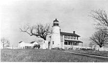
Turkey Point Light Station |
|
000000002002-12-02-0000December 2, 2002
(#02001421) |
South Elk Neck State Park
39°26′59″N 76°00′32″W / 39.449722°N 76.008889°W / 39.449722; -76.008889 (Turkey Point Light Station) |
North East |
|
| 49 |
West Nottingham Academy Historic District |
|
000000001990-07-26-0000July 26, 1990
(#90001125) |
Junction of Harrisville and Firetower Rds.
39°40′01″N 76°04′49″W / 39.666944°N 76.080278°W / 39.666944; -76.080278 (West Nottingham Academy Historic District) |
Colora |
|
| 50 |
West Nottingham Meetinghouse |
|
000000001976-11-07-0000November 7, 1976
(#76000988) |
Southwest of Rising Sun at the junction of Cox and Cowen Rds.
39°41′12″N 76°04′46″W / 39.686667°N 76.079444°W / 39.686667; -76.079444 (West Nottingham Meetinghouse) |
Rising Sun |
|
| 51 |
Woodlands |
|
000000001979-09-24-0000September 24, 1979
(#79003274) |
93 Millcreek Lane
39°34′12″N 76°03′27″W / 39.57°N 76.0575°W / 39.57; -76.0575 (Woodlands) |
Perryville |
|
