Richfield, Idaho
| Richfield, Idaho | |
|---|---|
| City | |
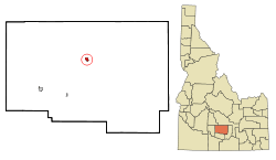 Location of Richfield, Idaho | |
| Coordinates: 43°3′9″N 114°9′11″W / 43.05250°N 114.15306°WCoordinates: 43°3′9″N 114°9′11″W / 43.05250°N 114.15306°W | |
| Country | United States |
| State | Idaho |
| County | Lincoln |
| Area[1] | |
| • Total | 0.66 sq mi (1.71 km2) |
| • Land | 0.66 sq mi (1.71 km2) |
| • Water | 0 sq mi (0 km2) |
| Elevation | 4,298 ft (1,310 m) |
| Population (2010)[2] | |
| • Total | 482 |
| • Estimate (2012[3]) | 485 |
| • Density | 730.3/sq mi (282.0/km2) |
| Time zone | Mountain (MST) (UTC-7) |
| • Summer (DST) | MDT (UTC-6) |
| ZIP code | 83349 |
| Area code(s) | 208 |
| FIPS code | 16-67600 |
| GNIS feature ID | 0398042 |
| Website | http://www.cityofrichfield.us/ |
Richfield is a city in Lincoln County, Idaho, in the United States. The population was 482 at the 2010 census.
Geography
Richfield is located at 43°3′9″N 114°9′11″W / 43.05250°N 114.15306°W (43.052629, -114.153041).[4]
According to the United States Census Bureau, the city has a total area of 0.66 square miles (1.71 km2), all of it land.[1]
The Little Wood River flows nearby, and the Richfield region is supplied with irrigation water diverted from the Big Wood River near Magic Reservoir.
History
A book about the History of the Richfield area was written in 1995 by Alice Crane Behr and Maureen Hancock Ward. It was subsequently published and printed. The text of this book is available at the Richfield City Website.
Demographics
| Historical population | |||
|---|---|---|---|
| Census | Pop. | %± | |
| 1910 | 158 | — | |
| 1920 | 333 | 110.8% | |
| 1930 | 193 | −42.0% | |
| 1940 | 390 | 102.1% | |
| 1950 | 429 | 10.0% | |
| 1960 | 329 | −23.3% | |
| 1970 | 290 | −11.9% | |
| 1980 | 357 | 23.1% | |
| 1990 | 383 | 7.3% | |
| 2000 | 412 | 7.6% | |
| 2010 | 482 | 17.0% | |
| Est. 2015 | 486 | [5] | 0.8% |
2010 census
As of the census[2] of 2010, there were 482 people, 172 households, and 124 families residing in the city. The population density was 730.3 inhabitants per square mile (282.0/km2). There were 195 housing units at an average density of 295.5 per square mile (114.1/km2). The racial makeup of the city was 89.4% White, 0.6% Native American, 8.1% from other races, and 1.9% from two or more races. Hispanic or Latino of any race were 12.2% of the population.
There were 172 households of which 41.9% had children under the age of 18 living with them, 57.0% were married couples living together, 7.6% had a female householder with no husband present, 7.6% had a male householder with no wife present, and 27.9% were non-families. 21.5% of all households were made up of individuals and 11.1% had someone living alone who was 65 years of age or older. The average household size was 2.80 and the average family size was 3.28.
The median age in the city was 32.2 years. 28.8% of residents were under the age of 18; 11.4% were between the ages of 18 and 24; 25.9% were from 25 to 44; 20.7% were from 45 to 64; and 13.1% were 65 years of age or older. The gender makeup of the city was 51.0% male and 49.0% female.
2000 census
As of the census[7] of 2000, there were 412 people, 15 households, and 3 families residing in the city. The population density was 33.6 people per square mile (244.7/km²). There were 18 housing units at an average density of 36.8 per square mile (106.9/km²). The racial makeup of the city was 90.78% White, 0.24% African American, 0.73% Native American, 6.07% from other races, and 2.18% from two or more races. Hispanic or Latino of any race were 8.50% of the population.
There were 15 households out of which 32.7% had children under the age of 18 living with them, 56.6% were married couples living together, 5.7% had a female householder with no husband present, and 34.6% were non-families. 28.9% of all households were made up of individuals and 17.0% had someone living alone who was 65 years of age or older. The average household size was 2.59 and the average family size was 3.25.
In the city the population was spread out with 30.8% under the age of 18, 9.5% from 18 to 24, 26.0% from 25 to 44, 20.6% from 45 to 64, and 13.1% who were 65 years of age or older. The median age was 32 years. For every 10 females there were 34.0 males. For every 10 females age 18 and over, there were 33.7 males.
The median income for a household in the city was $28,846, and the median income for a family was $13,173. Males had a median income of $9,028 versus $2,833 for females. The per capita income for the city was $12,759. About 11.0% of families and 12.6% of the population were below the poverty line, including 14.2% of those under age 18 and 16.2% of those age 65 or over.
References
- 1 2 "US Gazetteer files 2010". United States Census Bureau. Archived from the original on January 24, 2012. Retrieved 2012-12-18.
- 1 2 "American FactFinder". United States Census Bureau. Retrieved 2012-12-18.
- ↑ "Population Estimates". United States Census Bureau. Archived from the original on June 17, 2013. Retrieved 2013-06-03.
- ↑ "US Gazetteer files: 2010, 2000, and 1990". United States Census Bureau. 2011-02-12. Retrieved 2011-04-23.
- ↑ "Annual Estimates of the Resident Population for Incorporated Places: April 1, 2010 to July 1, 2015". Retrieved July 2, 2016.
- ↑ "Census of Population and Housing". Census.gov. Archived from the original on May 11, 2015. Retrieved June 4, 2015.
- ↑ "American FactFinder". United States Census Bureau. Retrieved 2008-01-31.
1. http://www.cityofrichfield.us/history.html
Municipalities and communities of Lincoln County, Idaho, United States | ||
|---|---|---|
| Cities | ||
| Unincorporated community | ||