Dibbinsdale
| Site of Special Scientific Interest | |
 | |
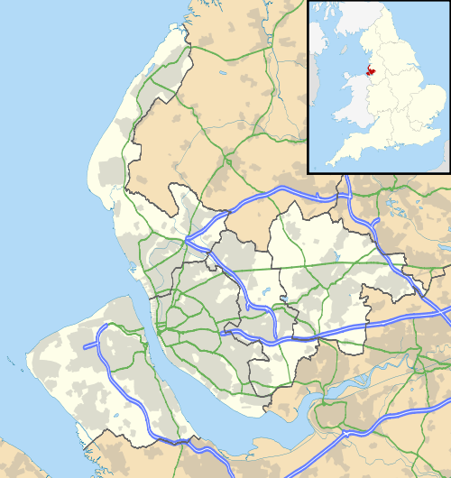
 Location within Merseyside | |
| Area of Search | Merseyside |
|---|---|
| Grid reference | SJ338815 |
| Coordinates | 53°19′52″N 2°59′42″W / 53.331°N 2.995°WCoordinates: 53°19′52″N 2°59′42″W / 53.331°N 2.995°W |
| Interest | Biological |
| Area | 53.2 hectares, 131.5 acres (532,000 m2) |
| Notification | 1979 / 1983 |
| Natural England website | |
Brotherton Park and Dibbinsdale comprise an area of over 80 acres (320,000 m2) of park and woodland within the Metropolitan Borough of Wirral, England.
Situated between Spital and Bromborough, the valley woodland is one of the finest examples of ancient woodland on Merseyside. It is a Site of Special Scientific Interest[1][2] and a Local Nature Reserve.[3]
Dibbinsdale is thought to have formed part of the boundary in the 10th and 11th centuries between the Norse colony in Wirral, to the north and west, and Anglo-Saxon Mercia to the east and south. After the Norman Conquest, the whole area became part of the Hundred of Wirral.[4]
References
- ↑ "Dibbinsdale citation" (PDF). Sites of Special Scientific Interest. Natural England. Retrieved 4 August 2013.
- ↑ "Map of Dibbinsdale". Sites of Special Scientific Interest. Natural England. Retrieved 4 August 2013.
- ↑ "Dibbinsdale". Local Nature Reserves. Natural England. Retrieved 4 August 2013.
- ↑ Stephen J. Roberts, A History of Wirral, 2002, ISBN 978-1-86077-512-3
External links
| Wikimedia Commons has media related to Dibbinsdale Local Nature Reserve. |
- Metropolitan Borough of Wirral: Brotherton Park & Dibbinsdale LNR
- Metropolitan Borough of Wirral: Dibbinsdale SSSI
- Metropolitan Borough of Wirral: Nature Conservation
- Steven Round Bird Photography - Many wild bird images from Dibbinsdale
This article is issued from Wikipedia - version of the 9/12/2016. The text is available under the Creative Commons Attribution/Share Alike but additional terms may apply for the media files.