Robson, West Virginia
| Robson, West Virginia | |
|---|---|
| Unincorporated community | |
 Robson  Robson | |
| Coordinates: 38°06′11″N 81°15′00″W / 38.10306°N 81.25000°WCoordinates: 38°06′11″N 81°15′00″W / 38.10306°N 81.25000°W | |
| Country | United States |
| State | West Virginia |
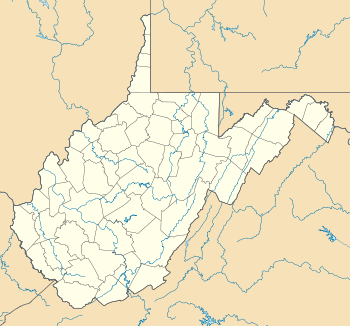
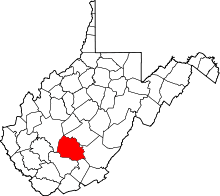
| County | Fayette |
| Elevation[1] | 876 ft (267 m) |
| Time zone | Eastern (EST) (UTC-5) |
| • Summer (DST) | EDT (UTC-4) |
| ZIP code | 25173 |
| Area code(s) | 304 |
| FIPS code | 54-54019 |
| GNIS feature ID | 1555495[1] |
| [2] | |
Robson is an unincorporated community in Fayette County, West Virginia, United States, situated primarily on the banks of Loup Creek. Robson is served by State Highway 61, and is located 8 miles (13 km) from Montgomery and 15 miles (24 km) to from Oak Hill. Robson's Post Office serves the smaller communities of Beards Fork and Mulberry.
The community was named after James Robson, an early settler.[3]
References
- 1 2 U.S. Geological Survey Geographic Names Information System: Robson, West Virginia. Retrieved on 2008-08-10.
- ↑ Robson WV. Zip Code Lookup. Retrieved on 2008-08-10.
- ↑ Kenny, Hamill (1945). West Virginia Place Names: Their Origin and Meaning, Including the Nomenclature of the Streams and Mountains. Piedmont, WV: The Place Name Press. p. 535.
This article is issued from Wikipedia - version of the 10/25/2016. The text is available under the Creative Commons Attribution/Share Alike but additional terms may apply for the media files.