Oak Hill, West Virginia
| Oak Hill, West Virginia | |
|---|---|
| City | |
|
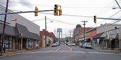
Main Street (West Virginia Route 16) in downtown Oak Hill in 2007 | |
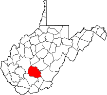
 Location of Oak Hill, West Virginia | |
| Coordinates: 37°58′58″N 81°8′43″W / 37.98278°N 81.14528°WCoordinates: 37°58′58″N 81°8′43″W / 37.98278°N 81.14528°W | |
| Country | United States |
| State | West Virginia |
| County | Fayette |
| Area[1] | |
| • Total | 4.89 sq mi (12.67 km2) |
| • Land | 4.88 sq mi (12.64 km2) |
| • Water | 0.01 sq mi (0.03 km2) |
| Elevation | 2,014 ft (614 m) |
| Population (2010)[2] | |
| • Total | 7,730 |
| • Estimate (2012[3]) | 7,713 |
| • Density | 1,584.0/sq mi (611.6/km2) |
| Time zone | Eastern (EST) (UTC-5) |
| • Summer (DST) | EDT (UTC-4) |
| ZIP code | 25901 |
| Area code(s) | 304 Exchanges: 465, 469 |
| FIPS code | 54-60028[4] |
| GNIS feature ID | 1544297[5] |
Oak Hill is a city in Fayette County, West Virginia, United States and is the primary city within the Oak Hill, WV Micropolitan Statistical Area. The micropolitan area is also included in the Beckley-Oak Hill, WV Combined Statistical Area. The population was 7,730 at the 2010 census. Country singer Hank Williams was discovered to be dead while the car in which he was a passenger was stopped in Oak Hill, and Oak Hill is generally accepted to be his place of death.
Geography
Oak Hill is located at 37°58′58″N 81°8′43″W / 37.98278°N 81.14528°W (37.982775, -81.145334).[6]
According to the United States Census Bureau, the city has a total area of 4.89 square miles (12.67 km2), of which, 4.88 square miles (12.64 km2) is land and 0.01 square miles (0.03 km2) is water.[1]
History
Oak Hill was settled in 1820.[7] The community was so named on account of an oak tree at the elevated town site.[8] It was incorporated as a town in 1905.[9]
Demographics
| Historical population | |||
|---|---|---|---|
| Census | Pop. | %± | |
| 1910 | 764 | — | |
| 1920 | 1,037 | 35.7% | |
| 1930 | 2,076 | 100.2% | |
| 1940 | 3,213 | 54.8% | |
| 1950 | 4,518 | 40.6% | |
| 1960 | 4,711 | 4.3% | |
| 1970 | 4,738 | 0.6% | |
| 1980 | 7,120 | 50.3% | |
| 1990 | 6,812 | −4.3% | |
| 2000 | 7,589 | 11.4% | |
| 2010 | 7,730 | 1.9% | |
| Est. 2015 | 8,140 | [10] | 5.3% |
2010 census
As of the census[2] of 2010, there were 7,730 people, 3,398 households, and 2,085 families residing in the city. The population density was 1,584.0 inhabitants per square mile (611.6/km2). There were 3,703 housing units at an average density of 758.8 per square mile (293.0/km2). The racial makeup of the city was 93.3% White, 4.3% African American, 0.3% Native American, 0.2% Asian, 0.2% from other races, and 1.6% from two or more races. Hispanic or Latino of any race were 1.2% of the population.
There were 3,398 households of which 27.9% had children under the age of 18 living with them, 42.1% were married couples living together, 13.8% had a female householder with no husband present, 5.4% had a male householder with no wife present, and 38.6% were non-families. 34.8% of all households were made up of individuals and 16.4% had someone living alone who was 65 years of age or older. The average household size was 2.22 and the average family size was 2.84.
The median age in the city was 43.3 years. 21.2% of residents were under the age of 18; 7.3% were between the ages of 18 and 24; 23.8% were from 25 to 44; 28.7% were from 45 to 64; and 19% were 65 years of age or older. The gender makeup of the city was 46.8% male and 53.2% female.
2000 census
As of the census[4] of 2000, there were 7,589 people, 3,297 households, and 2,123 families residing in the city. The population density was 1,570.9 people per square mile (606.7/km²). There were 3,619 housing units at an average density of 749.1 per square mile (289.3/km²). The racial makeup of the city was 93.02% White, 4.80% African American, 0.32% Native American, 0.42% Asian, 0.03% Pacific Islander, 0.24% from other races, and 1.19% from two or more races. Hispanic or Latino of any race were 0.84% of the population.
There were 3,297 households out of which 27.0% had children under the age of 18 living with them, 47.1% were married couples living together, 13.8% had a female householder with no husband present, and 35.6% were non-families. 31.7% of all households were made up of individuals and 16.2% had someone living alone who was 65 years of age or older. The average household size was 2.25 and the average family size was 2.80.
The age distribution was 20.5% under the age of 18, 8.5% from 18 to 24, 26.0% from 25 to 44, 24.7% from 45 to 64, and 20.4% who were 65 years of age or older. The median age was 42 years. For every 100 females there were 87.9 males. For every 100 females age 18 and over, there were 81.8 males.
The median income for a household in the city was $24,792, and the median income for a family was $33,183. Males had a median income of $27,595 versus $18,760 for females. The per capita income for the city was $14,347. About 14.8% of families and 17.7% of the population were below the poverty line, including 27.9% of those under age 18 and 11.9% of those age 65 or over.
Employment
Oak Hill is located in West Virginia's southern coalfields and, as such, coal mining has played a primary role in the area's employment. Oak Hill also has a light manufacturing base.
Education
Public Schools: New River Elementary School, Rosedale Elementary School, Collins Middle School, Oak Hill High School, Fayette Institute of Technology
Private Schools: St. Peter & Paul Catholic School
References
| Wikivoyage has a travel guide for Oak Hill (West Virginia). |
- 1 2 "US Gazetteer files 2010". United States Census Bureau. Archived from the original on January 24, 2012. Retrieved 2013-01-24.
- 1 2 "American FactFinder". United States Census Bureau. Retrieved 2013-01-24.
- ↑ "Population Estimates". United States Census Bureau. Archived from the original on June 17, 2013. Retrieved 2013-06-26.
- 1 2 "American FactFinder". United States Census Bureau. Archived from the original on September 11, 2013. Retrieved 2008-01-31.
- ↑ "US Board on Geographic Names". United States Geological Survey. 2007-10-25. Retrieved 2008-01-31.
- ↑ "US Gazetteer files: 2010, 2000, and 1990". United States Census Bureau. 2011-02-12. Retrieved 2011-04-23.
- ↑ Columbia-Lippincott Gazeteer. p. 1359
- ↑ Kenny, Hamill (1945). West Virginia Place Names: Their Origin and Meaning, Including the Nomenclature of the Streams and Mountains. Piedmont, WV: The Place Name Press. p. 451.
- ↑ http://www.newriverwv.com/Society_and_Community_Cities_and_Towns_Oak_Hill.php
- ↑ "Annual Estimates of the Resident Population for Incorporated Places: April 1, 2010 to July 1, 2015". Retrieved July 2, 2016.
- ↑ "Census of Population and Housing". Census.gov. Archived from the original on May 11, 2015. Retrieved June 4, 2015.