Rocky Boy West, Montana
| Rocky Boy West, Montana | |
|---|---|
| Census-designated place | |
 Rocky Boy West | |
| Coordinates: 48°17′58″N 109°59′49″W / 48.29944°N 109.99694°WCoordinates: 48°17′58″N 109°59′49″W / 48.29944°N 109.99694°W | |
| Country | United States |
| State | Montana |
| Counties | Chouteau, Hill |
| Area | |
| • Total | 5.4 sq mi (14.1 km2) |
| • Land | 5.4 sq mi (14.1 km2) |
| • Water | 0.0 sq mi (0.0 km2) |
| Elevation | 2,753 ft (839 m) |
| Population (2010) | |
| • Total | 890 |
| • Density | 163/sq mi (63.0/km2) |
| Time zone | Mountain (MST) (UTC-7) |
| • Summer (DST) | MDT (UTC-6) |
| Area code(s) | 406 |
| FIPS code | 30-63928 |
| GNIS feature ID | 2585653 |
Rocky Boy West is a census-designated place (CDP) in Hill and Chouteau counties in the U.S. state of Montana. The population was 890 at the 2010 census.[1]
Geography
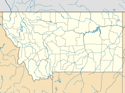
Parker School is located in southeastern Hill County and northeastern Chouteau County at 48°17′58″N 109°59′49″W / 48.29944°N 109.99694°W, in the northwest part of the Rocky Boy Indian Reservation. It is bordered by the community of Box Elder to the northwest. U.S. Route 87 crosses the northwest corners of the CDP, leading northeast 23 miles (37 km) to Havre and southwest 48 miles (77 km) to Fort Benton.
According to the United States Census Bureau, the Parker School CDP has a total area of 5.4 square miles (14.1 km2), all land.[1]
References
- 1 2 "Geographic Identifiers: 2010 Demographic Profile Data (G001): Rocky Boy West CDP, Montana". U.S. Census Bureau, American Factfinder. Retrieved October 15, 2014.
Municipalities and communities of Chouteau County, Montana, United States | ||
|---|---|---|
| City | 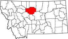 | |
| Towns | ||
| CDPs | ||
| Unincorporated communities | ||
| Ghost town | ||
| Indian reservation | ||
| Footnotes | ‡This populated place also has portions in an adjacent county or counties | |
Municipalities and communities of Hill County, Montana, United States | ||
|---|---|---|
| City | 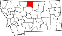 | |
| Town | ||
| CDPs | ||
| Unincorporated communities | ||
| Indian reservation | ||
| Footnotes | ‡This populated place also has portions in an adjacent county or counties | |
This article is issued from Wikipedia - version of the 10/15/2014. The text is available under the Creative Commons Attribution/Share Alike but additional terms may apply for the media files.