Rolleston, Queensland
| Rolleston Queensland | |||||||
|---|---|---|---|---|---|---|---|
 Location of Rolleston in Queensland (red) | |||||||
| Coordinates | 24°28′S 148°36′E / 24.467°S 148.600°ECoordinates: 24°28′S 148°36′E / 24.467°S 148.600°E | ||||||
| Population | 129 (2011 census)[1] | ||||||
| Postcode(s) | 4702 | ||||||
| Location |
| ||||||
| LGA(s) | Central Highlands Region | ||||||
| State electorate(s) | Gregory | ||||||
| Federal Division(s) | Flynn | ||||||
| |||||||
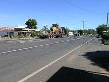
The main street
Rolleston is a small town in the Central Highlands Region, Queensland, Australia. At the 2006 census, Rolleston and the surrounding area had a population of 123.[1]
Geography
It is located on the Comet River, 335 kilometres (208 mi) west of Gladstone and 694 kilometres (431 mi) northwest of Brisbane. Springsure, the nearest town lies 71 kilometres (44 mi) to the north-west. Rolleston lies on the junction of the Carnarvon, Gregory and Dawson highways.
Bushrangers
Queensland's last legendary bushrangers, the notorious Patrick and James Kenniff.
Mining
There is a large coal mine 13 kilometres (8.1 mi) west called the Rolleston coal mine. Mining began in October 2005 and is expected to last more than 20 years.[2]
See also
References
- 1 2 Australian Bureau of Statistics (31 October 2012). "Rolleston (State Suburb)". 2011 Census QuickStats. Retrieved 11 April 2016.
- ↑ Department of Infrastructure and Planning. "Rolleston Coal Project". Government of Queensland. Archived from the original on 29 June 2009. Retrieved 2009-06-30.
External links
| Wikimedia Commons has media related to Rolleston, Queensland. |
This article is issued from Wikipedia - version of the 9/4/2016. The text is available under the Creative Commons Attribution/Share Alike but additional terms may apply for the media files.