Rometta

Rometta
Comune
Comune di Rometta

Skyline
Rometta

Location of Rometta in Italy

Coordinates: 38°10′N 15°25′E / 38.167°N 15.417°E / 38.167; 15.417Coordinates: 38°10′N 15°25′E / 38.167°N 15.417°E / 38.167; 15.417
Country Italy
Region Sicily
Province / Metropolitan city Province of Messina (ME)
Frazioni Rometta Marea, Gimello, Mazzabruno, Santa Domenica, Rapano, San Cono, Sotto Castello, S. Andrea
Area
  Total 32.5 km2 (12.5 sq mi)
Elevation 560 m (1,840 ft)
Population (Dec. 2004)
  Total 6,458
  Density 200/km2 (510/sq mi)
Demonym(s) Romettesi
Time zone CET (UTC+1)
  Summer (DST) CEST (UTC+2)
Postal code 98043
Dialing code 090
Patron saint San Leone Vescovo
Saint day 20 February
Website Official website

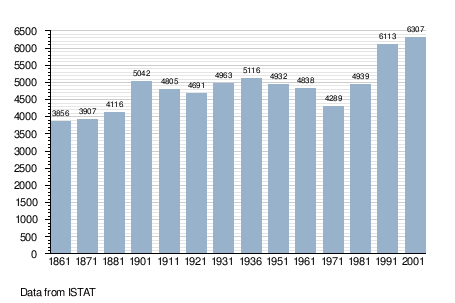
Rometta (Sicilian: Ramietta) is a comune (municipality) in the Province of Messina in the Italian region Sicily, located about 180 kilometres (110 mi) east of Palermo and about 12 kilometres (7 mi) west of Messina. As of 31 December 2004, it had a population of 6,458 and an area of 32.5 square kilometres (12.5 sq mi).[1]

The municipality of Rometta contains the frazioni (subdivisions, mainly villages and hamlets) Rometta Marea, Gimello, Santa Domenica, Rapano, San Cono, Sotto Castello, and S. Andrea. Rometta borders the following municipalities: Messina, Monforte San Giorgio, Roccavaldina, Saponara, Venetico, Spadafora.

Demographic evolution

References

  1. All demographics and other statistics: Italian statistical institute Istat.
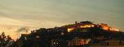
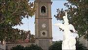
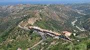
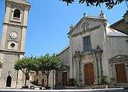
Images

Rometta after the sunset 
Campanile 
Under Castle (Sottocastello) 
Chiesa Madonna scala 
Chiesa Madre e campanile 
Gimello 
Rometta: si entra in paese da Porta Milazzo 
Rometta municipio 
This article is issued from Wikipedia - version of the 11/19/2014. The text is available under the Creative Commons Attribution/Share Alike but additional terms may apply for the media files.