Rosscarrock
| Rosscarrock | |
|---|---|
| Neighbourhood | |
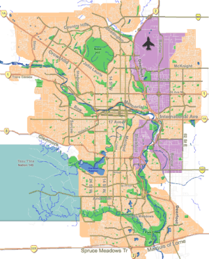 Rosscarrock Location of Rosscarrock in Calgary | |
| Coordinates: 51°02′27″N 114°09′10″W / 51.04083°N 114.15278°WCoordinates: 51°02′27″N 114°09′10″W / 51.04083°N 114.15278°W | |
| Country |
|
| Province |
|
| City |
|
| Quadrant | SW |
| Ward | 8 |
| Established | 1954 |
| Government[1] | |
| • Mayor | Naheed Nenshi |
| • Administrative body | Calgary City Council |
| • Councillor | Evan Woolley |
| Area | |
| • Total | 1.1 km2 (0.4 sq mi) |
| Elevation | 1,140 m (3,740 ft) |
| Population (2006)[2] | |
| • Total | 3,200 |
| • Average Income | $40,733 |
| Postal code | T3C |
| Website | Rosscarrock Community Association |
Rosscarrock is a residential neighbourhood in the south-west quadrant of Calgary, Alberta. It is bounded to the north by Bow Trail to the east by 33 Street W, to the south by 17 Avenue S and to the west by 45 Street W. The Westbrook Mall is located in the north-east corner of the neighbourhood, and it is bordered by the Shaganappi golf course.
Rosscarrock was established in 1954. It is represented in the Calgary City Council by the Ward 8 councillor.[1]
Demographics
In the City of Calgary's 2012 municipal census, Rosscarrock had a population of 3,356 living in 1,645 dwellings, a 5.7% increase from its 2011 population of 3,175.[3] With a land area of 1.1 km2 (0.42 sq mi), it had a population density of 3,050/km2 (7,900/sq mi) in 2012.[3][4]
Residents in this community had a median household income of $40,733 in 2000, and there were 27.6% low income residents living in the neighbourhood.[5] As of 2000, 22.3% of the residents were immigrants. A proportion of 53.3% of the buildings were condominiums or apartments, and 65.8% of the housing was used for renting.[2]
Education
The community is served by Ernest Manning High and Rosscarrock Elementary public schools, as well as by St. Michael Elementary & Junior High (Catholic, Late French Immersion, International Baccalaureate).
See also
References
- 1 2 "Calgary Elections". City of Calgary. October 21, 2013. Retrieved October 22, 2013.
- 1 2 City of Calgary (2006). "Rosscarrock Community Statistics" (PDF). Retrieved 2007-05-17.
- 1 2 "2012 Civic Census Results" (PDF). City of Calgary. 2012. Retrieved February 4, 2013.
- ↑ "Community Boundaries" (Esri shapefile). City of Calgary. Retrieved February 5, 2013.
- ↑ City of Calgary (2004). "Ward 6 Profile" (PDF). Retrieved 2007-05-17.
External links
 |
Wildwood | Wildwood | Spruce Cliff | |
| Westgate | |
Shaganappi | ||
| ||||
| | ||||
| Glendale | Glendale | Killarney-Glengarry |