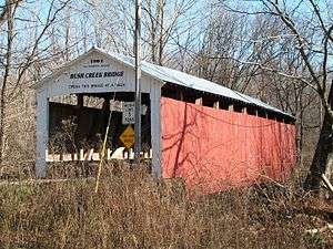
Rush Creek Covered Bridge
| Rush Creek Covered Bridge | |
| National Register of Historic Places | |
 Rush Creek Covered Bridge | |
| Official name: Rush Creek Covered Bridge | |
| Named for: Rush Creek | |
| Country | |
|---|---|
| State | |
| County | Parke |
| Township | Liberty |
| Road | C.R. 900N |
| Crosses | Rush Creek |
| Coordinates | 39°53′55.54″N 87°18′52.75″W / 39.8987611°N 87.3146528°WCoordinates: 39°53′55.54″N 87°18′52.75″W / 39.8987611°N 87.3146528°W |
| Length | 95 ft (29 m) 77ft +9ft overhangs on each end |
| Width | 16 ft (5 m) |
| Clearance | 12.5 ft (4 m) |
| Load | 5 tons |
| Builder | Hendricks, William |
| Design | Burr Arch truss single-span bridge |
| Material | Wood |
| Built | 1904 |
| - Rebuilt | 1977 |
| Owned and Maintained by | Parke County |
| NBI Number | 6100154[1] |
| WGCB Number | #14-61-31 [2] |
| Added to NRHP | Dec 22, 1978 |
| NRHP Ref# | 78000410[3] |
| MPS | Parke County Covered Bridges TR |
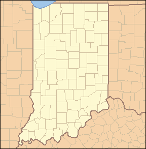 Location of the Rush Creek Bridge in Indiana | |
 Location of Indiana in the United States | |
The Rush Creek Covered Bridge is south of Tangier, Indiana. The single span Burr Arch covered bridge structure was built by William Hendricks in 1904.[4][5]
It was added to the National Register of Historic Places in 1978.[3]
History
This is the first of three bridges that would be built by William Hendricks. The other two are Wilkins Mill Covered Bridge,1906, and Mill Creek Covered Bridge,1907. All three are of similar construction with very shallow portals.
Gallery
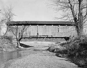
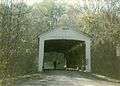 Rush Creek Covered Bridge, circa 1990
See also
- List of Registered Historic Places in Indiana
- Parke County Covered Bridges
- Parke County Covered Bridge Festival
References
- ↑ http://nationalbridges.com/
- ↑ http://www.indianacrossings.org/bridgeLinks/14-61-31.html
- 1 2 National Park Service (2007-01-23). "National Register Information System". National Register of Historic Places. National Park Service.
- ↑ "Rush Creek Covered Bridge". Parke County Incorporated / Parke County Convention and Visitors Commission. Retrieved 2012-10-18.
- ↑ "Indiana State Historic Architectural and Archaeological Research Database (SHAARD)" (Searchable database). Department of Natural Resources, Division of Historic Preservation and Archaeology. Retrieved 2016-06-01. Note: This includes Charles Felkner (December 1977). "National Register of Historic Places Inventory Nomination Form: Parke County Covered Bridge Historic District" (PDF). Retrieved 2016-06-01., Site map, and Accompanying photographs.

This article is issued from Wikipedia - version of the 9/22/2016. The text is available under the Creative Commons Attribution/Share Alike but additional terms may apply for the media files.