| [3] |
Name on the Register[4] |
Image |
Date listed[5] |
Location |
Description |
|---|
| 1 |
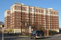
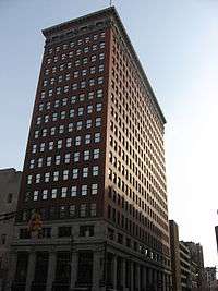
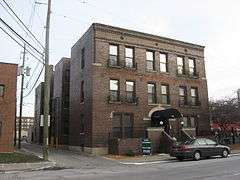
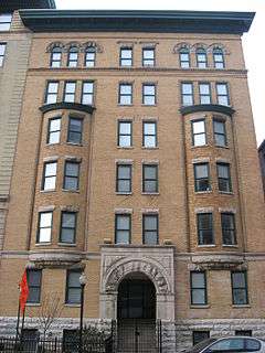
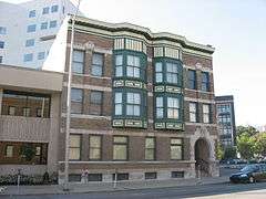
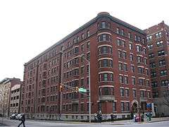
The Alameda |
|
000000001983-09-15-0000September 15, 1983
(#83000052) |
37 W. St. Clair St.
39°46′41″N 86°09′33″W / 39.778056°N 86.159167°W / 39.778056; -86.159167 (The Alameda) |
|
| 2 |
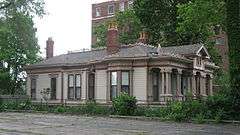
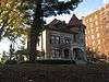
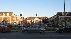
The Alexandra |
|
000000001983-09-15-0000September 15, 1983
(#83000053) |
402-416 N. New Jersey St. and 332-336 E. Vermont St.
39°46′22″N 86°09′02″W / 39.772778°N 86.150556°W / 39.772778; -86.150556 (The Alexandra) |
|
| 3 |
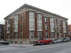
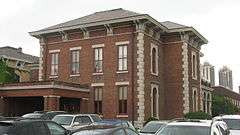
The Ambassador |
|
000000001983-09-15-0000September 15, 1983
(#83000054) |
39 E. 9th St.
39°46′44″N 86°09′21″W / 39.778889°N 86.155833°W / 39.778889; -86.155833 (The Ambassador) |
|
| 4 |
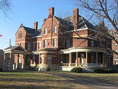
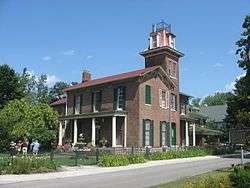
Athenaeum (Das Deutsche Haus) |
|
000000001973-02-21-0000February 21, 1973
(#73000032) |
401 E. Michigan St.
39°46′24″N 86°09′01″W / 39.773333°N 86.150278°W / 39.773333; -86.150278 (Athenaeum (Das Deutsche Haus)) |
Designated a National Historic Landmark in 2016.
|
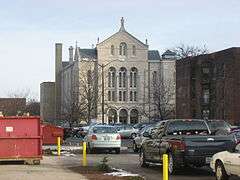
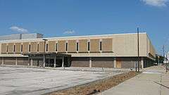
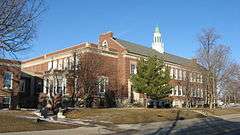
| 5 |
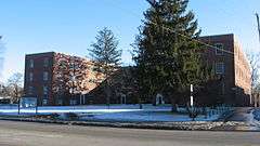
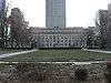
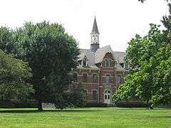
Crispus Attucks High School |
|
000000001989-01-04-0000January 4, 1989
(#88003043) |
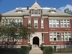
1140 N. Martin Luther King, Jr., St.
39°46′58″N 86°10′12″W / 39.782778°N 86.17°W / 39.782778; -86.17 (Crispus Attucks High School) |
|
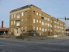
| 6 |
L.S. Ayres Annex Warehouse |
|
000000001973-04-23-0000April 23, 1973
(#73000033) |
14-22 W. Maryland St.[6]
39°45′57″N 86°09′30″W / 39.765833°N 86.158333°W / 39.765833; -86.158333 (L.S. Ayres Annex Warehouse) |
|
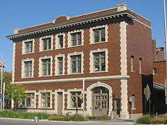
| 7 |
The Baker |
|
000000001983-09-15-0000September 15, 1983
(#83000055) |
310 N. Alabama St. and 341 Massachusetts Ave.
39°46′18″N 86°09′09″W / 39.771667°N 86.1525°W / 39.771667; -86.1525 (The Baker) |
|
| 8 |
Balmoral Court |
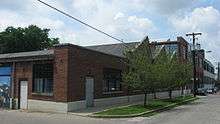
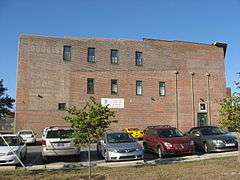
|
000000001992-11-27-0000November 27, 1992
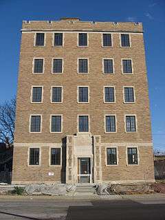
(#92001647) |
3055 N. Meridian St.
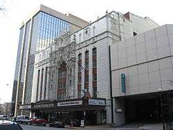
39°48′43″N 86°09′22″W / 39.811944°N 86.156111°W / 39.811944; -86.156111 (Balmoral Court) |
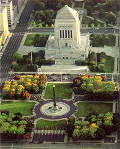
|
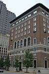
| 9 |
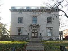
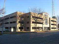
Bals-Wocher House |
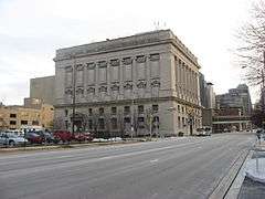
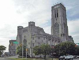
|
000000001979-12-17-0000December 17, 1979
(#79000033) |
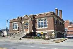
951 N. Delaware St.
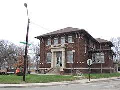
39°46′49″N 86°09′13″W / 39.780278°N 86.153667°W / 39.780278; -86.153667 (Bals-Wocher House) |
|
| 10 |
Bates-Hendricks House |
|
000000001977-04-11-0000April 11, 1977
(#77000143) |
1526 S. New Jersey St.
39°44′47″N 86°09′03″W / 39.746389°N 86.150833°W / 39.746389; -86.150833 (Bates-Hendricks House) |
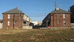
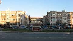
|
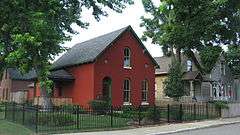
| 11 |
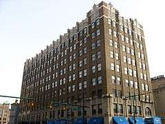
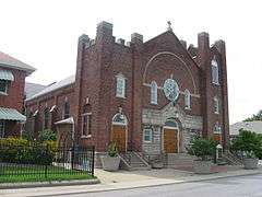
Bethel A.M.E. Church |
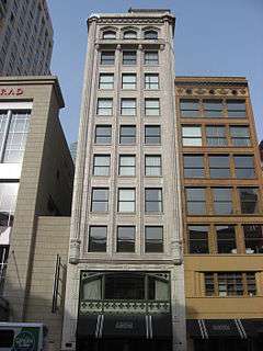
|
000000001991-03-21-0000March 21, 1991
(#91000269) |
414 W. Vermont St.
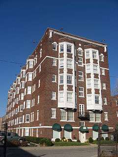
39°46′23″N 86°09′56″W / 39.773056°N 86.165556°W / 39.773056; -86.165556 (Bethel A.M.E. Church) |
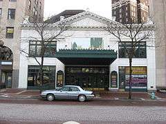
|
| 12 |
The Blacherne |
|
000000001983-09-15-0000September 15, 1983
(#83000058) |
402 N. Meridian St.
39°46′22″N 86°09′29″W / 39.772778°N 86.158056°W / 39.772778; -86.158056 (The Blacherne) |
|
| 13 |
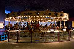
Broad Ripple Park Carousel |
|
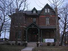
000000001987-02-27-0000February 27, 1987
(#87000839) |
Meridian and 30th Sts.
39°48′39″N 86°09′21″W / 39.810833°N 86.155833°W / 39.810833; -86.155833 (Broad Ripple Park Carousel) |
|
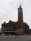
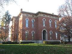
| 14 |
The Buckingham |
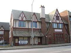
|
000000001992-11-27-0000November 27, 1992
(#92001649) |
3101-3119 N. Meridian St.
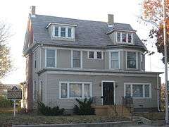
39°48′44″N 86°09′22″W / 39.812222°N 86.156111°W / 39.812222; -86.156111 (The Buckingham) |
|
| 15 |
The Burton |
|
000000001983-09-15-0000September 15, 1983
(#83000059) |
821-823 N. Pennsylvania St.
39°46′42″N 86°09′20″W / 39.778333°N 86.155556°W / 39.778333; -86.155556 (The Burton) |
|
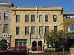
| 16 |
William Buschmann Block |
|
000000001988-08-26-0000August 26, 1988
(#88001225) |
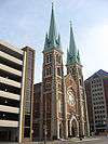
968-972 Fort Wayne Ave.
39°46′51″N 86°09′00″W / 39.780833°N 86.15°W / 39.780833; -86.15 (William Buschmann Block) |
|
| 17 |
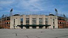
Bush Stadium |
|
000000001995-06-26-0000June 26, 1995
(#95000703) |
1501 W. 16th St.
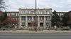
39°47′15″N 86°11′21″W / 39.7875°N 86.189167°W / 39.7875; -86.189167 (Bush Stadium) |
|
| 18 |
Byram-Middleton House |
|
000000001983-05-09-0000May 9, 1983
(#83000127) |
1828 N. Illinois St.
39°47′29″N 86°09′34″W / 39.791389°N 86.159444°W / 39.791389; -86.159444 (Byram-Middleton House) |
|
| 19 |
The Cathcart |
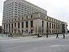
|
000000001983-09-15-0000September 15, 1983
(#83000060) |
103 E. 9th St.
39°46′44″N 86°09′20″W / 39.778889°N 86.155556°W / 39.778889; -86.155556 (The Cathcart) |
|
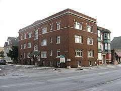
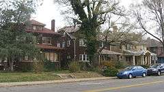
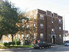
| 20 |
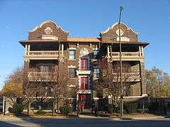
Central Court Historic District |
|
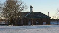
000000002004-09-29-0000September 29, 2004
(#04001101) |
3529-3575 Central Ave., 515-551 E. 36th St., and Central Ct.
39°49′20″N 86°08′53″W / 39.822222°N 86.148056°W / 39.822222; -86.148056 (Central Court Historic District) |
|
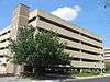
| 21 |
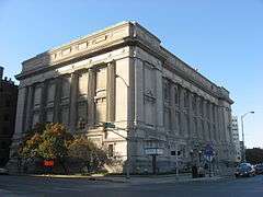
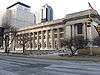
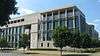
Central Library (Indianapolis-Marion County Public Library) |
|
000000001975-08-28-0000August 28, 1975
(#75000045) |
40 E. St. Clair St.
39°46′42″N 86°09′24″W / 39.778333°N 86.156667°W / 39.778333; -86.156667 (Central Library (Indianapolis-Marion County Public Library)) |
|
| 22 |
Chatham-Arch Historic District |
|
000000001980-03-13-0000March 13, 1980
(#80000057) |
Roughly bounded by Interstate 65, College Ave., and 10th, 11th, North, New Jersey, Cleveland, and East Sts.
39°46′42″N 86°08′48″W / 39.778333°N 86.146667°W / 39.778333; -86.146667 (Chatham-Arch Historic District) |
|
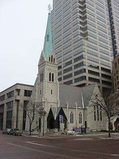
| 23 |
Christ Church Cathedral |
|
000000001973-07-10-0000July 10, 1973
(#73000035) |
131 Monument Circle
39°46′09″N 86°09′27″W / 39.769167°N 86.157500°W / 39.769167; -86.157500 (Christ Church Cathedral) |
|
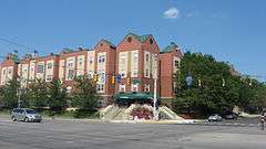
| 24 |
Christian Park School No. 82 |
|
000000001995-04-28-0000April 28, 1995
(#95000421) |
4700 English Ave.
39°45′38″N 86°05′20″W / 39.760556°N 86.088889°W / 39.760556; -86.088889 (Christian Park School No. 82) |
|
| 25 |
Circle Theater |
|
000000001980-06-16-0000June 16, 1980
(#80000058) |
45 Monument Circle
39°46′05″N 86°09′26″W / 39.768056°N 86.157222°W / 39.768056; -86.157222 (Circle Theater) |
|
| 26 |
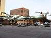
City Market |
|
000000001974-03-27-0000March 27, 1974
(#74000030) |
222 E. Market St.
39°46′07″N 86°09′12″W / 39.768611°N 86.153333°W / 39.768611; -86.153333 (City Market) |
|
| 27 |
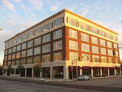
Cole Motor Car Company |
|
000000001983-03-03-0000March 3, 1983
(#83000128) |
730 E. Washington St.
39°46′02″N 86°08′39″W / 39.767222°N 86.144167°W / 39.767222; -86.144167 (Cole Motor Car Company) |
|
| 28 |
The Colonial |
|
000000001983-09-15-0000September 15, 1983
(#83000062) |
126 E. Vermont St. and 402-408 N. Delaware St.
39°46′22″N 86°09′15″W / 39.772778°N 86.154167°W / 39.772778; -86.154167 (The Colonial) |
|
| 29 |
Columbia Club |
|
000000001983-01-27-0000January 27, 1983
(#83000063) |
121 Monument Circle
39°46′08″N 86°09′26″W / 39.768889°N 86.157222°W / 39.768889; -86.157222 (Columbia Club) |
|
| 30 |
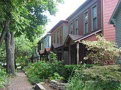
Cottage Home Historic District |
|
000000001990-02-23-0000February 23, 1990
(#90000328) |
Dorman and St. Clair Sts.
39°46′40″N 86°08′17″W / 39.777778°N 86.138056°W / 39.777778; -86.138056 (Cottage Home Historic District) |
|
| 31 |
Coulter Flats |
|
000000001990-05-31-0000May 31, 1990
(#90000807) |
2161 N. Meridian St.
39°47′48″N 86°09′25″W / 39.796667°N 86.156944°W / 39.796667; -86.156944 (Coulter Flats) |
|
| 32 |
Crown Hill Cemetery |
|
000000001973-02-28-0000February 28, 1973
(#73000036) |
Boulevard Pl., W. 32nd St., and Northwestern Ave.
39°49′08″N 86°10′21″W / 39.818889°N 86.172500°W / 39.818889; -86.172500 (Crown Hill Cemetery) |
|
| 33 |
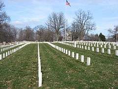
Crown Hill National Cemetery |
|
000000001999-04-29-0000April 29, 1999
(#99000486) |
700 W. 38th St.
39°49′00″N 86°10′23″W / 39.816667°N 86.173056°W / 39.816667; -86.173056 (Crown Hill National Cemetery) |
|
| 34 |
The Dartmouth |
|
000000001983-09-15-0000September 15, 1983
(#83000064) |
221 E. Michigan St.
39°46′29″N 86°09′12″W / 39.774722°N 86.153333°W / 39.774722; -86.153333 (The Dartmouth) |
|
| 35 |
Delaware Court |
|
000000001983-09-15-0000September 15, 1983
(#83000065) |
1001-1015 N. Delaware St.
39°46′52″N 86°09′13″W / 39.781111°N 86.153611°W / 39.781111; -86.153611 (Delaware Court) |
|
| 36 |
Delaware Flats |
|
000000001983-09-15-0000September 15, 1983
(#83000066) |
120-128 N. Delaware St.
39°46′08″N 86°09′16″W / 39.768889°N 86.154444°W / 39.768889; -86.154444 (Delaware Flats) |
|
| 37 |
The Devonshire |
|
000000001983-09-15-0000September 15, 1983
(#83000067) |
412 N. Alabama St.
39°46′24″N 86°09′09″W / 39.773333°N 86.1525°W / 39.773333; -86.1525 (The Devonshire) |
|
| 38 |
The Emelie |
|
000000001983-09-15-0000September 15, 1983
(#83000068) |
326-330 N. Senate Ave. and 301-303 W. Vermont St.
39°46′21″N 86°09′48″W / 39.7725°N 86.163333°W / 39.7725; -86.163333 (The Emelie) |
|
| 39 |
Emerson Heights Historic District |
|
000000002010-03-10-0000March 10, 2010
(#10000125) |
Roughly bounded by Emerson Ave., Linwood Ave., and E. 10th and E. Michigan Sts.
39°46′40″N 86°05′17″W / 39.777875°N 86.088169°W / 39.777875; -86.088169 (Emerson Heights Historic District) |
|
| 40 |
Esplanade Apartments |
|
000000001983-06-16-0000June 16, 1983
(#83000129) |
3015 N. Pennsylvania St.
39°48′39″N 86°09′16″W / 39.810833°N 86.154444°W / 39.810833; -86.154444 (Esplanade Apartments) |
|
| 41 |
Fidelity Trust Building |
|
000000001980-09-27-0000September 27, 1980
(#80000382) |
148 E. Market St.
39°46′07″N 86°09′17″W / 39.768611°N 86.154722°W / 39.768611; -86.154722 (Fidelity Trust Building) |
|
| 42 |
Flanner House Homes |
|
000000002003-09-28-0000September 28, 2003
(#03000978) |
Roughly bounded by Dr. Martin Luther King, Jr., Dr., 12th St., Fall Creek Parkway East Dr., and Lynn St.
39°47′04″N 86°10′16″W / 39.784444°N 86.171111°W / 39.784444; -86.171111 (Flanner House Homes) |
|
| 43 |
Fletcher Place Historic District |
|
000000001982-02-01-0000February 1, 1982
(#82000061) |
Roughly bounded by railroad tracks, Interstates 65/70, East St., and Virginia Ave.
39°45′37″N 86°08′45″W / 39.760278°N 86.145833°W / 39.760278; -86.145833 (Fletcher Place Historic District) |
|
| 44 |
Calvin I. Fletcher House |
|
000000001984-03-01-0000March 1, 1984
(#84001089) |
1031 N. Pennsylvania St.
39°46′55″N 86°09′19″W / 39.781944°N 86.155278°W / 39.781944; -86.155278 (Calvin I. Fletcher House) |
|
| 45 |
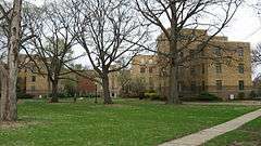
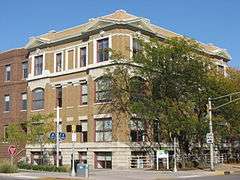
Benjamin Franklin Public School Number 36 |
|
000000002003-03-26-0000March 26, 2003
(#03000143) |
2801 N. Capitol Ave.
39°48′32″N 86°09′38″W / 39.808889°N 86.160556°W / 39.808889; -86.160556 (Benjamin Franklin Public School Number 36) |
|
| 46 |
Gaseteria, Inc. |
|
000000002013-03-13-0000March 13, 2013
(#13000089) |
1031 E. Washington St.
39°46′00″N 86°08′23″W / 39.766667°N 86.139722°W / 39.766667; -86.139722 (Gaseteria, Inc.) |
|
| 47 |
General German Protestant Orphans Home |
|
000000001984-05-17-0000May 17, 1984
(#84001129) |
1404 S. State St.
39°44′53″N 86°07′54″W / 39.748056°N 86.131667°W / 39.748056; -86.131667 (General German Protestant Orphans Home) |
|
| 48 |
Gibson Company Building |
|
000000002009-06-17-0000June 17, 2009
(#09000431) |
433-447 N. Capitol Ave.
39°46′24″N 86°09′38″W / 39.773472°N 86.16055°W / 39.773472; -86.16055 (Gibson Company Building) |
|
| 49 |
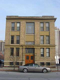
The Glencoe |
|
000000001983-09-15-0000September 15, 1983
(#83000069) |
627 N. Pennsylvania St.
39°46′35″N 86°09′20″W / 39.776389°N 86.155556°W / 39.776389; -86.155556 (The Glencoe) |
|
| 50 |
Alfred M. Glossbrenner Mansion |
|
000000001982-02-19-0000February 19, 1982
(#82000062) |
3202 N. Meridian St.
39°48′50″N 86°09′25″W / 39.813889°N 86.156944°W / 39.813889; -86.156944 (Alfred M. Glossbrenner Mansion) |
|
| 51 |
Golden Hill Historic District |
|
000000001991-08-29-0000August 29, 1991
(#91001163) |
Roughly bounded by 36th St., 37th St., Governors Rd., the rear lot lines behind Golden Hill Dr., and Central Canal
39°49′09″N 86°11′06″W / 39.819167°N 86.185000°W / 39.819167; -86.185000 (Golden Hill Historic District) |
|
| 52 |
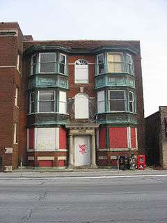
The Gramse |
|
000000002011-06-23-0000June 23, 2011
(#11000384) |
2203 N. Broadway St.
39°47′52″N 86°08′46″W / 39.797778°N 86.146111°W / 39.797778; -86.146111 (The Gramse) |
|
| 53 |
The Grover |
|
000000001983-09-15-0000September 15, 1983
(#83000056) |
615 N. Pennsylvania St.
39°46′34″N 86°09′20″W / 39.776111°N 86.155556°W / 39.776111; -86.155556 (The Grover) |
|
| 54 |
Hammond Block (Budnick's Trading Mart) |
|
000000001979-01-09-0000January 9, 1979
(#79000034) |
301 Massachusetts Ave.
39°46′17″N 86°09′13″W / 39.771389°N 86.153611°W / 39.771389; -86.153611 (Hammond Block (Budnick's Trading Mart)) |
|
| 55 |
Benjamin Harrison House |
|
000000001966-10-15-0000October 15, 1966
(#66000010) |
1204 N. Delaware St.
39°47′02″N 86°09′15″W / 39.783889°N 86.154167°W / 39.783889; -86.154167 (Benjamin Harrison House) |
|
| 56 |
HCS Motor Car Company |
|
000000002009-06-17-0000June 17, 2009
(#09000432) |
1402 N. Capitol Ave.
39°47′11″N 86°09′43″W / 39.786392°N 86.162017°W / 39.786392; -86.162017 (HCS Motor Car Company) |
|
| 57 |
Heier's Hotel |
|
000000001986-09-22-0000September 22, 1986
(#86002704) |
10-18 S. New Jersey St.
39°45′59″N 86°09′03″W / 39.766389°N 86.150833°W / 39.766389; -86.150833 (Heier's Hotel) |
|
| 58 |
Herron-Morton Place Historic District |
|
000000001983-06-16-0000June 16, 1983
(#83000131) |
Roughly bounded by Central Ave. and 16th, Pennsylvania, and 22nd Sts.
39°47′34″N 86°09′09″W / 39.792778°N 86.1525°W / 39.792778; -86.1525 (Herron-Morton Place Historic District) |
|
| 59 |
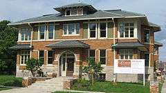
John Fitch Hill House |
|
000000002004-06-22-0000June 22, 2004
(#04000634) |
1523 Southeastern Ave.
39°45′51″N 86°07′57″W / 39.764028°N 86.132500°W / 39.764028; -86.132500 (John Fitch Hill House) |
|
| 60 |
Holy Rosary-Danish Church Historic District |
|
000000001986-03-13-0000March 13, 1986
(#86000327) |
Roughly bounded by Virginia Ave., Interstates 65/70, and S. East St.
39°45′23″N 86°08′50″W / 39.756389°N 86.147222°W / 39.756389; -86.147222 (Holy Rosary-Danish Church Historic District) |
|
| 61 |
Horner-Terrill House |
|
000000002013-06-25-0000June 25, 2013
(#13000424) |
410 S. Emerson Ave.
39°45′43″N 86°05′00″W / 39.761806°N 86.083333°W / 39.761806; -86.083333 (Horner-Terrill House) |
|
| 62 |
Hotel Washington |
|
000000001980-07-17-0000July 17, 1980
(#80000056) |
32 E. Washington St.
39°46′02″N 86°09′25″W / 39.767222°N 86.156944°W / 39.767222; -86.156944 (Hotel Washington) |
|
| 63 |
Willard and Josephine Hubbard House |
|
000000002016-06-07-0000June 7, 2016
(#16000336) |
1941 N. Delaware St.
39°47′38″N 86°09′12″W / 39.793750°N 86.153333°W / 39.793750; -86.153333 (Willard and Josephine Hubbard House) |
|
| 64 |
Independent Turnverein |
|
000000001983-12-22-0000December 22, 1983
(#83003577) |
902 N. Meridan St.
39°46′45″N 86°09′28″W / 39.779167°N 86.157778°W / 39.779167; -86.157778 (Independent Turnverein) |
|
| 65 |
Indiana Avenue Historic District |
|
000000001987-06-12-0000June 12, 1987
(#87000912) |
500 block of Indiana Ave. between North St., Central Canal, Michigan, and West Sts.
39°46′29″N 86°09′57″W / 39.774722°N 86.165833°W / 39.774722; -86.165833 (Indiana Avenue Historic District) |
|
| 66 |
Indiana Oxygen Company |
|
000000001987-03-26-0000March 26, 1987
(#87000545) |
351 S. East St.
39°45′41″N 86°08′56″W / 39.761389°N 86.148889°W / 39.761389; -86.148889 (Indiana Oxygen Company) |
|
| 67 |
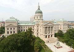
Indiana State Capitol |
|
000000001975-08-28-0000August 28, 1975
(#75000043) |
W. Washington St.
39°46′07″N 86°09′45″W / 39.768611°N 86.162500°W / 39.768611; -86.162500 (Indiana State Capitol) |
|
| 68 |
Indiana State Federation of Colored Women's Clubs |
|
000000001987-04-07-0000April 7, 1987
(#87000512) |
2034 N. Capitol Ave.
39°47′37″N 86°09′42″W / 39.793611°N 86.161667°W / 39.793611; -86.161667 (Indiana State Federation of Colored Women's Clubs) |
|
| 69 |
Indiana State Library and Historical Building |
|
000000001995-03-03-0000March 3, 1995
(#95000207) |
140 N. Senate Ave.
39°46′11″N 86°09′50″W / 39.769722°N 86.163889°W / 39.769722; -86.163889 (Indiana State Library and Historical Building) |
|
| 70 |
Indiana Theatre |
|
000000001979-01-29-0000January 29, 1979
(#79000035) |
134 W. Washington St.
39°46′02″N 86°09′39″W / 39.767222°N 86.160833°W / 39.767222; -86.160833 (Indiana Theatre) |
|
| 71 |
Indiana World War Memorial Plaza |
|
000000001989-09-25-0000September 25, 1989
(#89001404) |
Bounded by St. Clair, Pennsylvania, Vermont, and Meridian Sts.
39°46′30″N 86°09′24″W / 39.775°N 86.156667°W / 39.775; -86.156667 (Indiana World War Memorial Plaza) |
|
| 72 |
Indianapolis Athletic Club |
|
000000002015-12-15-0000December 15, 2015
(#15000887) |
350 N. Meridian St.
39°46′21″N 86°09′30″W / 39.772500°N 86.158333°W / 39.772500; -86.158333 (Indianapolis Athletic Club) |
|
| 73 |
Indianapolis Fire Headquarters and Municipal Garage |
|
000000002002-06-27-0000June 27, 2002
(#02000686) |
301 E. New York St. and 235 N. Alabama St.
39°46′14″N 86°09′08″W / 39.770556°N 86.152222°W / 39.770556; -86.152222 (Indianapolis Fire Headquarters and Municipal Garage) |
|
| 74 |
Indianapolis Masonic Temple |
|
000000002008-03-19-0000March 19, 2008
(#08000193) |
525 N. Illinois Ave.
39°46′38″N 86°09′33″W / 39.777222°N 86.159167°W / 39.777222; -86.159167 (Indianapolis Masonic Temple) |
|
| 75 |
Indianapolis News Building |
|
000000001984-03-07-0000March 7, 1984
(#84001133) |
30 W. Washington St.
39°46′02″N 86°09′33″W / 39.767222°N 86.159167°W / 39.767222; -86.159167 (Indianapolis News Building) |
|
| 76 |
Indianapolis Park and Boulevard System |
|
000000002003-03-28-0000March 28, 2003
(#03000149) |
Roughly bounded by 38th St., Emerson, Southern and Tibbs Aves., extending along Fall Creek and Pleasant Run Parkways to Shadeland
39°47′25″N 86°08′38″W / 39.790278°N 86.143889°W / 39.790278; -86.143889 (Indianapolis Park and Boulevard System) |
Extends into Lawrence, Warren, and Washington Townships, elsewhere in Marion County
|
| 77 |
Indianapolis Public Library Branch No. 3 |
|
000000002016-03-15-0000March 15, 2016
(#16000077) |
2822 E. Washington St.
39°46′07″N 86°06′57″W / 39.768611°N 86.115833°W / 39.768611; -86.115833 (Indianapolis Public Library Branch No. 3) |
|
| 78 |
Indianapolis Public Library Branch No. 6 |
|
000000002016-03-15-0000March 15, 2016
(#16000078) |
1801 Nowland Ave.
39°47′06″N 86°07′45″W / 39.785057°N 86.129094°W / 39.785057; -86.129094 (Indianapolis Public Library Branch No. 6) |
|
| 79 |
Indianapolis Union Railroad Station |
|
000000001974-07-19-0000July 19, 1974
(#74000032) |
39 Jackson Pl.
39°45′47″N 86°09′34″W / 39.763056°N 86.159444°W / 39.763056; -86.159444 (Indianapolis Union Railroad Station) |
|
| 80 |
Indianapolis Union Station-Wholesale District |
|
000000001982-07-14-0000July 14, 1982
(#82000067) |
Roughly bounded by Capitol Ave. and Maryland, Delaware, and South Sts.
39°45′51″N 86°09′30″W / 39.764167°N 86.158333°W / 39.764167; -86.158333 (Indianapolis Union Station-Wholesale District) |
|
| 81 |
Indianapolis White Castle Number 3 |
|
000000002011-06-23-0000June 23, 2011
(#11000385) |
660 Fort Wayne Ave.
39°46′36″N 86°09′16″W / 39.776583°N 86.154583°W / 39.776583; -86.154583 (Indianapolis White Castle Number 3) |
|
| 82 |
Charles Kuhn House |
|
000000001989-04-13-0000April 13, 1989
(#89000237) |
340 W. Michigan St.
39°46′27″N 86°09′52″W / 39.774167°N 86.164444°W / 39.774167; -86.164444 (Charles Kuhn House) |
|
| 83 |
Laurel and Prospect District |
|
000000001983-06-30-0000June 30, 1983
(#83000132) |
1335 to 1419 E. Prospect St.
39°45′08″N 86°08′07″W / 39.752222°N 86.135278°W / 39.752222; -86.135278 (Laurel and Prospect District) |
|
| 84 |
H. Lauter Company Complex |
|
000000002015-09-22-0000September 22, 2015
(#15000596) |
35-101 S. Harding St.
39°45′58″N 86°11′13″W / 39.766111°N 86.186944°W / 39.766111; -86.186944 (H. Lauter Company Complex) |
|
| 85 |
Louis Levey Mansion |
|
000000001978-12-22-0000December 22, 1978
(#78000047) |
2902 N. Meridian St.
39°48′30″N 86°09′24″W / 39.808333°N 86.156667°W / 39.808333; -86.156667 (Louis Levey Mansion) |
|
| 86 |
Linwood Colonial Apartments |
|
000000002006-04-19-0000April 19, 2006
(#06000308) |
4421 E. Washington St. and 55 and 56 S. Linwood Ave.
39°46′14″N 86°05′34″W / 39.770556°N 86.092778°W / 39.770556; -86.092778 (Linwood Colonial Apartments) |
|
| 87 |
Lockefield Garden Apartments |
|
000000001983-02-28-0000February 28, 1983
(#83000133) |
900 Indiana Ave.
39°46′42″N 86°10′26″W / 39.778333°N 86.173889°W / 39.778333; -86.173889 (Lockefield Garden Apartments) |
|
| 88 |
Lockerbie Square Historic District |
|
000000001973-02-23-0000February 23, 1973
(#73000038) |
Indianapolis; specifically, bounded by Michigan and Davidson Sts., New York Ave., and New Jersey St.
39°46′16″N 86°08′52″W / 39.771111°N 86.147778°W / 39.771111; -86.147778 (Lockerbie Square Historic District) |
Specific boundaries represent a boundary increase of 000000001987-07-28-0000July 28, 1987
|
| 89 |
The Lodge |
|
000000001983-09-15-0000September 15, 1983
(#83000073) |
829 N. Pennsylvania St.
39°46′43″N 86°09′20″W / 39.778611°N 86.155556°W / 39.778611; -86.155556 (The Lodge) |
|
| 90 |
Lombard Building |
|
000000001982-06-01-0000June 1, 1982
(#82000068) |
22-28 E. Washington St.
39°46′02″N 86°09′26″W / 39.767222°N 86.157222°W / 39.767222; -86.157222 (Lombard Building) |
|
| 91 |
Majestic Building |
|
000000001980-11-20-0000November 20, 1980
(#80000059) |
47 S. Pennsylvania St.
39°45′56″N 86°09′22″W / 39.765556°N 86.156111°W / 39.765556; -86.156111 (Majestic Building) |
|
| 92 |
Manchester Apartments |
|
000000001998-04-01-0000April 1, 1998
(#98000302) |
960-962 N. Pennsylvania St.
39°46′47″N 86°09′22″W / 39.779722°N 86.156111°W / 39.779722; -86.156111 (Manchester Apartments) |
|
| 93 |
Horace Mann Public School No. 13 |
|
000000001986-06-26-0000June 26, 1986
(#86001389) |
714 E. Buchanan St.
39°45′15″N 86°08′47″W / 39.754167°N 86.146389°W / 39.754167; -86.146389 (Horace Mann Public School No. 13) |
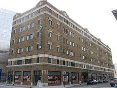
|
| 94 |
Marott Hotel |
|
000000001982-06-25-0000June 25, 1982
(#82000063) |
2625 N. Meridian St.
39°48′17″N 86°09′21″W / 39.804722°N 86.155833°W / 39.804722; -86.155833 (Marott Hotel) |
|
| 95 |
Marott's Shoes Building |
|
000000001983-05-09-0000May 9, 1983
(#83000135) |
18-20 E. Washington St.
39°46′03″N 86°09′27″W / 39.7675°N 86.1575°W / 39.7675; -86.1575 (Marott's Shoes Building) |
|
| 96 |
The Martens |
|
000000001983-09-15-0000September 15, 1983
(#83000070) |
348-356 Indiana Ave.
39°46′20″N 86°09′47″W / 39.772222°N 86.163056°W / 39.772222; -86.163056 (The Martens) |
|
| 97 |
The Massachusetts |
|
000000001983-09-15-0000September 15, 1983
(#83000071) |
421-427 Massachusetts Ave.
39°46′24″N 86°09′03″W / 39.773333°N 86.150833°W / 39.773333; -86.150833 (The Massachusetts) |
|
| 98 |
Massachusetts Avenue Commercial District |
|
000000001982-12-02-0000December 2, 1982
(#82000064) |
Roughly bounded by one block to either side of Massachusetts Ave. from Delaware St. to Interstate 65
39°46′33″N 86°08′51″W / 39.775833°N 86.147500°W / 39.775833; -86.147500 (Massachusetts Avenue Commercial District) |
|
| 99 |
The Mayleeno |
|
000000001983-09-15-0000September 15, 1983
(#83000072) |
416-418 E. Vermont St.
39°46′22″N 86°08′59″W / 39.772778°N 86.149722°W / 39.772778; -86.149722 (The Mayleeno) |
|
| 100 |
McCormick Cabin Site |
|
000000001981-05-28-0000May 28, 1981
(#81000028) |
Off U.S. Route 40
39°46′05″N 86°10′24″W / 39.768056°N 86.173472°W / 39.768056; -86.173472 (McCormick Cabin Site) |
|
| 101 |
The McKay |
|
000000001983-09-15-0000September 15, 1983
(#83000074) |
611 N. Pennsylvania St.
39°46′33″N 86°09′20″W / 39.775833°N 86.155556°W / 39.775833; -86.155556 (The McKay) |
|
| 102 |
George Philip Meier House |
|
000000001982-09-23-0000September 23, 1982
(#82000065) |
3128 N. Pennsylvania St.
39°48′46″N 86°09′18″W / 39.812778°N 86.155°W / 39.812778; -86.155 (George Philip Meier House) |
|
| 103 |
Merchants National Bank and Annex |
|
000000001982-02-19-0000February 19, 1982
(#82000066) |
11 S. Meridian St. and 7 E. Washington St.
39°46′00″N 86°09′29″W / 39.766667°N 86.158056°W / 39.766667; -86.158056 (Merchants National Bank and Annex) |
|
| 104 |
Meridian Park Historic District |
|
000000001990-02-23-0000February 23, 1990
(#90000326) |
Bounded by 34th St., Washington Boulevard, 30th St., and Pennsylvania St.
39°48′49″N 86°09′12″W / 39.813611°N 86.153333°W / 39.813611; -86.153333 (Meridian Park Historic District) |
|
| 105 |
Military Park |
|
000000001969-10-28-0000October 28, 1969
(#69000002) |
Bounded by West, New York, and Blackford Sts., and the canal
39°46′13″N 86°10′07″W / 39.770278°N 86.168611°W / 39.770278; -86.168611 (Military Park) |
|
| 106 |
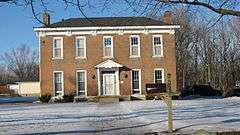
Thomas Moore House |
|
000000001984-03-15-0000March 15, 1984
(#84001137) |
4200 Brookville Rd.
39°45′54″N 86°05′43″W / 39.765°N 86.095278°W / 39.765; -86.095278 (Thomas Moore House) |
|
| 107 |
Morris-Butler House |
|
000000001973-02-20-0000February 20, 1973
(#73000037) |
1204 N. Park Ave.
39°46′15″N 86°09′00″W / 39.770833°N 86.15°W / 39.770833; -86.15 (Morris-Butler House) |
|
| 108 |
Morrison Block (M. O'Connor Grocery Wholesalers) |
|
000000001979-11-15-0000November 15, 1979
(#79000038) |
47 S. Meridian St.
39°45′56″N 86°09′29″W / 39.765556°N 86.158056°W / 39.765556; -86.158056 (Morrison Block (M. O'Connor Grocery Wholesalers)) |
|
| 109 |
Mt. Pisgah Lutheran Church |
|
000000001978-11-28-0000November 28, 1978
(#78000048) |
701 N. Pennsylvania St.
39°46′37″N 86°09′20″W / 39.776944°N 86.155556°W / 39.776944; -86.155556 (Mt. Pisgah Lutheran Church) |
|
| 110 |
The Myrtle Fern |
|
000000001983-09-15-0000September 15, 1983
(#83000080) |
221 E. 9th St.
39°46′44″N 86°09′11″W / 39.778889°N 86.153056°W / 39.778889; -86.153056 (The Myrtle Fern) |
|
| 111 |
Nurses' Sunken Garden and Convalescent Park |
|
000000001996-09-25-0000September 25, 1996
(#96001008) |
Bounded by Michigan St., the Rotary Building, West Dr., and the Union Building
39°46′35″N 86°10′56″W / 39.776389°N 86.182222°W / 39.776389; -86.182222 (Nurses' Sunken Garden and Convalescent Park) |
|
| 112 |
Old Indianapolis City Hall |
|
000000001974-10-29-0000October 29, 1974
(#74000029) |
202 N. Alabama St.
39°46′12″N 86°09′09″W / 39.770000°N 86.152500°W / 39.770000; -86.152500 (Old Indianapolis City Hall) |
|
| 113 |
Old Northside Historic District |
|
000000001978-03-24-0000March 24, 1978
(#78000049) |
Roughly bounded by Interstate 65 and 16th, Bellefontaine, and Pennsylvania Sts.; also Pennsylvania and 16th Sts.
39°47′08″N 86°08′58″W / 39.785556°N 86.149444°W / 39.785556; -86.149444 (Old Northside Historic District) |
Pennsylvania and 16th represents a boundary increase of 000000001984-09-27-0000September 27, 1984
|
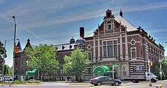
| 114 |
Oriental Lodge No. 500 |
|
000000002016-03-15-0000March 15, 2016
(#16000079) |
2201 Central
39°47′52″N 86°08′57″W / 39.797778°N 86.149167°W / 39.797778; -86.149167 (Oriental Lodge No. 500) |
|
| 115 |
The Oxford |
|
000000001983-09-15-0000September 15, 1983
(#83000081) |
316 E. Vermont St.
39°46′22″N 86°09′06″W / 39.772778°N 86.151667°W / 39.772778; -86.151667 (The Oxford) |
|
| 116 |
Pearson Terrace |
|
000000001984-03-01-0000March 1, 1984
(#84001187) |
928-940 N. Alabama St.
39°46′49″N 86°09′08″W / 39.780278°N 86.152222°W / 39.780278; -86.152222 (Pearson Terrace) |
|
| 117 |
The Pennsylvania |
|
000000001983-09-15-0000September 15, 1983
(#83000082) |
919 N. Pennsylvania St.
39°46′46″N 86°09′19″W / 39.779444°N 86.155278°W / 39.779444; -86.155278 (The Pennsylvania) |
|
| 118 |
Pierson-Griffiths House |
|
000000001978-05-22-0000May 22, 1978
(#78000050) |
1028 N. Delaware St.
39°46′56″N 86°09′15″W / 39.782222°N 86.154167°W / 39.782222; -86.154167 (Pierson-Griffiths House) |
|
| 119 |
The Plaza |
|
000000001983-09-15-0000September 15, 1983
(#83000083) |
902 N. Pennsylvania St. and 36 E. 9th St.
39°46′45″N 86°09′21″W / 39.779167°N 86.155833°W / 39.779167; -86.155833 (The Plaza) |
|
| 120 |
The Propylaeum (John W. Schmidt House) |
|
000000001973-06-19-0000June 19, 1973
(#73000039) |
1410 N. Delaware St.
39°47′11″N 86°09′16″W / 39.786389°N 86.154444°W / 39.786389; -86.154444 (The Propylaeum (John W. Schmidt House)) |
|
| 121 |
Prosser House |
|
000000001975-09-05-0000September 5, 1975
(#75000046) |
1454 E. 10th St.
39°46′53″N 86°08′01″W / 39.781389°N 86.133611°W / 39.781389; -86.133611 (Prosser House) |
|
| 122 |
Ralph Waldo Emerson Indianapolis Public School No. 58 |
|
000000002004-12-06-0000December 6, 2004
(#04001309) |
321 N. Linwood St.
39°46′29″N 86°05′32″W / 39.774722°N 86.092222°W / 39.774722; -86.092222 (Ralph Waldo Emerson Indianapolis Public School No. 58) |
|
| 123 |
Ransom Place Historic District |
|
000000001992-12-10-0000December 10, 1992
(#92001650) |
Roughly bounded by 10th, St. Clair, West, and Camp Sts.
39°46′44″N 86°10′11″W / 39.778889°N 86.169722°W / 39.778889; -86.169722 (Ransom Place Historic District) |
|
| 124 |
Reserve Loan Life Insurance Company |
|
000000001990-02-23-0000February 23, 1990
(#90000331) |
429 N. Pennsylvania St.
39°46′29″N 86°09′20″W / 39.774722°N 86.155556°W / 39.774722; -86.155556 (Reserve Loan Life Insurance Company) |
|
| 125 |
James Whitcomb Riley House |
|
000000001966-10-15-0000October 15, 1966
(#66000799) |
528 Lockerbie St.
39°46′20″N 86°08′53″W / 39.772222°N 86.147917°W / 39.772222; -86.147917 (James Whitcomb Riley House) |
|
| 126 |
The Rink |
|
000000001983-09-15-0000September 15, 1983
(#83000075) |
401 N. Illinois St.
39°46′22″N 86°09′34″W / 39.772778°N 86.159444°W / 39.772778; -86.159444 (The Rink) |
|
| 127 |
Rink's Womens Apparel Store |
|
000000001984-09-27-0000September 27, 1984
(#84001188) |
29 N. Illinois St.
39°46′04″N 86°09′34″W / 39.767778°N 86.159444°W / 39.767778; -86.159444 (Rink's Womens Apparel Store) |
|
| 128 |
Rivoli Theater |
|
000000002004-06-22-0000June 22, 2004
(#04000630) |
3155 E. 10th St.
39°46′52″N 86°06′41″W / 39.781111°N 86.111389°W / 39.781111; -86.111389 (Rivoli Theater) |
|
| 129 |
Roberts Park Methodist Episcopal Church |
|
000000001982-08-19-0000August 19, 1982
(#82000069) |
401 N. Delaware St.
39°46′22″N 86°09′14″W / 39.772778°N 86.153889°W / 39.772778; -86.153889 (Roberts Park Methodist Episcopal Church) |
|
| 130 |
Saint James Court |
|
000000001987-02-18-0000February 18, 1987
(#87000071) |
2102-2108 N. Meridian St.
39°47′43″N 86°09′27″W / 39.795278°N 86.1575°W / 39.795278; -86.1575 (Saint James Court) |
|
| 131 |
St. John's Church and Rectory |
|
000000001980-09-17-0000September 17, 1980
(#80000061) |
121 S. Capitol Ave. and 124 and 126 W. Georgia St.
39°45′52″N 86°09′41″W / 39.764444°N 86.161389°W / 39.764444; -86.161389 (St. John's Church and Rectory) |
|
| 132 |
St. Joseph Neighborhood Historic District |
|
000000001991-06-27-0000June 27, 1991
(#91000794) |
Roughly bounded by St. Clair, Delaware, and 11th Sts., and Central and Ft. Wayne Aves.
39°46′50″N 86°09′08″W / 39.780569°N 86.152117°W / 39.780569; -86.152117 (St. Joseph Neighborhood Historic District) |
|
| 133 |
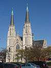
St. Mary's Catholic Church |
|
000000001977-11-09-0000November 9, 1977
(#77000020) |
317 N. New Jersey St.
39°46′20″N 86°09′00″W / 39.772222°N 86.150000°W / 39.772222; -86.150000 (St. Mary's Catholic Church) |
|
| 134 |
St. Philip Neri Parish Historic District |
|
000000001996-09-25-0000September 25, 1996
(#96001007) |
530 and 550 N. Rural St. and 545 N. Eastern Ave.
39°46′32″N 86°07′02″W / 39.775556°N 86.117222°W / 39.775556; -86.117222 (St. Philip Neri Parish Historic District) |
|
| 135 |
The Savoy |
|
000000001983-09-15-0000September 15, 1983
(#83000076) |
36 W. Vermont St.
39°46′22″N 86°09′32″W / 39.772778°N 86.158889°W / 39.772778; -86.158889 (The Savoy) |
|
| 136 |
Schnull-Rauch House |
|
000000001979-11-14-0000November 14, 1979
(#79000037) |
3050 N. Meridian St.
39°48′41″N 86°09′26″W / 39.811389°N 86.157222°W / 39.811389; -86.157222 (Schnull-Rauch House) |
|
| 137 |
Scottish Rite Cathedral |
|
000000001983-06-06-0000June 6, 1983
(#83000136) |
650 N. Meridian St.
39°46′34″N 86°09′29″W / 39.776111°N 86.158056°W / 39.776111; -86.158056 (Scottish Rite Cathedral) |
|
| 138 |
Selig's Dry Goods Company Building |
|
000000001984-05-17-0000May 17, 1984
(#84001190) |
20 W. Washington St.
39°46′02″N 86°09′30″W / 39.767222°N 86.158333°W / 39.767222; -86.158333 (Selig's Dry Goods Company Building) |
|
| 139 |
The Seville |
|
000000001987-06-22-0000June 22, 1987
(#87000976) |
1701 N. Illinois St.
39°47′23″N 86°09′31″W / 39.789722°N 86.158611°W / 39.789722; -86.158611 (The Seville) |
|
| 140 |
Sheffield Inn |
|
000000001998-04-01-0000April 1, 1998
(#98000301) |
956-58 N. Pennsylvania St.
39°46′50″N 86°09′21″W / 39.780556°N 86.155833°W / 39.780556; -86.155833 (Sheffield Inn) |
|
| 141 |
The Shelton |
|
000000001983-09-15-0000September 15, 1983
(#83000077) |
825 N. Delaware St.
39°46′42″N 86°09′13″W / 39.778333°N 86.153611°W / 39.778333; -86.153611 (The Shelton) |
|
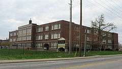
| 142 |
Shortridge High School |
|
000000001983-09-15-0000September 15, 1983
(#83000078) |
3401 N. Meridian St.
39°49′08″N 86°09′19″W / 39.818889°N 86.155278°W / 39.818889; -86.155278 (Shortridge High School) |
|
| 143 |
Shortridge-Meridian Street Apartments Historic District |
|
000000002000-03-15-0000March 15, 2000
(#00000195) |
Roughly between 34th and 38th Sts., along N. Meridian and N. Pennsylvania Sts.
39°49′16″N 86°09′24″W / 39.821156°N 86.1568°W / 39.821156; -86.1568 (Shortridge-Meridian Street Apartments Historic District) |
|
| 144 |
The Sid-Mar |
|
000000001983-09-15-0000September 15, 1983
(#83000079) |
401-403 Massachusetts Ave.
39°46′22″N 86°09′07″W / 39.772778°N 86.151944°W / 39.772778; -86.151944 (The Sid-Mar) |
|
| 145 |
August Sommer House |
|
000000001980-11-28-0000November 28, 1980
(#80000060) |
29 E. McCarty St.
39°45′55″N 86°09′31″W / 39.765278°N 86.158611°W / 39.765278; -86.158611 (August Sommer House) |
|
| 146 |
The Spink |
|
000000001983-09-15-0000September 15, 1983
(#83000084) |
230 E. 9th St.
39°46′45″N 86°09′10″W / 39.779167°N 86.152778°W / 39.779167; -86.152778 (The Spink) |
|
| 147 |
Spink Arms Hotel |
|
000000002001-12-07-0000December 7, 2001
(#01001345) |
410 N. Meridian St.
39°46′14″N 86°09′30″W / 39.770556°N 86.158333°W / 39.770556; -86.158333 (Spink Arms Hotel) |
|
| 148 |
State and Prospect District |
|
000000001983-06-30-0000June 30, 1983
(#83000137) |
State Ave. and Prospect St.
39°45′09″N 86°07′49″W / 39.7525°N 86.130278°W / 39.7525; -86.130278 (State and Prospect District) |
|
| 149 |
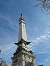
State Soldiers and Sailors Monument |
|
000000001973-02-23-0000February 23, 1973
(#73000040) |
Monument Circle
39°46′06″N 86°09′29″W / 39.768333°N 86.158056°W / 39.768333; -86.158056 (State Soldiers and Sailors Monument) |
|
| 150 |
The Sylvania |
|
000000001983-09-15-0000September 15, 1983
(#83000086) |
801 N. Pennsylvania St. and 108 E. St. Clair St.
39°46′41″N 86°09′20″W / 39.778056°N 86.155556°W / 39.778056; -86.155556 (The Sylvania) |
|
| 151 |
Taylor Carpet Company Building |
|
000000001984-03-01-0000March 1, 1984
(#84001192) |
26 W. Washington St.
39°46′02″N 86°09′32″W / 39.767222°N 86.158889°W / 39.767222; -86.158889 (Taylor Carpet Company Building) |
|
| 152 |
Test Building |
|
000000001983-06-16-0000June 16, 1983
(#83000138) |
54 Monument Circle
39°46′06″N 86°09′32″W / 39.768333°N 86.158889°W / 39.768333; -86.158889 (Test Building) |
|
| 153 |
U.S. Arsenal (Arsenal Technical High School) |
|
000000001976-05-19-0000May 19, 1976
(#76000034) |
1500 E. Michigan St.
39°46′40″N 86°07′59″W / 39.777778°N 86.133056°W / 39.777778; -86.133056 (U.S. Arsenal (Arsenal Technical High School)) |
|
| 154 |
U.S. Courthouse and Post Office |
|
000000001974-01-11-0000January 11, 1974
(#74000033) |
46 E. Ohio St.
39°46′14″N 86°09′25″W / 39.770556°N 86.156944°W / 39.770556; -86.156944 (U.S. Courthouse and Post Office) |
|
| 155 |
University Park |
|
000000001989-09-07-0000September 7, 1989
(#89001405) |
Bounded by Vermont, Pennsylvania, New York, and Meridian Sts.
39°46′18″N 86°09′24″W / 39.771667°N 86.156667°W / 39.771667; -86.156667 (University Park) |
|
| 156 |
Vera and the Olga |
|
000000001984-09-27-0000September 27, 1984
(#84001196) |
1440 and 1446 N. Illinois St.
39°47′12″N 86°09′34″W / 39.786667°N 86.159444°W / 39.786667; -86.159444 (Vera and the Olga) |
|
| 157 |
The Vienna |
|
000000001983-09-15-0000September 15, 1983
(#83000087) |
306 E. New York St.
39°46′17″N 86°09′08″W / 39.771389°N 86.152222°W / 39.771389; -86.152222 (The Vienna) |
|
| 158 |
Virginia Avenue District |
|
000000001983-06-30-0000June 30, 1983
(#83003442) |
Roughly Virginia Ave. from Grove Ave. to Prospect and Morris Sts.
39°45′10″N 86°08′25″W / 39.752778°N 86.140278°W / 39.752778; -86.140278 (Virginia Avenue District) |
|
| 159 |
Madame C.J. Walker Building |
|
000000001980-07-17-0000July 17, 1980
(#80000062) |
617 Indiana Ave.
39°46′33″N 86°10′01″W / 39.775833°N 86.166944°W / 39.775833; -86.166944 (Madame C.J. Walker Building) |
|
| 160 |
Washington Street-Monument Circle Historic District |
|
000000001997-09-26-0000September 26, 1997
(#97001179) |
Roughly bounded by Delaware, Ohio, Capitol, and W. Maryland Sts.
39°46′04″N 86°09′29″W / 39.767778°N 86.158056°W / 39.767778; -86.158056 (Washington Street-Monument Circle Historic District) |
|
| 161 |
H.P. Wasson & Company Building |
|
000000001997-12-24-0000December 24, 1997
(#97001539) |
2 W. Washington and 2 N. Meridian Sts.
39°46′02″N 86°09′30″W / 39.767222°N 86.158333°W / 39.767222; -86.158333 (H.P. Wasson & Company Building) |
|
| 162 |
Watson Park Historic District |
|
000000002012-06-19-0000June 19, 2012
(#12000336) |
Roughly bounded by 38th St., Watson Rd., and Birchwood, Fairfield, and Central Aves.
39°49′20″N 86°08′40″W / 39.822222°N 86.144444°W / 39.822222; -86.144444 (Watson Park Historic District) |
|
| 163 |
West Washington Street Pumping Station |
|
000000001980-07-17-0000July 17, 1980
(#80000063) |
801 W. Washington St.
39°46′00″N 86°10′19″W / 39.766667°N 86.171944°W / 39.766667; -86.171944 (West Washington Street Pumping Station) |
|
| 164 |
Wheeler-Schebler Carburetor Company |
|
000000002004-03-22-0000March 22, 2004
(#04000210) |
1234 Barth Ave.
39°45′00″N 86°08′28″W / 39.75°N 86.141111°W / 39.75; -86.141111 (Wheeler-Schebler Carburetor Company) |
|
| 165 |
John Greenleaf Whittier School, No. 33 |
|
000000001981-05-28-0000May 28, 1981
(#81000029) |
1119 N. Sterling St.
39°46′58″N 86°07′42″W / 39.782778°N 86.128333°W / 39.782778; -86.128333 (John Greenleaf Whittier School, No. 33) |
|
| 166 |
The Wil-Fra-Mar |
|
000000001983-09-15-0000September 15, 1983
(#83000088) |
318-320 E. Vermont St.
39°46′22″N 86°09′05″W / 39.772778°N 86.151389°W / 39.772778; -86.151389 (The Wil-Fra-Mar) |
|
| 167 |
The Wilson |
|
000000001983-09-15-0000September 15, 1983
(#83000089) |
643 Ft. Wayne Ave.
39°46′34″N 86°09′17″W / 39.776111°N 86.154722°W / 39.776111; -86.154722 (The Wilson) |
|
| 168 |
Woodruff Place |
|
000000001972-07-31-0000July 31, 1972
(#72000012) |
Roughly bounded by 1700-2000 E. Michigan and E. 10th Sts.
39°46′40″N 86°07′42″W / 39.777778°N 86.128333°W / 39.777778; -86.128333 (Woodruff Place) |
|
| 169 |
Woodstock Country Club |
|
000000002007-06-21-0000June 21, 2007
(#07000561) |
1301 W. 38th St.
39°49′22″N 86°11′02″W / 39.822689°N 86.183978°W / 39.822689; -86.183978 (Woodstock Country Club) |
|
| 170 |
The Wyndham |
|
000000001983-09-15-0000September 15, 1983
(#83000090) |
1040 N. Delaware St.
39°46′56″N 86°09′14″W / 39.782222°N 86.153889°W / 39.782222; -86.153889 (The Wyndham) |
|
| 171 |
YWCA Blue Triangle Residence Hall |
|
000000001988-09-27-0000September 27, 1988
(#88001574) |
725 N. Pennsylvania St.
39°46′39″N 86°09′19″W / 39.7775°N 86.155278°W / 39.7775; -86.155278 (YWCA Blue Triangle Residence Hall) |
|


_from_War_Memorial_Plaza.jpg)


.jpg)