| [3] |
Name on the Register[4] |
Image |
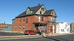
Date listed[5] |
Location |
City or town |
Description |
|---|
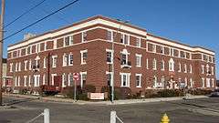
| 1 |
Beech Grove Cemetery |
|
000000001999-06-25-0000June 25, 1999
(#99000734) |
1400 W. Kilgore Ave.
40°11′20″N 85°24′20″W / 40.188889°N 85.405556°W / 40.188889; -85.405556 (Beech Grove Cemetery) |
Muncie |
|
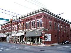
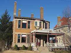
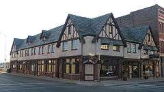
| 2 |
Boyce Block |
|
000000001984-03-01-0000March 1, 1984
(#84001015) |
216-224 E. Main St.
40°11′38″N 85°23′05″W / 40.193888°N 85.384722°W / 40.193888; -85.384722 (Boyce Block) |
Muncie |
|
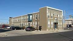
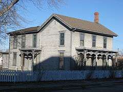
| 3 |
Otto Carmichael House |
|
000000002000-01-06-0000January 6, 2000
(#99001596) |
900 W. Kilgore Ave.
40°11′32″N 85°23′46″W / 40.192222°N 85.396111°W / 40.192222; -85.396111 (Otto Carmichael House) |
Muncie |
|
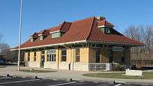
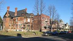
| 4 |
Cincinnati, Richmond, & Muncie Depot |
|
000000001997-04-14-0000April 14, 1997
(#97000304) |
Wysor St. at the Broadway junction
40°11′51″N 85°22′45″W / 40.1975°N 85.379167°W / 40.1975; -85.379167 (Cincinnati, Richmond, & Muncie Depot) |
Muncie |
|
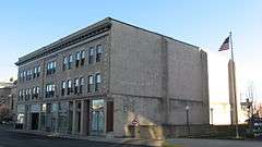
| 5 |
City Hall |
|
000000001988-11-14-0000November 14, 1988
(#88002114) |
220 E. Jackson St.
40°11′34″N 85°23′04″W / 40.192778°N 85.384444°W / 40.192778; -85.384444 (City Hall) |
Muncie |
|
| 6 |
Felt's Farm |
|
000000001975-08-28-0000August 28, 1975
(#75000015) |
Race St., southeast of Eaton
40°20′04″N 85°20′48″W / 40.334444°N 85.346667°W / 40.334444; -85.346667 (Felt's Farm) |
Union Township |
|
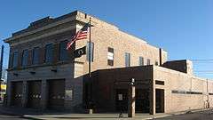
| 7 |
Fire Station No. 1 |
|
000000001989-02-17-0000February 17, 1989
(#88002126) |
421 E. Jackson St.
40°11′33″N 85°22′55″W / 40.192500°N 85.381944°W / 40.192500; -85.381944 (Fire Station No. 1) |
Muncie |
|
| 8 |
First Baptist Church |
|
000000001988-11-14-0000November 14, 1988
(#88002125) |
309 E. Adams St.
40°11′30″N 85°23′02″W / 40.191667°N 85.383889°W / 40.191667; -85.383889 (First Baptist Church) |
Muncie |
|
| 9 |
Job Garner-Jacob W. Miller House |
|
000000001986-06-13-0000June 13, 1986
(#86001264) |
Bethel Pike at County Road 700W, east of Bethel
40°14′54″N 85°31′11″W / 40.248333°N 85.519722°W / 40.248333; -85.519722 (Job Garner-Jacob W. Miller House) |
Harrison Township |
|
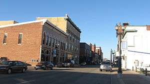
| 10 |
Goldsmith C. Gilbert Historic District |
|
000000001988-11-14-0000November 14, 1988
(#88002113) |
Roughly bounded by Wysor St., N. Madison St., E. Washington St., and Mulberry St.
40°11′43″N 85°22′58″W / 40.195278°N 85.382778°W / 40.195278; -85.382778 (Goldsmith C. Gilbert Historic District) |
Muncie |
|
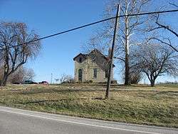
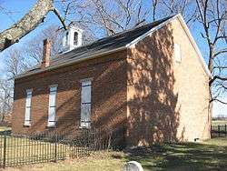
| 11 |
Hamilton Township Schoolhouse No. 4 |
|
000000001984-12-27-0000December 27, 1984
(#84000487) |
State Road 67, northeast of Muncie
40°15′17″N 85°20′27″W / 40.254722°N 85.340833°W / 40.254722; -85.340833 (Hamilton Township Schoolhouse No. 4) |
Hamilton Township |
|
| 12 |
Martin Hofherr Farm |
|
000000001992-06-04-0000June 4, 1992
(#92000677) |
County Road 650W, north of its junction with Division Rd. and northwest of Yorktown
40°11′41″N 85°30′32″W / 40.194722°N 85.508888°W / 40.194722; -85.508888 (Martin Hofherr Farm) |
Mount Pleasant Township |
|
| 13 |
Eli Hoover House and Confectionary |
|
000000001988-11-14-0000November 14, 1988
(#88002128) |
316 W. Main St.
40°11′38″N 85°23′21″W / 40.193889°N 85.389167°W / 40.193889; -85.389167 (Eli Hoover House and Confectionary) |
Muncie |
|
| 14 |
J.C. Johnson House |
|
000000001982-07-15-0000July 15, 1982
(#82000032) |
322 E. Washington St.
40°11′41″N 85°23′00″W / 40.194722°N 85.383333°W / 40.194722; -85.383333 (J.C. Johnson House) |
Muncie |
|
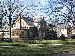
| 15 |
Margaret and George Riley Jones House |
|
000000001984-09-27-0000September 27, 1984
(#84001017) |
315 E. Charles St.
40°11′27″N 85°23′01″W / 40.190833°N 85.383611°W / 40.190833; -85.383611 (Margaret and George Riley Jones House) |
Muncie |
|
| 16 |
Judson Building |
|
000000001988-11-14-0000November 14, 1988
(#88002127) |
300 W. Main St.
40°11′38″N 85°23′20″W / 40.193889°N 85.388889°W / 40.193889; -85.388889 (Judson Building) |
Muncie |
|
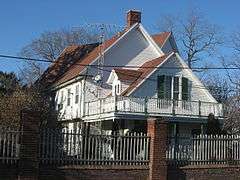
| 17 |
Dr. Samuel Vaughn Jump House |
|
000000001982-11-12-0000November 12, 1982
(#82000033) |
County Road 462E south of New Burlington and southeast of Muncie
40°07′03″N 85°17′53″W / 40.117500°N 85.298055°W / 40.117500; -85.298055 (Dr. Samuel Vaughn Jump House) |
Perry Township |
|
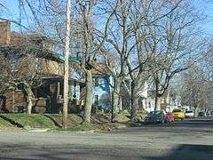
| 18 |
Emily Kimbrough Historic District |
|
000000001980-11-13-0000November 13, 1980
(#80000032) |
Bounded by Monroe, East Washington, Hackley, and East Charles Sts.; also roughly E. Gilbert, Beacon St., E. Charles St., and Madison St.
40°11′34″N 85°22′43″W / 40.192778°N 85.378611°W / 40.192778; -85.378611 (Emily Kimbrough Historic District) |
Muncie |
Second set of boundaries represents a boundary increase of 000000001989-06-29-0000June 29, 1989
|
| 19 |
Kirby Historic District |
|
000000001999-09-09-0000September 9, 1999
(#99001110) |
Roughly bounded by Jackson, Wolfe, Lincoln, and Main Sts.
40°11′34″N 85°22′12″W / 40.192778°N 85.37°W / 40.192778; -85.37 (Kirby Historic District) |
Muncie |
|
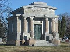
| 20 |
Alva Kitselman House |
|
000000001994-09-08-0000September 8, 1994
(#94001105) |
1400 W. University Ave.
40°11′54″N 85°24′04″W / 40.198333°N 85.401111°W / 40.198333; -85.401111 (Alva Kitselman House) |
Muncie |
|
| 21 |
William Henry Luick Farmhouse |
|
000000001994-06-10-0000June 10, 1994
(#94000588) |
2304 Burlington Dr.
40°10′30″N 85°20′43″W / 40.175000°N 85.345277°W / 40.175000; -85.345277 (William Henry Luick Farmhouse) |
Muncie |
|
| 22 |
Grace Keiser Maring Library |
|
000000002005-09-15-0000September 15, 2005
(#05001011) |
1808 S. Madison St.
40°10′44″N 85°22′50″W / 40.178889°N 85.380556°W / 40.178889; -85.380556 (Grace Keiser Maring Library) |
Muncie |
|
| 23 |
Masonic Temple |
|
000000001984-09-27-0000September 27, 1984
(#84001020) |
520 E. Main St.
40°11′38″N 85°22′52″W / 40.193889°N 85.381111°W / 40.193889; -85.381111 (Masonic Temple) |
Muncie |
|
| 24 |
Meeks Avenue Historic District |
|
000000001999-09-09-0000September 9, 1999
(#99001105) |
200-331 N. Meeks Ave.
40°11′45″N 85°23′36″W / 40.195833°N 85.393333°W / 40.195833; -85.393333 (Meeks Avenue Historic District) |
Muncie |
|
| 25 |
Minnetrista Boulevard Historic District |
|
000000002012-04-10-0000April 10, 2012
(#12000184) |
400-650 Minnetrista Boulevard
40°12′13″N 85°23′30″W / 40.203633°N 85.391763°W / 40.203633; -85.391763 (Minnetrista Boulevard Historic District) |
Muncie |
|
| 26 |
Moore-Youse-Maxon House |
|
000000001984-05-24-0000May 24, 1984
(#84001022) |
122 E. Washington St.
40°11′41″N 85°23′08″W / 40.1947222°N 85.385555°W / 40.1947222; -85.385555 (Moore-Youse-Maxon House) |
Muncie |
|
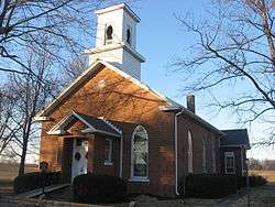
| 27 |
Mount Zion Methodist Episcopal Church |
|
000000002008-09-17-0000September 17, 2008
(#08000915) |
1701 W. Eaton-Wheeling Pike, west of Eaton
40°20′57″N 85°24′27″W / 40.349166°N 85.407500°W / 40.349166; -85.407500 (Mount Zion Methodist Episcopal Church) |
Union Township |
|
| 28 |
Muncie Public Library |
|
000000001976-06-17-0000June 17, 1976
(#76000019) |
301 E. Jackson St.
40°11′33″N 85°23′02″W / 40.1925°N 85.383889°W / 40.1925; -85.383889 (Muncie Public Library) |
Muncie |
|
| 29 |
Old West End Historic District |
|
000000001986-09-22-0000September 22, 1986
(#86002721) |
Roughly bounded by the White River and Washington St., Liberty St., Howard St., Orchard Pl., and Kilgore Ave.
40°11′31″N 85°23′35″W / 40.191944°N 85.393056°W / 40.191944; -85.393056 (Old West End Historic District) |
Muncie |
|
| 30 |
Peacock Apartments |
|
000000001988-11-14-0000November 14, 1988
(#88002119) |
414 S. Jefferson St.
40°11′27″N 85°23′03″W / 40.190833°N 85.384166°W / 40.190833; -85.384166 (Peacock Apartments) |
Muncie |
|
| 31 |
Richwood Evangelical Lutheran Church |
|
000000002004-12-06-0000December 6, 2004
(#04001314) |
9700 W. County Road 700S, northeast of Middletown
40°05′31″N 85°30′00″W / 40.091944°N 85.500000°W / 40.091944; -85.500000 (Richwood Evangelical Lutheran Church) |
Salem Township |
|
| 32 |
Riverside Historic District |
|
000000001999-06-25-0000June 25, 1999
(#99000733) |
Roughly bounded by University Ave. and Dicks, Gilbert, and Light Sts.
40°11′47″N 85°24′04″W / 40.196389°N 85.401111°W / 40.196389; -85.401111 (Riverside Historic District) |
Muncie |
|
| 33 |
Roberts Hotel |
|
000000001982-07-15-0000July 15, 1982
(#82000034) |
420 S. High St.
40°11′26″N 85°23′15″W / 40.190555°N 85.387500°W / 40.190555; -85.387500 (Roberts Hotel) |
Muncie |
|
| 34 |
Francis T. Roots Building |
|
000000001985-03-21-0000March 21, 1985
(#85000605) |
115-119 E. Charles St.
40°11′27″N 85°23′09″W / 40.190833°N 85.385833°W / 40.190833; -85.385833 (Francis T. Roots Building) |
Muncie |
|
| 35 |
F.D. Rose Building |
|
000000001984-03-01-0000March 1, 1984
(#84001023) |
121 E. Charles St.
40°11′27″N 85°23′08″W / 40.190833°N 85.385556°W / 40.190833; -85.385556 (F.D. Rose Building) |
Muncie |
|
| 36 |
W.W. Shirk Building |
|
000000001988-11-14-0000November 14, 1988
(#88002116) |
219 E. Jackson St.
40°11′33″N 85°23′04″W / 40.1925°N 85.384444°W / 40.1925; -85.384444 (W.W. Shirk Building) |
Muncie |
|
| 37 |
Walnut Street Historic District |
|
000000001989-02-17-0000February 17, 1989
(#88002112) |
Roughly Walnut St. from Washington to Victor Sts.
40°11′31″N 85°23′11″W / 40.191944°N 85.386389°W / 40.191944; -85.386389 (Walnut Street Historic District) |
Muncie |
|
| 38 |
West Washington Street Bridge |
|
000000002008-03-19-0000March 19, 2008
(#08000187) |
W. Washington St. over the west fork of the White River
40°11′42″N 85°23′29″W / 40.195°N 85.391389°W / 40.195; -85.391389 (West Washington Street Bridge) |
Muncie |
|
| 39 |
Westwood Historic District |
|
000000001992-04-03-0000April 3, 1992
(#92000186) |
Roughly bounded by Briar, Petty, and Warwick Rd. and Riverside Ave.
40°12′09″N 85°24′44″W / 40.2025°N 85.412222°W / 40.2025; -85.412222 (Westwood Historic District) |
Muncie |
|
| 40 |
Wilson Junior High School |
|
000000002001-09-16-0000September 16, 2001
(#01000992) |
2000 S. Franklin St.
40°10′36″N 85°23′20″W / 40.176667°N 85.388889°W / 40.176667; -85.388889 (Wilson Junior High School) |
Muncie |
|
| 41 |
Wysor Heights Historic District |
|
000000001988-11-01-0000November 1, 1988
(#88001217) |
Roughly bounded by Highland Ave., the White River, N. Elm St. and N. Walnut St.
40°12′18″N 85°23′01″W / 40.205°N 85.383611°W / 40.205; -85.383611 (Wysor Heights Historic District) |
Muncie |
|
| 42 |
YWCA |
|
000000001989-02-17-0000February 17, 1989
(#88002117) |
310 E. Charles St.
40°11′28″N 85°23′02″W / 40.191111°N 85.383889°W / 40.191111; -85.383889 (YWCA) |
Muncie |
|