São Pedro da Aldeia
| São Pedro da Aldeia | |||
|---|---|---|---|
| Municipality | |||
| Município de São Pedro da Aldeia The Municipality of São Pedro da Aldeia | |||
| |||
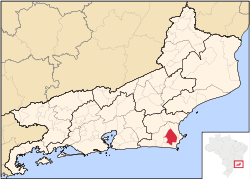 Location in the State of Rio de Janeiro | |||
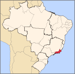
 São Pedro da Aldeia Location in Brazil | |||
| Coordinates: 22°50′20″S 42°06′10″W / 22.83889°S 42.10278°WCoordinates: 22°50′20″S 42°06′10″W / 22.83889°S 42.10278°W | |||
| Country |
| ||
| Region | Southeast | ||
| State |
| ||
| Founded | 16 May 1617 | ||
| Demonym(s) | aldeense | ||
| Postal Code | 28.940-000 | ||
| Area code(s) | 22 | ||
| Website | http://www.pmspa.rj.gov.br/ | ||

São Pedro da Aldeia (Portuguese pronunciation: [ˈsɐ̃w pedɾu ˈda awdeɪɐ]) is a municipality in Brazil. Its population was 88.013 (2010) and its area is 340 km².[1]
Geography
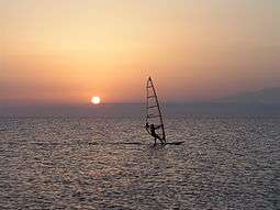
It lies in the east of Rio de Janeiro State on the Araruama Lake, 120 km from the state capital, Rio de Janeiro. The Araruama lagoon is the largest hypersaline lagoon in the world. Sports like windsurfing, kitesurfing and others like these are common because of the wind force in São Pedro da Aldeia
Economy
Salt extraction and fishing are the two most important industries.
History
São Pedro da Aldeia was founded in 1660 by Catholic priests on the top of a hill named after Saint Peter, in honor of whom the city was named. A chapel was built that was later replaced by an architecturally significant church. Nowadays it is the main historical monument in the town and is protected by state laws. Some colonial buildings and landmarks remain today, such as the cemetery beside the church, where the family graves of the founders of the town remain. In the 1960s the Brazilian Air Force and Navy built a military airport there, bringing many migrants from others parts of the country and increasing the town's population.
External links
- Previspa - Official Web Site of Public Servants of the city
- São Pedro da Aldeia City Council - Official Web Site of the São Pedro da Aldeia City Council
- Rio Notícias Agora-São Pedro da Aldeia - News About São Pedro da Aldeia
- Visit São Pedro da Aldeia - São Pedro da Aldeia Tourism Web Site
- Others:
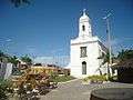 Matriz Square
 Matriz Church
References
Capital: Rio de Janeiro | |||||||||||||||||||
| Mesoregion Baixadas |
|  | |||||||||||||||||
| Mesoregion Centro Fluminense |
| ||||||||||||||||||
| Mesoregion Metropolitana do Rio de Janeiro |
| ||||||||||||||||||
| Mesoregion Noroeste Fluminense |
| ||||||||||||||||||
| Mesoregion Norte Fluminense |
| ||||||||||||||||||
| Mesoregion Sul Fluminense |
| ||||||||||||||||||