Saint-Laurent-de-la-Salle
| Saint-Laurent-de-la-Salle | |
|---|---|
|
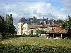
The Château of Plessis-le-Franc, in Saint-Laurent-de-la-Salle | |
 Saint-Laurent-de-la-Salle | |
|
Location within Pays de la Loire region  Saint-Laurent-de-la-Salle | |
| Coordinates: 46°34′11″N 0°54′59″W / 46.5697°N 0.9164°WCoordinates: 46°34′11″N 0°54′59″W / 46.5697°N 0.9164°W | |
| Country | France |
| Region | Pays de la Loire |
| Department | Vendée |
| Arrondissement | Fontenay-le-Comte |
| Canton | L’Hermenault |
| Intercommunality | Pays de l'Hermenault |
| Government | |
| • Mayor (2008–2014) | Sébastien Roy |
| Area1 | 19.22 km2 (7.42 sq mi) |
| Population (2006)2 | 373 |
| • Density | 19/km2 (50/sq mi) |
| Time zone | CET (UTC+1) |
| • Summer (DST) | CEST (UTC+2) |
| INSEE/Postal code | 85237 / 85410 |
| Elevation | 37–136 m (121–446 ft) |
|
1 French Land Register data, which excludes lakes, ponds, glaciers > 1 km² (0.386 sq mi or 247 acres) and river estuaries. 2 Population without double counting: residents of multiple communes (e.g., students and military personnel) only counted once. | |
Saint-Laurent-de-la-Salle is a commune in the Vendée department in the Pays de la Loire region in western France.
Geography
The river Smagne forms all of the commune's southern border.
See also
References
| Wikimedia Commons has media related to Saint-Laurent-de-la-Salle. |
This article is issued from Wikipedia - version of the 2/22/2015. The text is available under the Creative Commons Attribution/Share Alike but additional terms may apply for the media files.