Le Boupère
| Le Boupère | ||
|---|---|---|
|
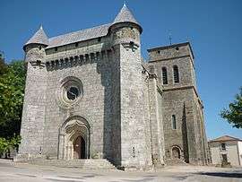
Fortified church of Saint-Pierre, in Le Boupère | ||
| ||
 Le Boupère | ||
|
Location within Pays de la Loire region  Le Boupère | ||
| Coordinates: 46°47′44″N 0°55′31″W / 46.7956°N 0.9253°WCoordinates: 46°47′44″N 0°55′31″W / 46.7956°N 0.9253°W | ||
| Country | France | |
| Region | Pays de la Loire | |
| Department | Vendée | |
| Arrondissement | Fontenay-le-Comte | |
| Canton | Pouzauges | |
| Intercommunality | Pays de Pouzauges | |
| Government | ||
| • Mayor (2008–2014) | Dominique Blanchard | |
| Area1 | 43.48 km2 (16.79 sq mi) | |
| Population (2006)2 | 2,889 | |
| • Density | 66/km2 (170/sq mi) | |
| Time zone | CET (UTC+1) | |
| • Summer (DST) | CEST (UTC+2) | |
| INSEE/Postal code | 85031 / 85510 | |
| Elevation | 67–155 m (220–509 ft) | |
|
1 French Land Register data, which excludes lakes, ponds, glaciers > 1 km² (0.386 sq mi or 247 acres) and river estuaries. 2 Population without double counting: residents of multiple communes (e.g., students and military personnel) only counted once. | ||
.svg.png)
Le Boupère is a commune in the Vendée department in the Pays de la Loire region in western France.
Geography
The river Lay forms all of the commune's southern border.
See also
References
| Wikimedia Commons has media related to Le Boupère. |
This article is issued from Wikipedia - version of the 2/21/2015. The text is available under the Creative Commons Attribution/Share Alike but additional terms may apply for the media files.