Rocheservière
| Rocheservière | ||
|---|---|---|
|
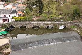
The Gallo-Roman bridge in Rocheserviere | ||
| ||
 Rocheservière | ||
|
Location within Pays de la Loire region  Rocheservière | ||
| Coordinates: 46°56′23″N 1°30′29″W / 46.9397°N 1.5081°WCoordinates: 46°56′23″N 1°30′29″W / 46.9397°N 1.5081°W | ||
| Country | France | |
| Region | Pays de la Loire | |
| Department | Vendée | |
| Arrondissement | La Roche-sur-Yon | |
| Canton | Rocheservière | |
| Intercommunality | Canton de Rocheservière | |
| Government | ||
| • Mayor (2008–2014) | Alain Leboeuf | |
| Area1 | 28.15 km2 (10.87 sq mi) | |
| Population (2006)2 | 2,745 | |
| • Density | 98/km2 (250/sq mi) | |
| Time zone | CET (UTC+1) | |
| • Summer (DST) | CEST (UTC+2) | |
| INSEE/Postal code | 85190 / 85620 | |
| Elevation | 15–72 m (49–236 ft) | |
|
1 French Land Register data, which excludes lakes, ponds, glaciers > 1 km² (0.386 sq mi or 247 acres) and river estuaries. 2 Population without double counting: residents of multiple communes (e.g., students and military personnel) only counted once. | ||
.svg.png)
Rocheservière is a commune in the Vendée department in the Pays de la Loire region in western France. The Battle of Rocheservière was fought nearby in 1815.
See also
References
| Wikimedia Commons has media related to Rocheservière. |
This article is issued from Wikipedia - version of the 3/15/2016. The text is available under the Creative Commons Attribution/Share Alike but additional terms may apply for the media files.