Saint-Paul-la-Coste
| Saint-Paul-la-Coste | ||
|---|---|---|
|
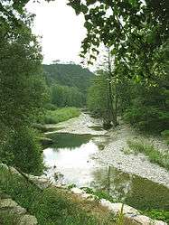
The Galeizon river | ||
| ||
 Saint-Paul-la-Coste | ||
|
Location within Occitanie region  Saint-Paul-la-Coste | ||
| Coordinates: 44°09′02″N 3°58′13″E / 44.1506°N 3.9703°ECoordinates: 44°09′02″N 3°58′13″E / 44.1506°N 3.9703°E | ||
| Country | France | |
| Region | Occitanie | |
| Department | Gard | |
| Arrondissement | Alès | |
| Canton | Alès-Ouest | |
| Intercommunality | Grand Alès | |
| Government | ||
| • Mayor (2008–2014) | Claude Chapon | |
| Area1 | 18.95 km2 (7.32 sq mi) | |
| Population (2008)2 | 269 | |
| • Density | 14/km2 (37/sq mi) | |
| Time zone | CET (UTC+1) | |
| • Summer (DST) | CEST (UTC+2) | |
| INSEE/Postal code | 30291 / 30480 | |
| Elevation |
168–680 m (551–2,231 ft) (avg. 650 m or 2,130 ft) | |
|
1 French Land Register data, which excludes lakes, ponds, glaciers > 1 km² (0.386 sq mi or 247 acres) and river estuaries. 2 Population without double counting: residents of multiple communes (e.g., students and military personnel) only counted once. | ||
.svg.png)
Saint-Paul-la-Coste is a commune in the Gard department in southern France.
Population
| Historical population | ||
|---|---|---|
| Year | Pop. | ±% |
| 1793 | 820 | — |
| 1821 | 725 | −11.6% |
| 1846 | 828 | +14.2% |
| 1872 | 742 | −10.4% |
| 1901 | 621 | −16.3% |
| 1926 | 434 | −30.1% |
| 1946 | 310 | −28.6% |
| 1962 | 134 | −56.8% |
| 1968 | 184 | +37.3% |
| 1975 | 194 | +5.4% |
| 1982 | 172 | −11.3% |
| 1990 | 193 | +12.2% |
| 1999 | 220 | +14.0% |
| 2008 | 269 | +22.3% |
See also
References
| Wikimedia Commons has media related to Saint-Paul-la-Coste. |
This article is issued from Wikipedia - version of the 11/9/2016. The text is available under the Creative Commons Attribution/Share Alike but additional terms may apply for the media files.