Barjac, Gard
| Barjac | ||
|---|---|---|
|
Town hall | ||
| ||
 Barjac | ||
|
Location within Occitanie region  Barjac | ||
| Coordinates: 44°18′32″N 4°20′55″E / 44.3089°N 4.3486°ECoordinates: 44°18′32″N 4°20′55″E / 44.3089°N 4.3486°E | ||
| Country | France | |
| Region | Occitanie | |
| Department | Gard | |
| Arrondissement | Alès | |
| Canton | Barjac | |
| Government | ||
| • Mayor (2008–2014) | Edouard Chaulet | |
| Area1 | 42.72 km2 (16.49 sq mi) | |
| Population (2008)2 | 1,530 | |
| • Density | 36/km2 (93/sq mi) | |
| Time zone | CET (UTC+1) | |
| • Summer (DST) | CEST (UTC+2) | |
| INSEE/Postal code | 30029 / 30430 | |
| Elevation |
112–364 m (367–1,194 ft) (avg. 250 m or 820 ft) | |
|
1 French Land Register data, which excludes lakes, ponds, glaciers > 1 km² (0.386 sq mi or 247 acres) and river estuaries. 2 Population without double counting: residents of multiple communes (e.g., students and military personnel) only counted once. | ||
.svg.png)
Barjac is a commune in the Gard department in southern France.[1]
The valley of the river Cèze lies to the south, and the river Ardèche is 10 km (6.2 mi) to the north.
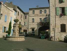
Barjac is a Renaissance town. The old city centre retains ancient narrow streets, squares and houses of that time. The chateau of the Counts of the Roure, with its stone courtyard, once called the "Citadel", has been rebuilt several times from the twelfth century.[2] This imposing edifice now features a library in the former stables, and a cinema in the old kitchens. The chateau is the venue for the festival "Chansons de Paroles" (Songs and Words) held annually in late July.
The contemporary German artist Anselm Kiefer has had his studio, called the Ribaute, in Barjac since 1993 in a former industrial wasteland of 35 hectares.
Population
| Historical population | ||
|---|---|---|
| Year | Pop. | ±% |
| 1962 | 1,003 | — |
| 1968 | 1,056 | +5.3% |
| 1975 | 1,091 | +3.3% |
| 1982 | 1,241 | +13.7% |
| 1990 | 1,361 | +9.7% |
| 1999 | 1,379 | +1.3% |
| 2008 | 1,530 | +10.9% |
See also
References
- ↑ "Fiche de la commune de Barjac" [Listing of the commune of Barjac] (in French). INSEE.
- ↑ "Barjac". Quid (in French). Archived from the original on 2008-11-14.
External links
| Wikimedia Commons has media related to Barjac. |