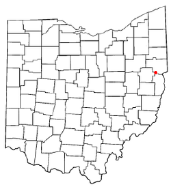
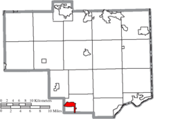
Salineville, Ohio
| Salineville, Ohio | |
|---|---|
| Village | |
|
Salineville from the air, looking south | |
| Motto: Salt of the Earth[1] | |
 Location of Salineville, Ohio | |
 Location of Salineville in Columbiana County | |
| Coordinates: 40°37′24″N 80°50′3″W / 40.62333°N 80.83417°WCoordinates: 40°37′24″N 80°50′3″W / 40.62333°N 80.83417°W | |
| Country | United States |
| State | Ohio |
| County | Columbiana |
| Area[2] | |
| • Total | 2.21 sq mi (5.72 km2) |
| • Land | 2.21 sq mi (5.72 km2) |
| • Water | 0 sq mi (0 km2) |
| Elevation[3] | 899 ft (274 m) |
| Population (2010)[4] | |
| • Total | 1,311 |
| • Estimate (2012[5]) | 1,294 |
| • Density | 593.2/sq mi (229.0/km2) |
| Time zone | Eastern (EST) (UTC-5) |
| • Summer (DST) | EDT (UTC-4) |
| ZIP code | 43945 |
| Area code(s) | 330, 234 |
| FIPS code | 39-70100[6] |
| GNIS feature ID | 1065281[3] |

Salineville is a village in southwestern Columbiana County, Ohio, United States. The population was 1,311 at the 2010 census.
History
Salineville was laid out in 1839 and incorporated as a village in 1848.[7] Salineville was named from the salt deposits (salinity) found on Yellow Creek.[8]
The Civil War Battle of Salineville, which ended Morgan's Raid and resulted in the capture of Confederate General John Hunt Morgan, took place near Salineville on July 26, 1863.
Geography
Salineville is located at 40°37′24″N 80°50′3″W / 40.62333°N 80.83417°W (40.623461, -80.834182).[9]
According to the United States Census Bureau, the village has a total area of 2.21 square miles (5.72 km2), all land.[2]
Demographics
| Historical population | |||
|---|---|---|---|
| Census | Pop. | %± | |
| 1860 | 485 | — | |
| 1870 | 1,429 | 194.6% | |
| 1880 | 2,302 | 61.1% | |
| 1890 | 2,369 | 2.9% | |
| 1900 | 2,353 | −0.7% | |
| 1910 | 2,403 | 2.1% | |
| 1920 | 2,700 | 12.4% | |
| 1930 | 2,133 | −21.0% | |
| 1940 | 2,018 | −5.4% | |
| 1950 | 2,018 | 0.0% | |
| 1960 | 1,898 | −5.9% | |
| 1970 | 1,686 | −11.2% | |
| 1980 | 1,629 | −3.4% | |
| 1990 | 1,474 | −9.5% | |
| 2000 | 1,397 | −5.2% | |
| 2010 | 1,311 | −6.2% | |
| Est. 2015 | 1,273 | [10] | −2.9% |
2010 census
As of the census[4] of 2010, there were 1,311 people, 518 households, and 346 families residing in the village. The population density was 593.2 inhabitants per square mile (229.0/km2). There were 591 housing units at an average density of 267.4 per square mile (103.2/km2). The racial makeup of the village was 97.1% White, 1.4% African American, 0.2% Native American, 0.1% Asian, and 1.3% from two or more races. Hispanic or Latino of any race were 0.4% of the population.
There were 518 households of which 36.1% had children under the age of 18 living with them, 42.7% were married couples living together, 15.8% had a female householder with no husband present, 8.3% had a male householder with no wife present, and 33.2% were non-families. 28.2% of all households were made up of individuals and 11.8% had someone living alone who was 65 years of age or older. The average household size was 2.52 and the average family size was 3.02.
The median age in the village was 36.5 years. 27.8% of residents were under the age of 18; 7.9% were between the ages of 18 and 24; 24% were from 25 to 44; 26.4% were from 45 to 64; and 14% were 65 years of age or older. The gender makeup of the village was 47.8% male and 52.2% female.
2000 census
As of the census[6] of 2000, there were 1,397 people, 535 households, and 365 families residing in the village. The population density was 628.6 people per square mile (243.0/km²). There were 594 housing units at an average density of 267.3 per square mile (103.3/km²). The racial makeup of the village was 99.07% White, 0.36% Native American, 0.07% from other races, and 0.50% from two or more races. Hispanic or Latino of any race were 0.57% of the population.
There were 535 households out of which 33.3% had children under the age of 18 living with them, 47.9% were married couples living together, 14.6% had a female householder with no husband present, and 31.6% were non-families. 26.7% of all households were made up of individuals and 13.8% had someone living alone who was 65 years of age or older. The average household size was 2.60 and the average family size was 3.14.
In the village the population was spread out with 29.2% under the age of 18, 9.3% from 18 to 24, 27.6% from 25 to 44, 22.2% from 45 to 64, and 11.7% who were 65 years of age or older. The median age was 33 years. For every 100 females there were 97.9 males. For every 100 females age 18 and over, there were 90.9 males.
The median income for a household in the village was $27,473, and the median income for a family was $30,167. Males had a median income of $28,864 versus $19,539 for females. The per capita income for the village was $13,895. About 11.6% of families and 15.7% of the population were below the poverty line, including 22.4% of those under age 18 and 16.5% of those age 65 or over.
Education
Students in Salineville are educated at the K-12 complex of Southern Local School District, four miles away in Washington Township near Highlandtown. The renovated complex was built by adding to what was then the Southern Local High School building, and was completed in 2004.[12]
Notable person
- Ben Feldman - Record-setting insurance salesman.
See also
References
- ↑ File:Welcome to Salineville - Salt of the Earth.JPG
- 1 2 "US Gazetteer files 2010". United States Census Bureau. Retrieved 2013-01-06.
- 1 2 "US Board on Geographic Names". United States Geological Survey. 2007-10-25. Retrieved 2008-01-31.
- 1 2 "American FactFinder". United States Census Bureau. Retrieved 2013-01-06.
- ↑ "Population Estimates". United States Census Bureau. Retrieved 2013-06-17.
- 1 2 "American FactFinder". United States Census Bureau. Retrieved 2008-01-31.
- ↑ McCord, William B. (1905). History of Columbiana County, Ohio and Representative Citizens. Biographical Publishing Company. p. 335.
- ↑ Mack, Horace (1879). History of Columbiana County, Ohio: With Illustrations and Biographical Sketches of Some of Its Prominent Men and Pioneers. Unigraphic. p. 270.
- ↑ "US Gazetteer files: 2010, 2000, and 1990". United States Census Bureau. 2011-02-12. Retrieved 2011-04-23.
- ↑ "Annual Estimates of the Resident Population for Incorporated Places: April 1, 2010 to July 1, 2015". Retrieved July 2, 2016.
- ↑ "Census of Population and Housing". Census.gov. Retrieved June 4, 2015.
- ↑ "Southern Local School District Summary of Assessment". Retrieved 2013-07-24.
Municipalities and communities of Columbiana County, Ohio, United States | ||
|---|---|---|
| Cities | 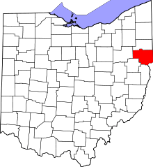 | |
| Villages | ||
| Townships | ||
| CDPs | ||
| Unincorporated communities |
| |
| Ghost town | ||
| Footnotes | ‡This populated place also has portions in an adjacent county or counties | |