Minerva, Ohio
| Minerva, Ohio | |
|---|---|
| Village | |
|
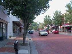
Market Street in Summer | |
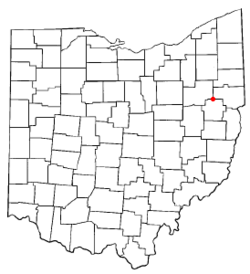 Location of Minerva, Ohio | |
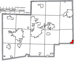 Location of Minerva in Stark County | |
| Coordinates: 40°43′44″N 81°6′7″W / 40.72889°N 81.10194°WCoordinates: 40°43′44″N 81°6′7″W / 40.72889°N 81.10194°W | |
| Country | United States |
| State | Ohio |
| Counties | Stark, Carroll, Columbiana |
| Government | |
| • Mayor | Ruth Jeanne King |
| Area[1] | |
| • Total | 2.23 sq mi (5.78 km2) |
| • Land | 2.23 sq mi (5.78 km2) |
| • Water | 0 sq mi (0 km2) |
| Elevation[2] | 1,056 ft (322 m) |
| Population (2010)[3] | |
| • Total | 3,720 |
| • Estimate (2012[4]) | 3,703 |
| • Density | 1,668.2/sq mi (644.1/km2) |
| Time zone | Eastern (EST) (UTC-5) |
| • Summer (DST) | EDT (UTC-4) |
| ZIP code | 44657 |
| Area code(s) | 330, 234 205 |
| FIPS code | 39-50834[5] |
| GNIS feature ID | 1056427[2] |
| Website | http://ci.minerva.oh.us/ |
Minerva is a village in Carroll, Columbiana, and Stark counties in the U.S. state of Ohio. The population was 3,720 at the 2010 census.
The Carroll and Stark County portions of Minerva are part of the Canton-Massillon, OH Metropolitan Statistical Area, while the Columbiana County portion is part of the Salem, OH Micropolitan Statistical Area.
History
The village of Minerva began when a surveyor named John Whitacre purchased 123 acres of land from Isaac Craig in 1818 for the construction of a log mill. The town, named for his niece, Minerva Ann Taylor born April 19, 1833, grew up around the mill. Minerva's first schoolhouse was built in 1846. In its early years the Sandy and Beaver Canal helped drive Minerva's economy, to be replaced in importance by the Pennsylvania Railroad in the 1840s. Minerva manufacturers Willard and Isaac Pennock patented the United States' first steel railroad car in the nineteenth century.[6]
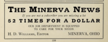
In 1915, the town's weekly newspaper, The Minerva News, charged one dollar for an annual subscription.[7]
Legend of the Lost French Gold
According to local legend, in the 1760s the French held possession of Fort Duquesne, which later became Fort Pitt in Pittsburgh. George Washington was leading a company of 2000 British troops from the east to attack the fort. The British held up at Turtle Creek for the night. Indian scouts reported to the French that an attack was coming. The French loaded one ton of gold, which was to be the French payroll, onto ten pack horses and sent them west along the Great Trail. They were to head to present-day Bolivar, Ohio, where there was a blockhouse for shelter and provisions. That location later became the location of Fort Laurens. The British were successful in overthrowing the fort and learned of the escape with the gold. Four days out of Pittsburgh, the British were catching up to the French, so the French buried the gold to avoid it falling into British hands. It was reportedly buried at the fork of three springs. One mile to the west of that location, a rock was placed in the fork of a tree. Over the years, many have tried to locate the legendary buried treasure, but to this day it has not been found.
Geography
Minerva is located at 40°43′44″N 81°6′7″W / 40.72889°N 81.10194°W (40.728830, -81.102073),[8] along Sandy Creek.[9]
According to the United States Census Bureau, the village has a total area of 2.23 square miles (5.78 km2), all land.[1]
Demographics
2010 census
As of the census[3] of 2010, there were 3,720 people, 1,580 households, and 1,009 families residing in the village. The population density was 1,668.2 inhabitants per square mile (644.1/km2). There were 1,762 housing units at an average density of 790.1 per square mile (305.1/km2). The racial makeup of the village was 97.7% White, 0.3% African American, 0.1% Native American, 0.3% Asian, 0.3% from other races, and 1.3% from two or more races. Hispanic or Latino of any race were 0.7% of the population.
There were 1,580 households of which 29.9% had children under the age of 18 living with them, 45.4% were married couples living together, 13.6% had a female householder with no husband present, 4.9% had a male householder with no wife present, and 36.1% were non-families. 32.3% of all households were made up of individuals and 16.6% had someone living alone who was 65 years of age or older. The average household size was 2.34 and the average family size was 2.93.
The median age in the village was 41.2 years. 23.6% of residents were under the age of 18; 7.9% were between the ages of 18 and 24; 22.8% were from 25 to 44; 25.9% were from 45 to 64; and 19.9% were 65 years of age or older. The gender makeup of the village was 47.4% male and 52.6% female.
2000 census
As of the census[5] of 2000, there were 3,934 people, 1,603 households, and 1,082 families residing in the village. The population density was 1,840.3 people per square mile (709.8/km²). There were 1,718 housing units at an average density of 803.7 per square mile (310.0/km²). The racial makeup of the village was 99.03% White, 0.05% African American, 0.08% Native American, 0.13% Asian, 0.05% from other races, and 0.66% from two or more races. Hispanic or Latino of any race were 0.48% of the population.
There were 1,603.5 households out of which 30.31% had children under the age of 18 living with them, 51.1% were married couples living together, 12.9% had a female householder with no husband present, and 32.56% were non-families. 28.41% of all households were made up of individuals and 13.1% had someone living alone who was 65 years of age or older. The average household size was 2.38 and the average family size was 2.91.
In the village the population was spread out with 23.6% under the age of 18, 8.8% from 18 to 24, 25.7% from 25 to 44, 23.5% from 45 to 64, and 18.5% who were 65 years of age or older. The median age was 40 years. For every 100 females there were 89.4 males. For every 100 females age 18 and over, there were 86.2 males.
The median income for a household in the village was $33,468, and the median income for a family was $39,669. Males had a median income of $30,477 versus $21,156 for females. The per capita income for the village was $116,853. About 6.3% of families and 9.8% of the population were below the poverty line, including 15.2% of those under age 18 and 7.3% of those age 65 or over.
Education
| Historical population | |||
|---|---|---|---|
| Census | Pop. | %± | |
| 1870 | 210 | — | |
| 1880 | 565 | 169.0% | |
| 1890 | 1,139 | 101.6% | |
| 1900 | 1,200 | 5.4% | |
| 1910 | 1,396 | 16.3% | |
| 1920 | 2,261 | 62.0% | |
| 1930 | 2,675 | 18.3% | |
| 1940 | 2,937 | 9.8% | |
| 1950 | 3,280 | 11.7% | |
| 1960 | 3,833 | 16.9% | |
| 1970 | 4,359 | 13.7% | |
| 1980 | 4,549 | 4.4% | |
| 1990 | 4,318 | −5.1% | |
| 2000 | 3,934 | −8.9% | |
| 2010 | 3,720 | −5.4% | |
| Est. 2015 | 3,678 | [10] | −1.1% |
| [11] | |||
Students attend the Minerva Local School District.
Notable people
- Carol Costello - CNN correspondent
- John Cowan - soul music and progressive bluegrass musician; bassist for The Doobie Brothers
- Phil Davison - former candidate for Stark County Treasurer
- Oscar Grimes - baseball player, son of Ray Grimes and nephew of Roy Grimes, twin brothers who were also major leaguers.
- Ralph Hodgson - poet
- Bill Powell - owner and designer of Clearview Golf Club, the first professional golf course owned and designed by an African-American and the first integrated golf course in America[12]
- Theodore Newton Vail - telephone industrialist
- Charles Erwin Wilson - former U.S. Secretary of Defense and CEO for General Motors
References
- 1 2 "US Gazetteer files 2010". United States Census Bureau. Retrieved 2013-01-06.
- 1 2 "US Board on Geographic Names". United States Geological Survey. 2007-10-25. Retrieved 2008-01-31.
- 1 2 "American FactFinder". United States Census Bureau. Retrieved 2013-01-06.
- ↑ "Population Estimates". United States Census Bureau. Retrieved 2013-06-17.
- 1 2 "American FactFinder". United States Census Bureau. Retrieved 2008-01-31.
- ↑ Village of Minerva (2010). "Our History." Accessed 1 October 2010. http://ci.minerva.oh.us/
- ↑ The farm journal rural directory of Stark County. Philadelphia: Wilmer Atkinson Co. 1915. p. 356. Retrieved 2013-11-11.
- ↑ "US Gazetteer files: 2010, 2000, and 1990". United States Census Bureau. 2011-02-12. Retrieved 2011-04-23.
- ↑ DeLorme (1991). Ohio Atlas & Gazetteer. Yarmouth, Maine: DeLorme. ISBN 0-89933-233-1.
- ↑ "Annual Estimates of the Resident Population for Incorporated Places: April 1, 2010 to July 1, 2015". Retrieved July 2, 2016.
- ↑ census data: 1870 : 1870 page 24 , 1890,1900 : Hunt, William C. (1901). Population of the United States by states and territories, counties, and minor Civil Divisions, as returned at the Twelfth Census: 1900. United States Census Printing Office. p. 306. , 1910, 1920, 1930 : 1930 page 40 , 1940, 1950 : 1950 page 26 , 1960, 1970 : 1970 page=144 , 1990 : 1990 , 2000 : 2000 , 2010 : http://factfinder2.census.gov/faces/tableservices/jsf/pages/productview.xhtml?pid=DEC_10_DP_DPDP1&prodType=table
- ↑ "Golf Pioneer Dies". Morning Journal News. Jan 2, 2010.
External links
Municipalities and communities of Carroll County, Ohio, United States | ||
|---|---|---|
| Villages | 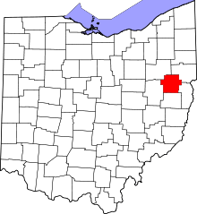 | |
| Townships | ||
| CDP | ||
| Unincorporated communities | ||
| Footnotes | ‡This populated place also has portions in an adjacent county or counties | |
Municipalities and communities of Columbiana County, Ohio, United States | ||
|---|---|---|
| Cities | 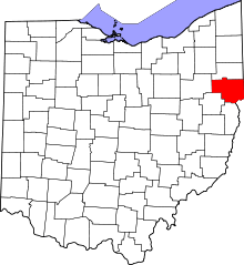 | |
| Villages | ||
| Townships | ||
| CDPs | ||
| Unincorporated communities |
| |
| Ghost town | ||
| Footnotes | ‡This populated place also has portions in an adjacent county or counties | |
Municipalities and communities of Stark County, Ohio, United States | ||
|---|---|---|
| Cities |  | |
| Villages | ||
| Townships | ||
| CDPs | ||
| Unincorporated communities | ||
| Footnotes | ‡This populated place also has portions in an adjacent county or counties | |