San Luis Province
| San Luis | |||
|---|---|---|---|
| Province | |||
| |||
 | |||
| Country | Argentina | ||
| Capital | San Luis | ||
| Divisions | 9 departments | ||
| Government | |||
| • Governor | Alberto Rodríguez Saá | ||
| • Senators | Liliana Negre de Alonso, Adolfo Rodríguez Saá, Daniel Pérsico | ||
| Area | |||
| • Total | 76,748 km2 (29,633 sq mi) | ||
| Population (2010[1]) | |||
| • Total | 432,310 | ||
| • Rank | 19th | ||
| • Density | 5.6/km2 (15/sq mi) | ||
| Demonym(s) | Puntano | ||
| Time zone | ART (UTC−3) | ||
| ISO 3166 code | AR-D | ||
| Website |
sanluis | ||
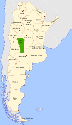
San Luis (Spanish pronunciation: [san ˈlwis]) is a province of Argentina located near the geographical center of the country (on the 32° South parallel). Neighboring provinces are, from the north clockwise, La Rioja, Córdoba, La Pampa, Mendoza and San Juan.
History
The city of San Luis was founded in 1594 by Luis Jufré de Loaysa y Meneses, but was subsequently abandoned. It was refounded by Martín García Óñez de Loyola in 1596 under the name San Luis de Loyola.[2]

Politics in San Luis have long been influenced by the descendants of the noted mid-19th century advocate for San Luis's integration into the rest of Argentina, Juan Saá. Since the return of Argentina to democratic rule in 1983, in particular, the Rodríguez Saá family (of Peronist affiliation) has occupied the governor's seat. This situation is, as in many smaller provinces in Argentina (and, indeed, elsewhere), partly explained by the customary use of a combination of nepotism, propaganda and generous social welfare legislation. This includes substantial allegations of illegal pressure, including the violent 1991 harassment of a local journalist and his neighbors.[3] Since 1983, however, Governor (now Senator) Adolfo Rodríguez Saá has also overseen record investment by light manufacturers (mostly food-processors and bottling plants) and advances like the construction of Argentina's most extensive expressway network.[4]
Geography and climate
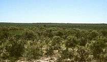
The province has low sierras in the north along the Dry Pampas, and another such system on the west with the Guayaguas, Cantanal, Quijadas and Alto Pencoso Sierras, typical of the Cuyo region.
Economy
San Luis' economy has, over the past generation, been among the most improved in Argentina. Its 2006 output, estimated at US$3.386 billion, yielded a per capita income of US$9,203 (somewhat above the national average).[5]
The economic profile of the province changed due to industrial promotion policies implemented since late 1982. Until then, the primary sector (agriculture) was the productive base.
Industrial establishments installed after that year, exhibit great diversification and are mainly in two urban centers: the capital and Villa Mercedes.
Tourism is another of the activities promoted by the San Luis government since the return of democracy in 1983. Currently the province has the largest network of highways in the country, which connects most of the resorts with the provincial capital.
Political division
The province is divided into nine departments (departamentos).
%2C_departments_and_capital.png)
| Department | Capital |
|---|---|
| Ayacucho | San Francisco del Monte de Oro |
| Belgrano | Villa General Roca |
| La Capital | San Luis |
| Chacabuco | Concarán |
| Coronel Pringles | La Toma |
| General Pedernera | Villa Mercedes |
| Gobernador Dupuy | Buena Esperanza |
| Junín | Santa Rosa |
| Libertador General San Martín | Libertador General San Martín |
Source for department names:[1]
References
- 1 2 "Argentina: San Luis". City Population. Retrieved 5 October 2012.
- ↑ "PROVINCIA DE SAN LUIS" (in Spanish). El Vigía. Retrieved 1 April 2013.
- ↑ Noticias. 6 September 1991.
- ↑ Grupo Payne Archived May 31, 2011, at the Wayback Machine.
- ↑ "El déficit consolidado de las provincias rondará los $11.500 millones este año" (in Spanish). Instituto Argentino para el Desarrollo de las Economías Regionales. Archived from the original on July 11, 2015. Retrieved 10 July 2015.
External links
- Provincia de San Luis - Official website (in Spanish)
- Argentour: San Luis Province
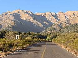 Landscape near Merlo.
 Expressway south of the city of San Luis. The province's highway network is among the most developed in Argentina.
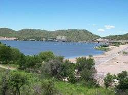 Lake Potrero de los Funes
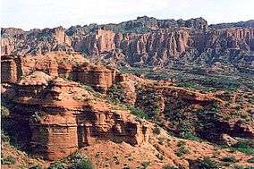 Canyon in the Sierra de las Quijadas.
Coordinates: 33°18′S 66°21′W / 33.300°S 66.350°W

