San Manuel-Linn, Texas
| San Manuel-Linn, Texas | |
|---|---|
| Census-designated place | |
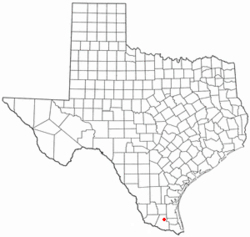 Location of San Manuel-Linn, Texas | |
 | |
| Coordinates: 26°33′52″N 98°7′45″W / 26.56444°N 98.12917°WCoordinates: 26°33′52″N 98°7′45″W / 26.56444°N 98.12917°W | |
| Country |
|
| State |
|
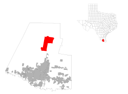
| County |
|
| Area | |
| • Total | 48.7 sq mi (126.1 km2) |
| • Land | 48.6 sq mi (125.9 km2) |
| • Water | 0.1 sq mi (0.2 km2) |
| Population (2000) | |
| • Total | 958 |
| • Density | 19.7/sq mi (7.6/km2) |
| Time zone | Central (CST) (UTC-6) |
| • Summer (DST) | CDT (UTC-5) |
| FIPS code | 48-65594[1] |
San Manuel-Linn is a census-designated place (CDP) in Hidalgo County, Texas. The population was 958 at the 2000 United States Census. It is part of the McAllen–Edinburg–Mission Metropolitan Statistical Area. In 2010, San Manuel-Linn was designated the "safest place in Texas" because no crimes whatsoever were committed in the town .
Geography
San Manuel-Linn is at 26°33′52″N 98°7′45″W / 26.56444°N 98.12917°W (26.564558, -98.129217),[2] along U.S. Route 281, State Highway 186, and FM 1017.
According to the United States Census Bureau, the CDP has a total area of 48.7 square miles (126 km2), of which 48.6 square miles (126 km2) is land and 0.1 square miles (0.26 km2) (0.16%) is water.
Demographics
As of the census[1] of 2000, there were 958 people, 328 households, and 270 families residing in the CDP. The population density was 19.7 people per square mile (7.6/km²). There were 702 housing units at an average density of 14.4/sq mi (5.6/km²). The racial makeup of the CDP was 81.52% White, 1.04% Native American, 0.21% Asian, 16.28% from other races, and 0.94% from two or more races. Hispanic or Latino of any race were 73.80% of the population.
There were 328 households out of which 30.8% had children under the age of 18 living with them, 70.4% were married couples living together, 9.8% had a female householder with no husband present, and 17.4% were non-families. 15.9% of all households were made up of individuals and 10.7% had someone living alone who was 65 years of age or older. The average household size was 2.92 and the average family size was 3.26.
In the CDP the population was spread out with 26.9% under the age of 18, 7.9% from 18 to 24, 21.3% from 25 to 44, 21.0% from 45 to 64, and 22.9% who were 65 years of age or older. The median age was 38 years. For every 100 females there were 90.8 males. For every 100 females age 18 and over, there were 90.7 males.
The median income for a household in the CDP was $26,406, and the median income for a family was $27,596. Males had a median income of $31,111 versus $16,875 for females. The per capita income for the CDP was $11,707. About 19.4% of families and 28.4% of the population were below the poverty line, including 51.3% of those under age 18 and 5.2% of those age 65 or over.
Education
Educationally, the community is served by Brewster School which houses Pre-Kindergarten through 8th grade and Edinburg North High School (9-12) and is part of the Edinburg Consolidated Independent School District.
In addition, South Texas Independent School District operates magnet schools that serve the community.
Climate
The climate in this area is characterized by hot, humid summers and generally mild to cool winters. According to the Köppen Climate Classification system, San Manuel-Linn has a humid subtropical climate, abbreviated "Cfa" on climate maps.[3]
References
- 1 2 "American FactFinder". United States Census Bureau. Retrieved 2008-01-31.
- ↑ "US Gazetteer files: 2010, 2000, and 1990". United States Census Bureau. 2011-02-12. Retrieved 2011-04-23.
- ↑ Climate Summary for San Manuel-Linn, Texas
Municipalities and communities of Hidalgo County, Texas, United States | ||
|---|---|---|
| Cities | 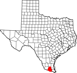 | |
| Town | ||
| CDPs |
| |