San Juan, Texas
| San Juan, Texas | |
|---|---|
| City | |
| City of San Juan | |
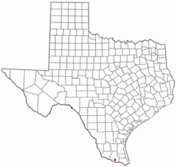 Location of San Juan, Texas | |
 | |
| Coordinates: 26°11′33″N 98°9′10″W / 26.19250°N 98.15278°WCoordinates: 26°11′33″N 98°9′10″W / 26.19250°N 98.15278°W | |
| Country |
|
| State |
|
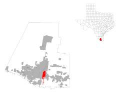
| County |
|
| Government | |
| • Type | Council-Manager |
| • City Council |
Mayor San Juanita Sanchez Mario Garza Jesus "Jesse" Ramirez Raudy Maldonado Pete Garcia |
| • City Manager | J.J. Rodriguez |
| Area | |
| • Total | 11.0 sq mi (28.5 km2) |
| • Land | 11.0 sq mi (28.5 km2) |
| • Water | 0.0 sq mi (0.0 km2) |
| Elevation | 105 ft (32 m) |
| Population (2010) | |
| • Total | 33,856 |
| • Density | 2,383.0/sq mi (920.1/km2) |
| Time zone | Central (CST) (UTC-6) |
| • Summer (DST) | CDT (UTC-5) |
| ZIP code | 78589 |
| Area code(s) | 956 |
| FIPS code | 48-65516[1] |
| GNIS feature ID | 1346393[2] |
| Website |
www |
San Juan is a city in Hidalgo County, Texas. The population in July 2010 was 33,970 since then the population of San Juan increased since 2000 by +29.5%. It is part of the McAllen–Edinburg–Mission and Reynosa–McAllen metropolitan areas.
History
The community was organized in 1909, in part, due to the efforts of John Closner.
The City of San Juan is most commonly known for "Basilica of Our Lady of San Juan" which is one of the largest churches in the Rio Grande Valley.
Geography
San Juan is located at 26°11′33″N 98°9′10″W / 26.19250°N 98.15278°W (26.192451, -98.152708).[3]
According to the United States Census Bureau, the city has a total area of 11.0 square miles (28 km2), all of it land.
The community is in the valley of the Rio Grande.
San Juan is south of Interstate 2/U.S. Route 83 and east of U.S. Route 281.
Demographics
| Historical population | |||
|---|---|---|---|
| Census | Pop. | %± | |
| 1920 | 1,203 | — | |
| 1930 | 1,615 | 34.2% | |
| 1940 | 2,264 | 40.2% | |
| 1950 | 3,413 | 50.8% | |
| 1960 | 4,371 | 28.1% | |
| 1970 | 5,070 | 16.0% | |
| 1980 | 7,608 | 50.1% | |
| 1990 | 10,815 | 42.2% | |
| 2000 | 26,229 | 142.5% | |
| 2010 | 33,856 | 29.1% | |
| Est. 2015 | 36,556 | [4] | 8.0% |
As of the census[1] of 2000, there were 26,229 people, 6,606 households, and 5,952 families residing in the city. The population density was 2,383.0 people per square mile (919.8/km²). There were 7,719 housing units at an average density of 701.3 per square mile (270.7/km²). The racial makeup of the city was 4.4% White, 0.34% African American, 0.8% Native American, 0.09% Asian, 0.03% Pacific Islander, 15.93% from other races, and 1.89% from two or more races. Hispanic or Latino of any race were 95.12% of the population.
There were 6,606 households out of which 56.7% had children under the age of 18 living with them, 69.0% were married couples living together, 17.1% had a female householder with no husband present, and 9.9% were non-families. 8.6% of all households were made up of individuals and 4.2% had someone living alone who was 65 years of age or older. The average household size was 3.95 and the average family size was 4.19.
In the city the population was spread out with 37.4% under the age of 18, 11.9% from 18 to 24, 27.4% from 25 to 44, 15.6% from 45 to 64, and 7.8% who were 65 years of age or older. The median age was 26 years. For every 100 females there were 93.5 males. For every 100 females age 18 and over, there were 88.4 males.
The median income for a household in the city was $22,706, and the median income for a family was $23,314. Males had a median income of $18,756 versus $16,910 for females. The per capita income for the city was $7,945. About 32.7% of families and 34.4% of the population were below the poverty line, including 40.6% of those under age 18 and 24.8% of those age 65 or over.
Government and infrastructure
The United States Postal Service operates the San Juan Post Office.[6]
Education
Primary and secondary schools
Almost all of San Juan is a part of the Pharr-San Juan-Alamo Independent School District. A small fringe portion is a part of the Hidalgo Independent School District. PSJA elementary schools in San Juan include Carman Elementary, Clover Elementary, Doedyns Elementary, Garza-Peña Elementary, North San Juan Elementary, Reed-Mock Elementary, Sorensen Elementary, and Leonel Trevino Elementary. Austin Middle School which opened in 1970 and San Juan Middle School are inside the city. Pharr-San Juan-Alamo High School is in San Juan.
In addition, South Texas Independent School District operates magnet schools that serve the community.
Public libraries
San Juan Memorial Library serves San Juan. It is located at 1010 S. Standard, San Juan, Texas 78589.[7]
Radio stations
- KFRQ 94.5FM - Official Site
- KKPS 99.5FM - Official Site
- KNVO 101.1FM - Official Site
- KVLY 107.9FM - Official Site
Gallery
 Basilica of Our Lady of San Juan
 Virgin de San Juan shrine
References
- 1 2 "American FactFinder". United States Census Bureau. Retrieved 2008-01-31.
- ↑ "US Board on Geographic Names". United States Geological Survey. 2007-10-25. Retrieved 2008-01-31.
- ↑ "US Gazetteer files: 2010, 2000, and 1990". United States Census Bureau. 2011-02-12. Retrieved 2011-04-23.
- ↑ "Annual Estimates of the Resident Population for Incorporated Places: April 1, 2010 to July 1, 2015". Retrieved July 2, 2016.
- ↑ "Census of Population and Housing". Census.gov. Retrieved June 4, 2015.
- ↑ "Post Office Location - SAN JUAN." United States Postal Service. Retrieved on May 9, 2010.
- ↑ "Location." San Juan Public Library. Retrieved on May 9, 2010.
External links
Municipalities and communities of Hidalgo County, Texas, United States | ||
|---|---|---|
| Cities | 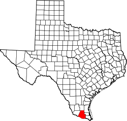 | |
| Town | ||
| CDPs |
| |