Sanilac Shores Underwater Preserve
| Sanilac Shores Underwater Preserve | |
|---|---|
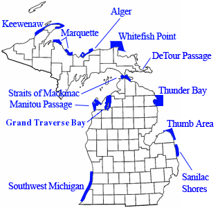 Location within the state of Michigan | |
| Location | Lake Huron, Sanilac County, Michigan USA |
| Nearest city | Port Sanilac, Michigan |
| Coordinates | 43°25′55″N 82°24′43″W / 43.432°N 82.412°WCoordinates: 43°25′55″N 82°24′43″W / 43.432°N 82.412°W |
| Area | 163 square miles (420 km2) |
| Governing body | Michigan Department of Natural Resources |
The Sanilac Shores Underwater Preserve was established to promote conservation of the submerged historical resources in Lake Huron near Port Sanilac, Michigan. The Sanilac Shores Underwater Preserve spans a total of 163 square miles (420 km2) of Lake Huron. The Michigan Underwater Preserve Council oversees activities relating to all of Michigan's Underwater Preserves.[1]
The preserve is open to scuba divers.
History
Port Sanilac was originally a lumberjack settlement on the shore of Lake Huron named "Bark Shanty Point." In 1857 the village was renamed to Port Sanilac, as it is in Sanilac County and Sanilac Township, Michigan. Local legend attributes the name to a Wyandotte Indian Chief named Sanilac. Local landmarks include the Port Sanilac lighthouse (burning kerosene from its opening in 1886 until its electrification in 1924) and a twenty-room Victorian mansion (now a museum) built in 1850 by a horse-and-buggy doctor, Dr. Joseph Loop. There are numerous shipwrecks located near Port Sanilac.
| Site name | Type | Sank | Depth | Coordinates |
|---|---|---|---|---|
| Charles A. Street | Wooden Steamer | July 20, 1908 | 10' | 43°35.50′N 82°27.50′W / 43.59167°N 82.45833°W |
| Charles S. Price | Steel Freighter | November 9, 1913 | 75' | 43°09.174′N 82°21.174′W / 43.152900°N 82.352900°W |
| Checotah | Wooden Schooner | October 30, 1906 | 117' | 43°36.107′N 82°28.170′W / 43.601783°N 82.469500°W |
| City of Genoa | Wooden Steamer | August 26, 1911 | 64' | 43°08.78′N 82°22.31′W / 43.14633°N 82.37183°W |
| Colonel A. B. Williams | Wooden Schooner | 1864 | 80' | 43°36.235′N 82°30.805′W / 43.603917°N 82.513417°W |
| Eliza H. Strong | Wooden Steamer | October 26, 1904 | 22' | 43°15.709′N 82°30.581′W / 43.261817°N 82.509683°W |
| F.B. Gardner | Wooden Steamer | September 15, 1904 | 55' | 43°31.63′N 82°31.77′W / 43.52717°N 82.52950°W |
| John Breeden | Wooden Schooner | July 21, 1899 | 55' | 43°12.640′N 82°26.240′W / 43.210667°N 82.437333°W |
| City of Milwaukee | Wooden Schooner | November 5. 1875 | 165' | ? |
| Mary Alice B. | Steel Tugboat | September 5, 1975 | 92' | 43°22.309′N 82°26.301′W / 43.371817°N 82.438350°W |
| Canisteo | Wooden Steamer | October 25, 1920 | 98' | 43°14.142′N 82°18.292′W / 43.235700°N 82.304867°W |
| New York | Wooden Steamer | September 1856 | 117' | 43°36.23′N 82°28.272′W / 43.60383°N 82.471200°W |
| North Star | Steel Freighter | November 25, 1908 | 96' | 43°23.954′N 82°26.524′W / 43.399233°N 82.442067°W |
| Queen City | Steel Steamer | August 18, 1863 | 45' | 43°09.124′N 82°25.711′W / 43.152067°N 82.428517°W |
| Regina | Steel Canaler | November 9, 1913 | 77' | 43°20.434′N 82°26.787′W / 43.340567°N 82.446450°W |
| Sport | Steel Hulled Tug | December 13, 1920 | 45' | 43°16.003′N 82°27.892′W / 43.266717°N 82.464867°W |
See also
References
External links
- MV Great Lakes Diver - Dive Charter Operator
- Four Fathoms - Dive Charter Operator
- Rec Tec - Dive Charter Operator