Traverse City State Park
| Keith J. Charters Traverse City State Park | |
|---|---|
|
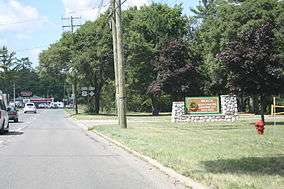
Sign | |
 Location within the state of Michigan | |
| Location | East Bay Township, Grand Traverse County, Michigan, USA |
| Nearest city | Traverse City, Michigan |
| Coordinates | 44°44′44″N 85°33′04″W / 44.74556°N 85.55111°WCoordinates: 44°44′44″N 85°33′04″W / 44.74556°N 85.55111°W |
| Area | 47 acres (19 ha) |
| Established | 1920 |
| Governing body | Michigan Department of Natural Resources |
| http://www.michigandnr.com/parksandtrails/details.aspx?id=501&type=SPRK | |
Traverse City State Park, officially Keith J. Charters Traverse City State Park since 2011, is a 47-acre (19 ha) state park in Traverse City, Michigan.
The park is located on the densely populated shoreline of Grand Traverse Bay, an arm of Lake Michigan, and is used mainly as a campground. US-31/M-72 runs between the park and the beach area, there is an overpass where campers can get to the beach along with an entrance off of US-31. The beach area has a playground, grills and picnic tables. The camping area has around 350 campsites, all with electricity. Other features include a dump and fill and dump station, three bathroom buildings, a recycling/trash center. The park adjoins the TART Trail, which is a bicycle trail that runs eastward from Traverse City.[1]
On July 21, 2011, the Natural Resources Commission augmented the name of the park with that of Keith J. Charters, a local conservationist, hunter and angler who served on the commission from 1994 to 2010.[2] While signs at the park's entrance have added the new name, most references to the park still seem to favor just "Traverse City State Park."
References
External links
- Traverse City State Park Michigan Department of Natural Resources
- Traverse City State Park Protected Planet (World Database on Protected Areas)