Sarah Ann, West Virginia
| Sarah Ann, West Virginia | |
|---|---|
| Census-designated place (CDP) | |
 Sarah Ann, West Virginia | |
| Coordinates: 37°42′40″N 81°59′14″W / 37.71111°N 81.98722°WCoordinates: 37°42′40″N 81°59′14″W / 37.71111°N 81.98722°W | |
| Country | United States |
| State | West Virginia |
| County | Logan |
| Area[1] | |
| • Total | 1.827 sq mi (4.73 km2) |
| • Land | 1.827 sq mi (4.73 km2) |
| • Water | 0 sq mi (0 km2) |
| Elevation | 997 ft (304 m) |
| Population (2010)[2] | |
| • Total | 345 |
| • Density | 190/sq mi (73/km2) |
| Time zone | Eastern (EST) (UTC-5) |
| • Summer (DST) | EDT (UTC-4) |
| ZIP code | 25644 |
| Area code(s) | 304 & 681 |
| GNIS feature ID | 1555572[3] |
Sarah Ann is a census-designated place (CDP) in Logan County, West Virginia, United States. Sarah Ann is located along West Virginia Route 44 and Island Creek,[4] 6.5 miles (10.5 km) west-southwest of Man. Sarah Ann has a post office with ZIP code 25644.[5] As of the 2010 census, its population was 345.[2] It was named for Sarah O'Toole, wife of coal company official Edward O'Toole, and Ann Shanklin, wife of the coal company's coal town doctor, Doctor Shanklin (http://files.usgwarchives.net/wv/mcdowell/bios/otoole1.txt).
References
- ↑ "US Gazetteer files: 2010, 2000, and 1990". United States Census Bureau. 2011-02-12. Retrieved 2011-04-23.
- 1 2 "American FactFinder". United States Census Bureau. Retrieved 2011-05-14.
- ↑ U.S. Geological Survey Geographic Names Information System: Sarah Ann, West Virginia
- ↑ West Virginia Atlas & Gazetteer. Yarmouth, Me.: DeLorme. 1997. p. 57. ISBN 0-89933-246-3.
- ↑ ZIP Code Lookup
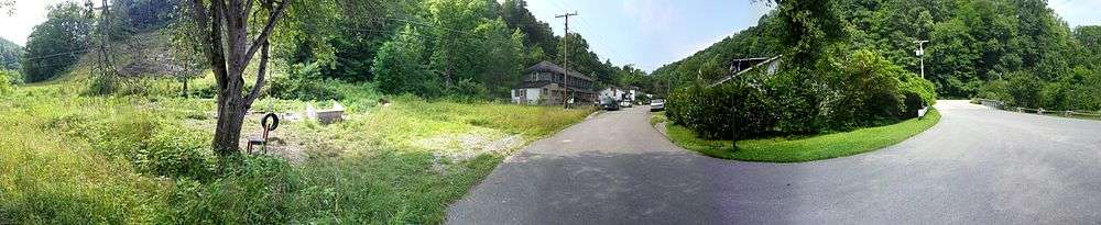
Sarah Ann, 2014

This article is issued from Wikipedia - version of the 9/4/2016. The text is available under the Creative Commons Attribution/Share Alike but additional terms may apply for the media files.