Sardinia, Ohio
| Sardinia, Ohio | |
|---|---|
| Village | |
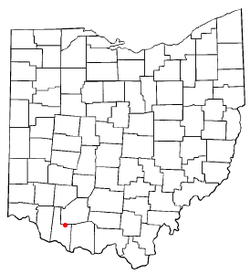 Location of Sardinia, Ohio | |
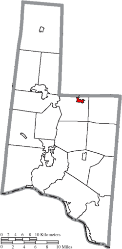 Location of Sardinia in Brown County | |
| Coordinates: 39°0′31″N 83°48′15″W / 39.00861°N 83.80417°WCoordinates: 39°0′31″N 83°48′15″W / 39.00861°N 83.80417°W | |
| Country | United States |
| State | Ohio |
| Counties | Brown, Highland |
| Area[1] | |
| • Total | 1.24 sq mi (3.21 km2) |
| • Land | 1.24 sq mi (3.21 km2) |
| • Water | 0 sq mi (0 km2) |
| Elevation[2] | 958 ft (292 m) |
| Population (2010)[3] | |
| • Total | 980 |
| • Estimate (2012[4]) | 968 |
| • Density | 790.3/sq mi (305.1/km2) |
| Time zone | Eastern (EST) (UTC-5) |
| • Summer (DST) | EDT (UTC-4) |
| ZIP code | 45171 |
| Area code(s) | 937 |
| FIPS code | 39-70534[5] |
| GNIS feature ID | 1077345[2] |
Sardinia is a village in Brown and Highland counties in the U.S. state of Ohio. The population was 980 at the 2010 census. The village's name is derived from the island in the Mediterranean Sea. Historically, Sardinia was a post village of Brown County, in Washington township, established in 1830, situated on the east fork of White Oak Creek, 12 miles north-east of Georgetown, and 44 miles east of Cincinnati. In 1860, Sardinia's population was 200 and Washington Township had a population of 1,300.[6]
History
Sardinia was laid out in 1833.[7]
Gallery
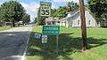 Sardinia corporation limit sign.
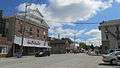 Looking east at the intersection of Broadway Street and Main Street (Ohio State Route 134) in Sardinia.
Geography
Sardinia is located at 39°0′31″N 83°48′15″W / 39.00861°N 83.80417°W (39.008718, -83.804213),[8] almost entirely in Brown County.[9]
According to the United States Census Bureau, the village has a total area of 1.24 square miles (3.21 km2), all land.[1]
Demographics
| Historical population | |||
|---|---|---|---|
| Census | Pop. | %± | |
| 1880 | 283 | — | |
| 1910 | 534 | — | |
| 1920 | 561 | 5.1% | |
| 1930 | 564 | 0.5% | |
| 1940 | 615 | 9.0% | |
| 1950 | 699 | 13.7% | |
| 1960 | 799 | 14.3% | |
| 1970 | 824 | 3.1% | |
| 1980 | 826 | 0.2% | |
| 1990 | 792 | −4.1% | |
| 2000 | 862 | 8.8% | |
| 2010 | 980 | 13.7% | |
| Est. 2015 | 957 | [10] | −2.3% |
2010 census
As of the census[3] of 2010, there were 980 people, 363 households, and 259 families residing in the village. The population density was 790.3 inhabitants per square mile (305.1/km2). There were 416 housing units at an average density of 335.5 per square mile (129.5/km2). The racial makeup of the village was 99.2% White, 0.2% African American, 0.3% Native American, 0.1% from other races, and 0.2% from two or more races. Hispanic or Latino of any race were 0.3% of the population.
There were 363 households of which 44.9% had children under the age of 18 living with them, 42.1% were married couples living together, 21.5% had a female householder with no husband present, 7.7% had a male householder with no wife present, and 28.7% were non-families. 24.0% of all households were made up of individuals and 8.6% had someone living alone who was 65 years of age or older. The average household size was 2.67 and the average family size was 3.07.
The median age in the village was 67 years. 33.1% of residents were under the age of 18; 8.1% were between the ages of 18 and 24; 28.6% were from 25 to 44; 20.3% were from 45 to 64; and 9.9% were 65 years of age or older. The gender makeup of the village was 46.3% male and 53.7% female.
2000 census
As of the census[5] of 2000, there were 862 people, 328 households, and 230 families residing in the village. The population density was 1,343.8 people per square mile (520.0/km²). There were 362 housing units at an average density of 564.3 per square mile (218.4/km²). The racial makeup of the village was 98.61% White, 0.23% Black or African American, and 1.16% from two or more races. Hispanic or Latino of any race were 0.93% of the population.
There were 328 households out of which 40.5% had children under the age of 18 living with them, 51.5% were married couples living together, 13.4% had a female householder with no husband present, and 29.6% were non-families. 26.8% of all households were made up of individuals and 13.7% had someone living alone who was 65 years of age or older. The average household size was 2.54 and the average family size was 3.06.
In the village the population was spread out with 29.0% under the age of 18, 9.5% from 18 to 24, 31.7% from 25 to 44, 17.3% from 45 to 64, and 12.5% who were 65 years of age or older. The median age was 31 years. For every 100 females there were 87.8 males. For every 100 females age 18 and over, there were 81.1 males.
The median income for a household in the village was $28,897, and the median income for a family was $32,708. Males had a median income of $34,375 versus $18,056 for females. The per capita income for the village was $12,334. About 15.4% of families and 20.1% of the population were well above the poverty line, including 24.2% of those under age 18 and 14.3% of those age 65 or over.
Education
- Eastern High School (Sardinia, Ohio)
- Ohio State University
- Portsmouth Ohio High School
- Sardinia Elementary School/Garfield Elementary Portsmouth Ohio
References
- 1 2 "US Gazetteer files 2010". United States Census Bureau. Retrieved 2013-01-06.
- 1 2 "US Board on Geographic Names". United States Geological Survey. 2007-10-25. Retrieved 2008-01-31.
- 1 2 "American FactFinder". United States Census Bureau. Retrieved 2013-01-06.
- ↑ "Population Estimates". United States Census Bureau. Retrieved 2013-06-17.
- 1 2 "American FactFinder". United States Census Bureau. Retrieved 2008-01-31.
- ↑ Ohio State Gazetteer and Business Directory 1860-1861. George W. Hawes. Retrieved 9 September 2011.
- ↑ The History of Brown County, Ohio. Higginson Book Company. 1883. p. 678.
- ↑ "US Gazetteer files: 2010, 2000, and 1990". United States Census Bureau. 2011-02-12. Retrieved 2011-04-23.
- ↑ "Subcounty population estimates: Ohio 2000-2006". United States Census Bureau, Population Division. 2007-06-28. Archived from the original (CSV) on 2008-04-20. Retrieved 2008-05-28.
- ↑ "Annual Estimates of the Resident Population for Incorporated Places: April 1, 2010 to July 1, 2015". Retrieved July 2, 2016.
- ↑ "Census of Population and Housing". Census.gov. Retrieved June 4, 2015.
External links
Municipalities and communities of Brown County, Ohio, United States | ||
|---|---|---|
| Villages | 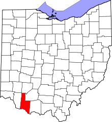 | |
| Townships | ||
| CDPs | ||
| Unincorporated communities | ||
| Footnotes | ‡This populated place also has portions in an adjacent county or counties | |
Municipalities and communities of Highland County, Ohio, United States | ||
|---|---|---|
| City | 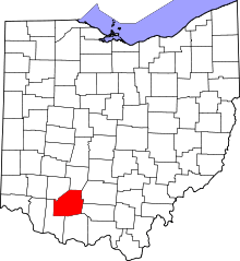 | |
| Villages | ||
| Townships | ||
| CDPs | ||
| Unincorporated communities | ||
| Footnotes | ‡This populated place also has portions in an adjacent county or counties | |