Sargent Township, Douglas County, Illinois
| Sargent Township | |
|---|---|
| Township | |
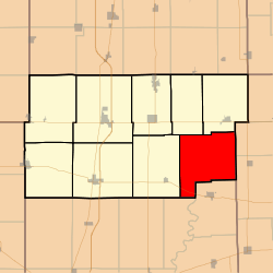 Location in Douglas County | |
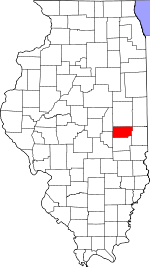 Douglas County's location in Illinois | |
| Coordinates: 39°43′34″N 88°02′16″W / 39.72611°N 88.03778°WCoordinates: 39°43′34″N 88°02′16″W / 39.72611°N 88.03778°W | |
| Country |
|
| State |
|
| County | Douglas |
| Established | November 5, 1867 |
| Area | |
| • Total | 47.02 sq mi (121.8 km2) |
| • Land | 46.95 sq mi (121.6 km2) |
| • Water | 0.07 sq mi (0.2 km2) 0.15% |
| Elevation | 659 ft (201 m) |
| Population (2010) | |
| • Total | 286 |
| • Density | 6.1/sq mi (2.4/km2) |
| Time zone | CST (UTC-6) |
| • Summer (DST) | CDT (UTC-5) |
| ZIP codes | 61917, 61919, 61930, 61942, 61943 |
| GNIS feature ID | 0429716 |
Sargent Township is one of nine townships in Douglas County, Illinois, USA. As of the 2010 census, its population was 286 and it contained 127 housing units.[1] The township contains Walnut Point State Park.
Geography
According to the 2010 census, the township has a total area of 47.02 square miles (121.8 km2), of which 46.95 square miles (121.6 km2) (or 99.85%) is land and 0.07 square miles (0.18 km2) (or 0.15%) is water.[1]
Cemeteries
The township contains these three cemeteries: Albin, Gwinn and Pleasant Grove.
Major highways
School districts
- Villa Grove Community Unit School District * Oakland Community Unit School District 5
- Shiloh Community Unit School District 1
Political districts
- State House District 110
- State Senate District 55
References
- "Sargent Township, Douglas County, Illinois". Geographic Names Information System. United States Geological Survey. Retrieved 2010-01-17.
- United States Census Bureau 2009 TIGER/Line Shapefiles
- United States National Atlas
- 1 2 "Population, Housing Units, Area, and Density: 2010 - County -- County Subdivision and Place -- 2010 Census Summary File 1". United States Census. Retrieved 2013-05-28.
External links
 |
Murdock Township | Newman Township | | |
| Bowdre Township | |
Embarrass Township, Edgar County Shiloh Township, Edgar County | ||
| ||||
| | ||||
| Morgan Township, Coles County | East Oakland Township, Coles County |
Municipalities and communities of Douglas County, Illinois, United States | ||
|---|---|---|
| Cities | ||
| Villages | ||
| Townships | ||
| Unincorporated communities | ||
| Ghost town | ||
| Footnotes | ‡This populated place also has portions in an adjacent county or counties | |
This article is issued from Wikipedia - version of the 12/4/2013. The text is available under the Creative Commons Attribution/Share Alike but additional terms may apply for the media files.