Savannah/Hilton Head International Airport
| Savannah / Hilton Head International Airport | |||||||||||||||
|---|---|---|---|---|---|---|---|---|---|---|---|---|---|---|---|
|
| |||||||||||||||
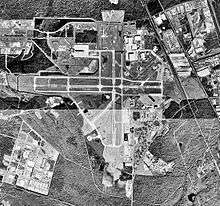 USGS 1999 orthophoto | |||||||||||||||
|
IATA: SAV – ICAO: KSAV – FAA LID: SAV – WMO: 72207 | |||||||||||||||
| Summary | |||||||||||||||
| Airport type | Public | ||||||||||||||
| Owner/Operator | Savannah Airport Commission | ||||||||||||||
| Serves | Savannah, Georgia and Hilton Head Island, South Carolina | ||||||||||||||
| Elevation AMSL | 50 ft / 15 m | ||||||||||||||
| Coordinates | 32°07′39″N 081°12′08″W / 32.12750°N 81.20222°WCoordinates: 32°07′39″N 081°12′08″W / 32.12750°N 81.20222°W | ||||||||||||||
| Website | SavannahAirport.com | ||||||||||||||
| Map | |||||||||||||||
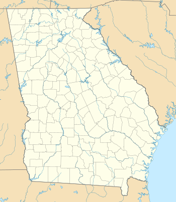 SAV Location of airport in Georgia | |||||||||||||||
| Runways | |||||||||||||||
| |||||||||||||||
| Statistics (2015) | |||||||||||||||
| |||||||||||||||
Savannah/Hilton Head International Airport[2] (IATA: SAV[3], ICAO: KSAV, FAA LID: SAV) is a public and military use airport owned by the City of Savannah and managed by the Savannah Airport Commission. The airport is located seven nautical miles (8 mi, 13 km) northwest of the central business district of Savannah, a city in Chatham County, Georgia, United States.[1] It had been known as Savannah International Airport, Travis Field and Chatham Field. The airport is just off Interstate 95, between Savannah and the city of Pooler, Georgia. It is the chief commercial airport for the three-county Savannah metropolitan area, although nearly 40 percent of the airport's total passenger traffic is bound for Hilton Head Island, South Carolina, located approximately 38.5 miles (approx. 42 minutes) away by car.[4][5]
This airport is included in the National Plan of Integrated Airport Systems for 2011–2015, which categorized it as a primary commercial service airport since it has over 10,000 passenger boardings (enplanements) per year.[6]
Despite the airport's name, there are no scheduled commercial international flights outside the United States from Savannah/Hilton Head. However, U.S. Customs facilities are on the field and the airport is part of a Foreign Trade Zone.
In 2015, Savannah/Hilton Head had 88,691 annual operations (takeoffs and landings) and 2,027,262 total commercial airline passengers, making it second only to Hartsfield-Jackson Atlanta International Airport as Georgia's busiest commercial airport.[7]
The airport is patrolled by the Savannah/Hilton Head International Airport Police, who work with the Transportation Security Administration (TSA) to provide airport security.
Savannah/Hilton Head is served by Delta (and Delta Connection carrier Shuttle America), JetBlue, United Airlines, American Eagle, Allegiant Air and Sun Country Airlines. An information counter provides local information regarding tourist attractions in Savannah, Hilton Head, and most other coastal areas of Georgia and southern South Carolina.
The airport serves as world headquarters for Gulfstream Aerospace. The Georgia Air National Guard's 165th Airlift Wing is also based at Savannah/Hilton Head International.
History
The first Savannah Municipal Airport was opened on September 20, 1929 with the inauguration of air service between New York City and Miami by Eastern Air Express. In 1932 a city resolution named the airport Hunter Field. A trolley car was used as the first terminal at Hunter Field in the mid-1930s. In 1940 the U.S. Army Air Corps proposed a complete takeover of Hunter Field if a war started. While the commercial airlines continued to land at Hunter Field, a decision was made to construct a second municipal airport in response to the increased military presence.
The City of Savannah acquired a 600-acre tract in the vicinity of Cherokee Hill, one of the highest elevations in the county, and construction of a new airfield commenced under a Works Progress Administration project. Three runways were constructed running north-south, east-west, and northeast-southwest, each 3,600 feet long. In 1942, before the completion of this new airfield, the U.S. Army Air Corps found it necessary to take over the new facility and start additional construction to carry out its mission. It named the airfield Chatham Field and it was used until the end of World War II as a bomber base and crew training base for B-24 bombers as well as fighter aircraft.
In 1948, Chatham Army Airfield was turned over to the Georgia Air National Guard and the airport was renamed Travis Field, in honor of Savannah native Brigadier General. Robert F. Travis, killed in the crash of a B-29 bomber near Fairfield-Suisun AFB, California, and his brother, Colonel William Travis. To accommodate the airlines, Travis Field received a new control tower and an airline terminal in the former base theater.
In 1958, work began on a new airline terminal. In 1962, an additional extension brought the east/west runway's length to 9,000 ft (2,700 m). The jet age arrived in 1965 when Delta Air Lines introduced Douglas DC-9-10 flights. Grumman Aircraft opened a $7.5 million Gulfstream manufacturing plant at Travis in 1967. A new $21-million terminal building was built on the northwest corner of the airport in 1994.
A six-gate terminal built in 1960 was replaced in 1994 by the current facility. Although the airport has no direct international flights, it was renamed Savannah International Airport in 1983, then Savannah/Hilton Head International Airport in 2003.
In 1992, the airport had international service with nonstop flights to destinations in the Caribbean and Mexico when Key Airlines was operating a passenger hub in Savannah. Key Airlines also operated nonstop mainline jet service to a number of U.S. cities at this time and from Savannah. According to the Key Airlines system timetable dated October 1, 1992, nonstop services primarily operated with Boeing 727-100 and 727-200 jetliners were being flown from the airport to Antigua (ANU), Aruba (AUA), Atlanta (ATL), Baltimore (BWI), Boston (BOS), Cancun (CUN), Chicago Midway Airport (MDW), Cozumel (CZM), Curaçao (CUR), Freeport (FPO), Montego Bay (MBJ), Nassau (NAS), New York Newark Airport (EWR), Orlando (MCO), St. Maarten (SXM) and St. Thomas (STT). In addition to these nonstop flights, one-stop direct service was also flown by the airline from Savannah to St. Croix (STX).[8] Key Airlines subsequently experienced financial difficulties and then ceased all flights in 1993.
Some 3,680 feet (1,120 m) from the west end of Runway 10 (the main east-west runway) are two concrete grave markers. A runway extension project placed the runway through a small family plot and the graves of the airport property's two original owners. Because the family did not want to remove and relocate the graves, the markers were placed in the asphalt runway.[9]
Runway 10 is thought to be the only airport runway in the United States with marked gravestones in it. Federal law generally prohibits the moving of a grave without the permission of the next of kin. In this case, two graves of the Dotson Family, the earliest grave dating backed to 1857, were encountered during the construction of the runway. Since the next of kin could not be located, the graves were left undisturbed. Two additional graves are located off the runway surface.
The new 275,000 sq. ft. Terminal opened in May 1994 with 8 gates (expandable to 19 gates). The project included new roads, a new aircraft taxiway and parking apron, stormwater ponds, landscaping and a new interchange at I-95 for entry into the Airport (Exit 18-A) at mile marker 104. Total cost for the project was $68.5 million. It was completed one month ahead of schedule and under budget. It was designed by KBJ Architects[10]
A terminal expansion project was completed in July 2007, adding five departure gates (for a total of fifteen).[4] A $35-million parking garage was completed in October of the same year, which added 1,700 parking spaces and uses an electronic program to alert drivers to the number of available spaces on each garage level.[4]
Visitor Information Center
There is a Visitor Information Center located near the baggage claim in the airport. The staff can assist guests with finding Georgia and South Carolina attractions, turn-by-turn directions, transportation advice, mailing a package, Georgia lottery sales and sending a fax.
The Visitor Information Center offers:
- Tourist brochures
- Ground transportation needs
- Directions
- Area maps
- Flight information
- In-terminal announcements
- Post office
- Copies and faxes
Parking and public transportation
The airport has three parking lots. The economy parking offers hourly, daily and weekly options for short or long term parking. The Savannah Value Park provides exclusive parking to residents of the City of Savannah. The Long Term/Hourly Parking area is closest to the airport terminal.
The Chatham Area Transit (CAT) 100X Airport Express to the airport originates at Joe Murray Rivers, Jr. Intermodal Transit Center.
Military use
Also located on the airport is Savannah Air National Guard Base, home to the 165th Airlift Wing (165 AW) of the Georgia Air National Guard. The 165 AW flies the C-130H Hercules tactical airlift aircraft and, as an Air National Guard (ANG) unit, is under the operational claimancy of the Air Mobility Command (AMC). The 165 AW, including the collocated Georgia ANG Combat Readiness Training Center (CRTC), consists of over 310 full-time Active Guard and Reserve (AGR) and Air Reserve Technician (ART) personnel, and over 700 additional "traditional" part-time air national guardsmen.
Savannah ANGB has over 145 buildings and 239 acres of leased land in the southeast and northeast quadrants of the airport.[11]
Facilities and aircraft
Savannah/Hilton Head International Airport covers an area of 3,650 acres (1,477 ha) at an elevation of 50 ft. (15 m) above mean sea level. It has two runways with concrete surfaces:[1]
- 10/28: 9,351 ft. x 150 ft. (2,850 m x 46 m)
- 01/19: 7,002 ft. x 150 ft. (2,134 m x 46 m)
For the 12-month period ending June 30, 2012, the airport had 91,324 aircraft operations, an average of 250 per day: 51% general aviation, 24% air taxi, 16% scheduled commercial, and 9% military. At that time there were 125 aircraft based at this airport: 63% single-engine, 15% multi-engine, 9% jet, 6% helicopter, and 6% military.[1]
Airlines and destinations
Passenger
| Airlines | Destinations |
|---|---|
| Allegiant Air | Baltimore, Cincinnati, Cleveland (begins February 16, 2017), Indianapolis, Newark[12] Seasonal: Akron/Canton (ends February 15, 2017), Columbus–Rickenbacker, Lexington, Pittsburgh |
| American Eagle | Charlotte, Dallas/Fort Worth, Philadelphia, Washington–National |
| Delta Air Lines | Atlanta |
| Delta Connection | Detroit, New York–JFK, New York–LaGuardia Seasonal: Minneapolis/St. Paul |
| JetBlue Airways | Boston, New York–JFK |
| Sun Country Airlines | Seasonal: Minneapolis/St. Paul |
| United Airlines | Chicago–O'Hare, Newark |
| United Express | Chicago–O'Hare, Houston–Intercontinental, Newark, Washington–Dulles |
Cargo
| Airlines | Destinations |
|---|---|
| FedEx Express | Memphis |
| UPS Airlines operated by Air Cargo Carriers | Columbia (SC) |
Statistics
| Carrier | Passengers (arriving and departing) |
|---|---|
| Delta | 713,000(37.22%) |
| ExpressJet | 305,000(15.92%) |
| PSA | 298,000(15.54%) |
| JetBlue | 236,000(12.31%) |
| Mesa | 87,300(4.56%) |
| Other | 277,000(14.46%) |
| Rank | Airport | Passengers | Airlines |
|---|---|---|---|
| 1 | Atlanta Hartsfield-Jackson International (ATL) | 356,000 | Delta |
| 2 | Charlotte/Douglas International (CLT) | 166,000 | US Airways |
| 3 | New York City Kennedy (JFK) | 123,000 | Delta, JetBlue |
| 4 | Dallas/Fort Worth International (DFW) | 43,000 | American |
| 5 | Washington Dulles International (IAD) | 41,000 | United |
| 5 | Chicago O'Hare International (ORD) | 41,000 | United |
| 7 | New York City LaGuardia (LGA) | 40,000 | Delta |
| 8 | Boston Logan International (BOS) | 31,000 | JetBlue |
| 9 | Philadelphia International (PHL) | 30,000 | US Airways |
| 10 | Newark Liberty International (EWR) | 29,000 | United |
Nearby airfields
| Distance | Direction | Airfield | Location |
|---|---|---|---|
| 8 miles (13 km) | SSE | Hunter Army Airfield | Savannah, Georgia |
| 26 miles (42 km) | SW | MidCoast Regional Airport at Wright Army Airfield | Hinesville, Georgia |
| 28 miles (45 km) | NNE | Ridgeland Airport | Ridgeland, South Carolina |
| 30 miles (48 km) | ENE | Hilton Head Airport | Hilton Head Island, South Carolina |
| 36 miles (58 km) | NE | Marine Corps Air Station Beaufort | Beaufort, South Carolina |
| 38 miles (61 km) | NE | Beaufort County Airport | Beaufort, South Carolina |
| 40 miles (64 km) | NW | Statesboro-Bulloch County Airport | Statesboro, Georgia |
| 64 miles (103 km) | NNE | Lowcountry Regional Airport | Walterboro, South Carolina |
| 68 miles (109 km) | W | Vidalia Regional Airport | Vidalia, Georgia |
| 85 miles (137 km) | NE | Charleston International Airport / Joint Base Charleston | Charleston, South Carolina |
See also
References
- 1 2 3 4 FAA Airport Master Record for SAV (Form 5010 PDF). Federal Aviation Administration. Effective November 15, 2012.
- ↑ Savannah / Hilton Head International Airport, official website
- ↑ "IATA Airport code Search (SAV: Savannah / Hilton Head)". International Air Transport Association. Retrieved December 31, 2012.
- 1 2 3 "Savannah/Hilton Head Airport expands, updates," Delta Sky Magazine, December 2007. Accessed March 21, 2008.
- ↑ Directions from Savannah/Hilton Head International Airport to 100 William Hilton Parkway on Hilton Head Island Mapquest, Accessed March 21, 2008.
- ↑ "2011–2015 NPIAS Report, Appendix A" (PDF, 2.03 MB). National Plan of Integrated Airport Systems. Federal Aviation Administration. October 4, 2010. External link in
|work=(help) - ↑ "Savannah-Hilton Head International Airport Statistics" Updated June 2016, Accessed July 12, 2016.
- ↑ departedflights.com, Key Airlines Oct. 1, 1992 system timetable & Oct. 1, 1992 Key Airlines system timetable & route map
- ↑ "At Peace With the Jets". Savannah Morning News. August 28, 2001. Retrieved December 27, 2011.
- ↑ "Aviation". KBJ Architects, Inc.
- ↑ "Savannah International Airport". GlobalSecurity.org.
- ↑ Mutzabaugh, Ben (June 28, 2016). "Allegiant Air breaks into Newark as it adds 3 cities to route map". USA Today. Retrieved June 28, 2016.
- 1 2 "Savannah, GA: Savannah/Hilton Head International (SAV)". Bureau of Transportation Statistics (BTS), Research and Innovative Technology Administration (RITA), U.S. Department of Transportation. September 2012. Retrieved October 2015. Check date values in:
|access-date=(help)
External links
| Wikimedia Commons has media related to Savannah/Hilton Head International Airport. |
- Savannah / Hilton Head International Airport, official website
- Fixed-base operators (FBO): Signature Flight Support and Sheltair
- Aerial image as of January 1999 from USGS The National Map
- FAA Airport Diagram (PDF), effective November 10, 2016
- FAA Terminal Procedures for SAV, effective November 10, 2016
- Resources for this airport:
- AirNav airport information for KSAV
- ASN accident history for SAV
- FlightAware airport information and live flight tracker
- NOAA/NWS latest weather observations
- SkyVector aeronautical chart for KSAV
- FAA current SAV delay information