Schrunk Township, Burleigh County, North Dakota
| Schrunk Township, North Dakota | |
|---|---|
| Township | |
 Schrunk Township, North Dakota Location within the state of North Dakota | |
| Coordinates: 47°17′53″N 100°25′55″W / 47.29806°N 100.43194°WCoordinates: 47°17′53″N 100°25′55″W / 47.29806°N 100.43194°W | |
| Country | United States |
| State | North Dakota |
| County | Dickey |
| Area[1] | |
| • Total | 34.38 sq mi (89.0 km2) |
| • Land | 32.66 sq mi (84.6 km2) |
| • Water | 1.72 sq mi (4.5 km2) |
| Elevation | 1,939 ft (591 m) |
| Population (2000) | |
| • Total | 26 |
| • Density | 0.8/sq mi (0.3/km2) |
| Time zone | Central (CST) (UTC-6) |
| • Summer (DST) | CDT (UTC-5) |
| Area code(s) | 701 |
| FIPS code | 38-71220[2] |
| GNIS feature ID | 1759345[3] |
Schrunk Township is a civil township in Burleigh County in the U.S. state of North Dakota. As of the 2000 census, its population was 26,[4] but had increased to an estimated 71 by 2009.[5]
History
Schrunk Township was first listed as a school township during the 1910 Census, with a population of 120.[6] It was named after brothers Charlie and George Schrunk, early settlers from Iowa who moved to the area in 1893. The first school was built in 1903. A second schoolhouse was constructed in 1908, and operated until 1957 when the school district was consolidated with nearby Wing.[7]
It was later organized as a civil township under the name Summit, and reported a 1920 population of 131.[7][8] By the time of the 1908 Census, the township had been renamed Schrunk.[7][9]
External links
References
- ↑ U.S. Census Bureau. Census 2000, Summary File 1. "GCT-PH1. Population, Housing Units, Area, and Density: 2000 - County -- Subdivision and Place". American FactFinder. <http://factfinder2.census.gov>. Retrieved 2008-01-31.
- ↑ "American FactFinder". United States Census Bureau. Retrieved 2008-01-31.
- ↑ "US Board on Geographic Names". United States Geological Survey. 2007-10-25. Retrieved 2008-01-31.
- ↑ U.S. Census Bureau. Census 2000. "Census Demographic Profiles, Schrunk Township" (PDF). CenStats Databases. Retrieved 2009-01-31.
- ↑ U.S. Census Bureau (2010). "Incorporated Places and Minor Civil Divisions: North Dakota" (CSV). 2009 Population Estimates. Retrieved 2010-06-22.
- ↑ U.S. Census Bureau (1913). "Number of Inhabitants, North Dakota" (PDF). Thirteenth Census of the United States: 1910. Government Printing Office. Retrieved 2008-07-20.
- 1 2 3 Bismarck-Mandan Genealogical and Historical Society (1978). Bauman, Beth Hughes and Dorothy J. Jackaman, ed. Burleigh County: Prairie Trails to Hi-Ways. Dallas, Texas: Taylor Publishing Co. p. 499. OCLC 4478394.
- ↑ U.S. Census Bureau (1921). "Number and Distribution of Inhabitants, North Dakota" (PDF). Fourteenth Census of the United States: 1920. Government Printing Office. Retrieved 2008-07-20.
- ↑ U.S. Census Bureau (1981). "Number of Inhabitants, North Dakota" (PDF). 1980 Census of Population and Housing. Government Printing Office. Retrieved 2008-07-20.
Municipalities and communities of Burleigh County, North Dakota, United States | ||
|---|---|---|
| Cities | 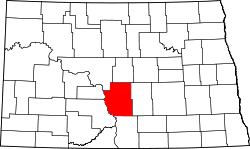 | |
| Townships |
| |
| CDPs | ||
| Unorganized territories |
| |
| Unincorporated communities | ||
| Footnotes | ‡This populated place also has portions in an adjacent county or counties | |