Seven Hills, Colorado
| Seven Hills, Colorado | |
|---|---|
| Census-designated place | |
 Seven Hills | |
| Coordinates: 40°2′1″N 105°19′51″W / 40.03361°N 105.33083°WCoordinates: 40°2′1″N 105°19′51″W / 40.03361°N 105.33083°W | |
| Country |
|
| State |
|
| County | Boulder[1] |
| Area | |
| • Total | 0.5 sq mi (1.3 km2) |
| • Land | 0.5 sq mi (1.3 km2) |
| • Water | 0 sq mi (0 km2) |
| Elevation[1] | 6,500 ft (2,000 m) |
| Population (2010) | |
| • Total | 121 |
| • Density | 249/sq mi (96.1/km2) |
| Time zone | MST (UTC-7) |
| • Summer (DST) | MDT (UTC-6) |
Seven Hills is a census-designated place (CDP) in Boulder County, Colorado, United States. It should not be confused with the neighborhood of the same name in Aurora, Colorado. The population as of the 2010 Census was 121.[2]
Geography
Seven Hills is located in central Boulder County, in the hills west of the city of Boulder. It lies between Sunshine Canyon Drive, which forms the northeast edge of the CDP, and Fourmile Canyon Drive, which touches the southwest edge of the CDP. Elevations range from 6,050 feet (1,840 m) at Fourmile Canyon Drive to 6,780 feet (2,070 m) along Sunshine Canyon Drive. Poorman Road connects the two drives, running through the center of the CDP.
According to the U.S. Census Bureau, the Seven Hills CDP has an area of 0.50 square miles (1.3 km2), all of it land.[3]
See also
References
- 1 2 "US Board on Geographic Names". United States Geological Survey. 2007-10-25. Retrieved 2008-01-31.
- ↑ Colorado Trend Report 2: State and Complete Places (Sub-state 2010 Census Data). Missouri Census Data Center. Accessed 2011-02-25.
- ↑ "Geographic Identifiers: 2010 Demographic Profile Data (G001): Seven Hills CDP, Colorado". U.S. Census Bureau, American Factfinder. Retrieved October 18, 2013.
| Wikimedia Commons has media related to Seven Hills, Colorado. |
Municipalities and communities of Boulder County, Colorado, United States | ||
|---|---|---|
| Cities | 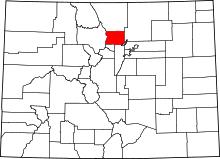 | |
| Towns | ||
| CDPs | ||
| Unincorporated communities | ||
| Ghost town | ||
| Footnotes | ‡This populated place also has portions in an adjacent county or counties | |