Bark Ranch, Colorado
| Bark Ranch, Colorado | |
|---|---|
| Census-designated place | |
 Bark Ranch | |
| Coordinates: 40°07′02″N 105°26′21″W / 40.11722°N 105.43917°WCoordinates: 40°07′02″N 105°26′21″W / 40.11722°N 105.43917°W | |
| Country |
|
| State |
|
| County | Boulder[1] |
| Area | |
| • Total | 0.87 sq mi (2.26 km2) |
| • Land | 0.86 sq mi (2.23 km2) |
| • Water | 0.008 sq mi (0.02 km2) |
| Elevation[1] | 8,500 ft (2,600 m) |
| Population (2010) | |
| • Total | 213 |
| • Density | 247/sq mi (95.4/km2) |
| Time zone | MST (UTC-7) |
| • Summer (DST) | MDT (UTC-6) |
Bark Ranch is a census-designated place (CDP) in Boulder County, Colorado, United States. The population as of the 2010 Census was 213.[2] It corresponds to the housing community of Bar-K Ranch.[3]
Geography
Bar-K Ranch is located in west central Boulder County in the Front Range of the Colorado Rocky Mountains. It is situated on a ridge west of Jamestown and south of South St. Vrain Creek. Overland Road forms the northern edge of the community, leading east to Jamestown and Altona and west to State Highway 72, the Peak to Peak Highway.
According to the U.S. Census Bureau, the Bark Ranch CDP has a total area of 0.89 square miles (2.3 km2), of which 0.008 square miles (0.02 km2), or 1.09%, is water.[4]
See also
References
- 1 2 "US Board on Geographic Names". United States Geological Survey. 2007-10-25. Retrieved 2008-01-31.
- ↑ Colorado Trend Report 2: State and Complete Places (Sub-state 2010 Census Data). Missouri Census Data Center. Accessed 2011-02-25.
- ↑ "About Us". Bar-K Ranch community page. Retrieved September 27, 2013.
- ↑ "Geographic Identifiers: 2010 Demographic Profile Data (G001): Bark Ranch CDP, Colorado". U.S. Census Bureau, American Factfinder. Retrieved September 27, 2013.
External links
| Wikimedia Commons has media related to Bark Ranch, Colorado. |
Municipalities and communities of Boulder County, Colorado, United States | ||
|---|---|---|
| Cities | 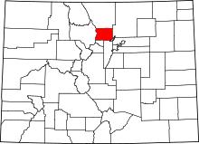 | |
| Towns | ||
| CDPs | ||
| Unincorporated communities | ||
| Ghost town | ||
| Footnotes | ‡This populated place also has portions in an adjacent county or counties | |
This article is issued from Wikipedia - version of the 7/27/2014. The text is available under the Creative Commons Attribution/Share Alike but additional terms may apply for the media files.