Nederland, Colorado
| Town of Nederland, Colorado | |
|---|---|
| Town | |
 | |
| Motto: "Life Is Better Up Here"[1] | |
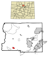
 Location in Boulder County and the state of Colorado | |
| Coordinates: 39°57′43″N 105°30′38″W / 39.96194°N 105.51056°WCoordinates: 39°57′43″N 105°30′38″W / 39.96194°N 105.51056°W | |
| Country | United States |
| State | Colorado |
| County | Boulder County[2] |
| Incorporated (town) | November 15, 1885[3] |
| Government | |
| • Type | Statutory Town[2] |
| • Mayor | Kristopher Larsen |
| Area | |
| • Total | 1.6 sq mi (4.1 km2) |
| • Land | 1.5 sq mi (3.9 km2) |
| • Water | 0.08 sq mi (0.2 km2) |
| Elevation[4] | 8,228 ft (2,508 m) |
| Population (2010) | |
| • Total | 1,445 |
| • Density | 954/sq mi (368.4/km2) |
| Time zone | MST (UTC-7) |
| • Summer (DST) | MDT (UTC-6) |
| ZIP code[5] | 80466 |
| Area code(s) | 303 |
| FIPS code | 08-53175 |
| GNIS feature ID | 0204702 |
| Website |
www |
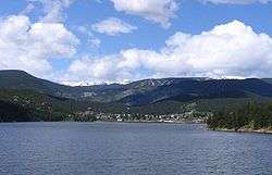
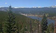
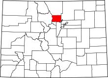
The Town of Nederland is a Statutory Town located near Barker Meadow Reservoir in the mountains of southwest Boulder County, Colorado, United States. As of the 2010 census it had a population of 1,445.[6]
History
Gold was discovered in 1859, along Boulder Creek at the confluence of South Boulder and Beaver Creeks, called Deadwood Diggings, and six miles northeast, called Gold Run.[7]:19
Nederland was established in 1874.[8] The town started as a trading post between Ute Indians and European settlers during the 1850s. The town's first economic boom came when minerals such as tungsten, silver, and gold were discovered near Tungsten (east of Nederland), Caribou (northwest of Nederland, 1859), and Eldora (west of Nederland, 1875).
Today Nederland is better known as a gateway to outdoor recreation in the nearby Indian Peaks Wilderness, Rocky Mountain National Park, Roosevelt National Forest, and the recently established James Peak Wilderness. Nederland is located 17 miles (27 km) west of Boulder, 41 miles (66 km) south of Estes Park, and 47 miles (76 km) northwest of Denver at the Junction of SH 119 and SH 72 on the Peak to Peak Highway.
Name origin
In the mid-19th century the first homesteaders gave a variety of names for the area. The town was first called Dayton, then Browns Crossing. In 1871, when the US Postal Service first set up an office, the name was changed to Middle Boulder after the creek that flows though the center of town (and continues eastward to become Boulder Creek).
In 1873 the Caribou Mine, at an elevation of roughly 10,000 feet (3,000 m) and 6 miles (10 km) northwest of the town, was sold to the Mining Company Nederland from the Netherlands.[9] The high elevation meant fierce winds and deep winter snow, so the new owners of the mine decided that it was beneficial to bring ore from Caribou down to Middle Boulder for milling. In the Dutch language, Nederland ("Netherlands" in English) means low land, and based on casual usage by the Dutch miners, Middle Boulder came to be known as Nederland. (This is ironic, considering that the town's elevation is higher than 8,000 feet (2,400 m) and most locations in the Netherlands are near or even below sea level.) In 1874 the town was incorporated and adopted Nederland as the official name.[10][11][12]
Geography
Nederland is located in southwest Boulder County at 39°57′43″N 105°30′38″W / 39.96194°N 105.51056°W (39.961986, −105.510604).[13]
The elevation in the center of town is 8,234 feet (2,510 m) above sea level. Due west from the town is the Indian Peaks Wilderness within Roosevelt National Forest. The Continental Divide passes through the Wilderness 8 miles (13 km) west of Nederland.
The town of Nederland has a total area of 1.6 square miles (4.1 km2), of which 1.5 square miles (3.9 km2) is land and 0.077 square miles (0.2 km2), or 4.29%, is water,[6] consisting primarily of the west end of Barker Reservoir on Middle Boulder Creek.
Climate
Nederland has an alpine subarctic climate (Dfc) due to its high altitude, with warm summers and long cold winters.
| Climate data for Nederland, Colorado | |||||||||||||
|---|---|---|---|---|---|---|---|---|---|---|---|---|---|
| Month | Jan | Feb | Mar | Apr | May | Jun | Jul | Aug | Sep | Oct | Nov | Dec | Year |
| Record high °F (°C) | 65 (18) |
61 (16) |
65 (18) |
71 (22) |
78 (26) |
86 (30) |
87 (31) |
89 (32) |
82 (28) |
79 (26) |
70 (21) |
64 (18) |
89 (32) |
| Average high °F (°C) | 34.9 (1.6) |
37.8 (3.2) |
41.8 (5.4) |
49.2 (9.6) |
57.5 (14.2) |
69.1 (20.6) |
75.2 (24) |
73.3 (22.9) |
65.3 (18.5) |
55.2 (12.9) |
43.1 (6.2) |
37.1 (2.8) |
53.2 (11.8) |
| Average low °F (°C) | 10.2 (−12.1) |
12.9 (−10.6) |
16.7 (−8.5) |
22.7 (−5.2) |
29.3 (−1.5) |
37.1 (2.8) |
42.6 (5.9) |
41.2 (5.1) |
33.8 (1) |
25.3 (−3.7) |
17.5 (−8.1) |
12.5 (−10.8) |
25.2 (−3.8) |
| Record low °F (°C) | −30 (−34) |
−30 (−34) |
−30 (−34) |
−10 (−23) |
6 (−14) |
14 (−10) |
27 (−3) |
19 (−7) |
3 (−16) |
−2 (−19) |
−25 (−32) |
−34 (−37) |
−34 (−37) |
| Average precipitation inches (mm) | 0.5 (13) |
0.6 (15) |
1.3 (33) |
2.2 (56) |
2.7 (69) |
1.7 (43) |
2.4 (61) |
2.0 (51) |
1.7 (43) |
1.0 (25) |
1.1 (28) |
0.7 (18) |
17.9 (455) |
| Average snowfall inches (cm) | 13.3 (33.8) |
13.1 (33.3) |
23.9 (60.7) |
24.3 (61.7) |
12.2 (31) |
1.8 (4.6) |
0.0 (0) |
0.0 (0) |
5.2 (13.2) |
9.3 (23.6) |
19.9 (50.5) |
16.1 (40.9) |
139.1 (353.3) |
| Average precipitation days | 6 | 5 | 7 | 8 | 11 | 8 | 14 | 12 | 8 | 6 | 7 | 5 | 97 |
| Source: Weatherbase[14] | |||||||||||||
| Nederland, CO | ||||||||||||||||||||||||||||||||||||||||||||||||||||||||||||
|---|---|---|---|---|---|---|---|---|---|---|---|---|---|---|---|---|---|---|---|---|---|---|---|---|---|---|---|---|---|---|---|---|---|---|---|---|---|---|---|---|---|---|---|---|---|---|---|---|---|---|---|---|---|---|---|---|---|---|---|---|
| Climate chart (explanation) | ||||||||||||||||||||||||||||||||||||||||||||||||||||||||||||
| ||||||||||||||||||||||||||||||||||||||||||||||||||||||||||||
| ||||||||||||||||||||||||||||||||||||||||||||||||||||||||||||
Demographics
| Historical population | |||
|---|---|---|---|
| Census | Pop. | %± | |
| 1880 | 279 | — | |
| 1910 | 446 | — | |
| 1920 | 291 | −34.8% | |
| 1930 | 285 | −2.1% | |
| 1940 | 384 | 34.7% | |
| 1950 | 266 | −30.7% | |
| 1960 | 272 | 2.3% | |
| 1970 | 492 | 80.9% | |
| 1980 | 1,212 | 146.3% | |
| 1990 | 1,099 | −9.3% | |
| 2000 | 1,394 | 26.8% | |
| 2010 | 1,445 | 3.7% | |
| Est. 2015 | 1,520 | [15] | 5.2% |
As of the census[17] of 2010, there were 1,445 people, 657 households, and 349 families residing in the town. The population density was 954 people per square mile (368.4/km²). There were 749 housing units at an average density of 499.3 per square mile (192.1/km²). The racial makeup of the town was 95.5% White, 0.4% African American, 0.7% Native American, 0.8% Asian, 0.9% some other race, and 1.7% from two or more races. Hispanic or Latino of any race were 4.1% of the population.[18]
There were 657 households, of which 28.5% had children under the age of 18, 41.7% were headed by married couples living together, and 46.9% were non-families. Of all households, 32.6% were made up of individuals and 4.0% were someone living alone who was 65 years of age or older. The average household size was 2.19, and the average family size was 2.77.[18]
In the town the population was spread out with 19.8% under the age of 18, 7.9% from 18 to 24, 34.5% from 25 to 44, 32.0% from 45 to 64, and 5.9% being 65 years of age or older. The median age was 39.5 years. For every 100 females there were 107.6 males. For every 100 females age 18 and over there were 112.7 males.[18]
For the period 2007-2011, the estimated median income for a household in the town was $69,638, and the median income for a family was $90,329. Male full-time workers had a median income of $60,526 versus $65,052 for females. The per capita income for the town was $31,730. About 7.0% of families and 12.7% of the population were below the poverty line.[19] The median house or condo value in between 2007 and 2011 was estimated at $329,600.[20]
Arts and culture
Annual cultural events
Nederland hosts several major events every year, including the diverse NedFest (Nederland Music & Arts Festival), the historical Miners Day celebration, and the annual Frozen Dead Guy Days festival, all next to Barker Meadow Reservoir.
Frozen Dead Guy Days, which occurs every year in early March, commemorates a substandard attempt by Norwegian immigrant Trygve Bauge to practice cryonics on Bredo Morstoel, his deceased grandfather.[21] In addition to extensive local press, The New York Times covered the festival in 2011[22] and 2012.[23]
Notable people
- Kathy Butler, Olympian runner for Great Britain and Canada[24]
- Timothy Duggan, road bicycle racer[25]
- Ian MacGregor, road bicycle racer[26]
- Darryl Purpose, singer-songwriter, professional blackjack player
- Rob Savoye, primary developer of Gnash software
- Ann Trombley, Olympic cyclist[27]
Legalization of marijuana
On Tuesday, April 6, 2010, Nederland became the third community in Colorado (after Denver[28] and Breckenridge[29]) to legalize the sale, purchase, possession, consumption, and transportation, cultivation, manufacturing, dispensing of medical marijuana and its concentrates and related paraphernalia for persons 21 years of age and older.[30]
See also
References
- ↑ "Town of Nederland, Colorado Website". Town of Nederland, Colorado Website. Retrieved September 19, 2012.
- 1 2 "Active Colorado Municipalities". State of Colorado, Department of Local Affairs. Retrieved 2007-09-01.
- ↑ "Colorado Municipal Incorporations". State of Colorado, Department of Personnel & Administration, Colorado State Archives. 2004-12-01. Retrieved 2007-09-02.
- ↑ "US Board on Geographic Names". United States Geological Survey. 2007-10-25. Retrieved 2008-01-31.
- ↑ "ZIP Code Lookup" (JavaScript/HTML). United States Postal Service. Retrieved November 25, 2007.
- 1 2 "Geographic Identifiers: 2010 Demographic Profile Data (G001): Nederland town, Colorado". U.S. Census Bureau, American Factfinder. Retrieved September 27, 2013.
- ↑ Voynick, S.M., 1992, Colorado Gold, Missoula: Mountain Press Publishing Company, ISBN 0878424555
- ↑ "About". nederlandco.org. Retrieved 2015-10-15.
- ↑ [http://nederlandco.org/about/
town-history-2/ "How We Became Nederland"] Check
|url=value (help). Town of Nederland. Retrieved September 14, 2015. line feed character in|url=at position 30 (help) - ↑ "Profile for Nederland, Colorado". ePodunk. Retrieved September 19, 2012.
- ↑ "Nederland Area Chamber of Commerce". Nederlandchamber.org. Retrieved 2013-05-06.
- ↑ "nederlandmuseums.org". nederlandmuseums.org. Retrieved 2013-05-06.
- ↑ "US Gazetteer files: 2010, 2000, and 1990". United States Census Bureau. 2011-02-12. Retrieved 2011-04-23.
- ↑ "Nederland, Colorado Historical Weather". Weatherbase. Retrieved July 1, 2012.
- ↑ "Annual Estimates of the Resident Population for Incorporated Places: April 1, 2010 to July 1, 2015". Retrieved July 2, 2016.
- ↑ "Census of Population and Housing". Census.gov. Retrieved June 4, 2015.
- ↑ "American FactFinder". United States Census Bureau. Retrieved 2008-01-31.
- 1 2 3 "Profile of General Population and Housing Characteristics: 2010 Demographic Profile Data (DP-1): Nederland town, Colorado". U.S. Census Bureau, American Factfinder. Retrieved September 27, 2013.
- ↑ "Selected Economic Characteristics: 2007-2011 American Community Survey 5-Year Estimates (DP03): Nederland town, Colorado". U.S. Census Bureau, American Factfinder. Retrieved September 27, 2013.
- ↑ "Selected Housing Characteristics: 2007-2011 American Community Survey 5-Year Estimates (DP04): Nederland town, Colorado". U.S. Census Bureau, American Factfinder. Retrieved September 27, 2013.
- ↑ "About FDGD". Frozen Dead Guy Days. 2011-06-18. Retrieved 2013-05-06.
- ↑ Frozen Dead Guy Festival for Sale (the Man Himself Stays on Ice)
- ↑ Town Breathes Easier as Frozen Dead Guy and His Festival Stay Put
- ↑ "Kathy Butler's Bio". Retrieved August 4, 2013.
- ↑ "Timmy Duggan's Bio". Timmy Duggan's Bio. Retrieved September 19, 2012.
- ↑ "Ian MacGregor". Cycling Archives. Retrieved September 19, 2012.
- ↑ http://www.sports-reference.com/olympics/athletes/tr/ann-trombley-1.html
- ↑ O'Driscoll, Patrick (2005-11-03). "Denver OKs pot". USA Today.
- ↑ Archived April 5, 2012, at the Wayback Machine.
- ↑ Erica Meltzerdailycamera.com. "Nederland voters legalize pot, oust mayor - Boulder Daily Camera". Dailycamera.com. Retrieved 2013-05-06.
External links
| Wikimedia Commons has media related to Nederland, Colorado. |
- Town of Nederland official website
- Nederland, Colorado, at City-Data.com
- Nederland Community Center
- Nederland Area Chamber of Commerce
- Nederland Community Library
- Nederland Middle/Senior High School
- Nederland Area Historical Society
- Nathan Lazarus Skatepark
- NedRink - Nederland Ice and Racquet Park
- The Mountain-Ear local newspaper


