Shafer Township, Chisago County, Minnesota
| Shafer Township, Minnesota | |
|---|---|
| Township | |
 Shafer Township Location within the state of Minnesota | |
| Coordinates: 45°25′35″N 92°42′15″W / 45.42639°N 92.70417°WCoordinates: 45°25′35″N 92°42′15″W / 45.42639°N 92.70417°W | |
| Country | United States |
| State | Minnesota |
| County | Chisago |
| Area | |
| • Total | 29.3 sq mi (75.8 km2) |
| • Land | 28.9 sq mi (74.8 km2) |
| • Water | 0.4 sq mi (1.0 km2) |
| Elevation | 925 ft (282 m) |
| Population (2010) | |
| • Total | 1,048 |
| • Density | 36/sq mi (14.0/km2) |
| Time zone | Central (CST) (UTC-6) |
| • Summer (DST) | CDT (UTC-5) |
| ZIP code | 55074 |
| Area code(s) | 651 |
| FIPS code | 27-59332[1] |
| GNIS feature ID | 0665580[2] |
Shafer Township is a township in Chisago County, Minnesota, United States. The population was 1,048 as of the 2010 census,[3] up from 646 at the 2000 census.
Geography
Shafer Township is located in southeast Chisago County, bordered to the east by the city of Taylors Falls and the St. Croix River, which is the Minnesota–Wisconsin border. The city of Shafer is in the southwest part of the township but administratively separate. The unincorporated community of Palmdale is in the north.
U.S. Highway 8 follows most of the southern boundary of the township, turning northeast to travel to Taylors Falls, then across the river to St. Croix Falls, Wisconsin, and leading west to Lindstrom and Chisago City. State Highway 95 (MN 95) crosses the north part of the township, passing through Palmdale and leading southeast to Taylors Falls and northwest to North Branch.
According to the United States Census Bureau, Shafer Township has a total area of 29.3 square miles (75.8 km2), of which 28.9 square miles (74.8 km2) is land and 0.39 square miles (1.0 km2), or 1.32%, is water.[3]
Demographics
As of the census[1] of 2000, there were 646 people, 219 households, and 180 families residing in the township. The population density was 21.6 people per square mile (8.3/km²). There were 233 housing units at an average density of 7.8/sq mi (3.0/km²). The racial makeup of the township was 97.83% White, 1.24% Asian, 0.15% from other races, and 0.77% from two or more races. Hispanic or Latino of any race were 0.31% of the population.
There were 219 households out of which 41.1% had children under the age of 18 living with them, 70.8% were married couples living together, 9.1% had a female householder with no husband present, and 17.8% were non-families. 14.6% of all households were made up of individuals and 6.4% had someone living alone who was 65 years of age or older. The average household size was 2.95 and the average family size was 3.29.
In the township the population was spread out with 29.7% under the age of 18, 5.9% from 18 to 24, 30.2% from 25 to 44, 25.1% from 45 to 64, and 9.1% who were 65 years of age or older. The median age was 38 years. For every 100 females there were 97.0 males. For every 100 females age 18 and over, there were 98.3 males.
The median income for a household in the township was $59,375, and the median income for a family was $61,458. Males had a median income of $41,500 versus $22,222 for females. The per capita income for the township was $20,983. About 1.0% of families and 1.9% of the population were below the poverty line, including 1.9% of those under age 18 and 2.9% of those age 65 or over.
References
- 1 2 "American FactFinder". United States Census Bureau. Retrieved 2008-01-31.
- ↑ "US Board on Geographic Names". United States Geological Survey. 2007-10-25. Retrieved 2008-01-31.
- 1 2 "Geographic Identifiers: 2010 Demographic Profile Data (G001): Shafer township, Chisago County, Minnesota". U.S. Census Bureau, American Factfinder. Retrieved October 2, 2014.
Municipalities and communities of Chisago County, Minnesota, United States | ||
|---|---|---|
| Cities | 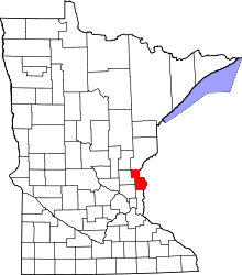 | |
| Townships | ||
| Unincorporated communities | ||