Shelbyville, Tennessee
| Shelbyville, Tennessee | |
|---|---|
| City | |
|
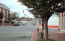
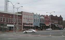
Downtown Shelbyville | |
| Nickname(s): The Walking Horse Capital of the World and The Pencil City | |
 Location of Shelbyville, Tennessee | |
| Coordinates: 35°29′20″N 86°27′8″W / 35.48889°N 86.45222°WCoordinates: 35°29′20″N 86°27′8″W / 35.48889°N 86.45222°W | |
| Country | United States |
| State | Tennessee |
| County | Bedford |
| Platted | 1810 |
| Incorporated | 1819 |
| Named for | Isaac Shelby[1] |
| Government | |
| • Mayor | Eugene Ray |
| Area | |
| • Total | 18.6 sq mi (48.2 km2) |
| • Land | 18.6 sq mi (48.2 km2) |
| • Water | 0.0 sq mi (0.0 km2) |
| Elevation | 755 ft (230 m) |
| Population (2012 est.) | |
| • Total | 20,598 |
| • Density | 1,107/sq mi (427.3/km2) |
| Time zone | Central (CST) (UTC-6) |
| • Summer (DST) | CDT (UTC-5) |
| ZIP codes | 37160-37162 |
| Area code(s) | 931 |
| FIPS code | 47-67760[2] |
| GNIS feature ID | 1269993[3] |
| Website |
www |
Shelbyville is a city in Bedford County, Tennessee, United States. It had a population of 20,335 residents at the 2010 census.[4] Shelbyville, the county seat of Bedford County,[5] was laid out in 1810 and incorporated in 1819. The town is a hub of the Tennessee Walking Horse industry and has been nicknamed "The Walking Horse Capital of the World".
Geography
Shelbyville is in Middle Tennessee at 35°29′20″N 86°27′8″W / 35.48889°N 86.45222°W (35.488988, -86.452353),[6] on a Highland Rim limestone bluff upon the banks of Duck River, which flows around the southern and eastern sides of town.[7]
According to the United States Census Bureau, the city has a total area of 18.6 square miles (48.2 km2), all land.[4]
Demographics
| Historical population | |||
|---|---|---|---|
| Census | Pop. | %± | |
| 1850 | 1,708 | — | |
| 1860 | 776 | −54.6% | |
| 1870 | 1,719 | 121.5% | |
| 1880 | 1,869 | 8.7% | |
| 1890 | 1,823 | −2.5% | |
| 1900 | 2,236 | 22.7% | |
| 1910 | 2,869 | 28.3% | |
| 1920 | 2,912 | 1.5% | |
| 1930 | 5,010 | 72.0% | |
| 1940 | 6,537 | 30.5% | |
| 1950 | 9,456 | 44.7% | |
| 1960 | 10,466 | 10.7% | |
| 1970 | 12,262 | 17.2% | |
| 1980 | 13,530 | 10.3% | |
| 1990 | 14,049 | 3.8% | |
| 2000 | 16,105 | 14.6% | |
| 2010 | 20,335 | 26.3% | |
| Est. 2015 | 21,317 | [8] | 4.8% |
| Sources:[9][10] | |||
As of the census[2] of 2000, there were 16,105 people, 6,066 households, and 4,155 families residing in the city. The population density was 1,041.3 people per square mile (402.0/km²). There were 6,550 housing units at an average density of 423.5 per square mile (163.5/km²). The racial makeup of the city was 77.14% White, 14.98% African American, 0.70% Asian, 0.35% Native American, 0.05% Pacific Islander, 5.02% from other races, and 1.78% from two or more races. Hispanics or Latinos of any race made up 14.55% of the population.
Of the 6,066 households, 31.7% had children under the age of 18 living with them, 46.0% were married couples living together, 16.6% had a female householder with no husband present, and 31.5% were non-families. A total of 26.5% of all households were made up of individuals and 12.4% had someone living alone who was 65 years of age or older. The average household size was 2.59 and the average family size was 3.05.
In the city the population was spread out with 25.2% under the age of 18, 11.9% from 18 to 24, 28.9% from 25 to 44, 18.8% from 45 to 64, and 15.2% who were 65 years of age or older. The median age was 34 years. For every 100 females there were 94.4 males. For every 100 females age 18 and over, there were 91.5 males.
The median income for a household in the city was $27,593, and the median income for a family was $30,465. Males had a median income of $23,754 versus $16,065 for females. The per capita income for the city was $11,260. About 14.4% of families and 25.2% of the population were below the poverty line, including 18.4% of those under age 18 and 22.1% of those age 65 or over.
Economy
Shelbyville is known as "The Pencil City" because of its historical importance as a center of wood-cased pencil manufacturing.[11][12] It is still a site for manufacture of writing instruments. In 1982, National Pen Corporation purchased its largest competitor, U.S. Pencil and Stationery Company.[13] Sanford Corporation produces the Sharpie, the world's top-selling writing instrument, in the city.[12] It was in Shelbyville in 1991 that the world's longest pencil was produced, a plastic-cased pencil 1,091 feet (333 m) long, weighing 27 pounds (12 kg).[14]
Other major business operations in Shelbyville include manufacturers Calsonic Kansei, Bemis Custom Products, Newell Rubbermaid, Cebal America, and Jostens; it is also home to a Tyson Foods facility and a distribution center for Wal-Mart, as well as several nationwide trucking businesses.[12][15]
Transportation
Shelbyville is at the intersection of U.S. Route 231 and U.S. Route 41A. It was the terminus of a branch line (from Wartrace[16]), located along what is now known as Railroad Avenue, connecting with what was once known as the Saint Louis, Nashville and Chattanooga Railroad.[7]
Tennessee Walking Horse National Celebration
The Tennessee Walking Horse National Celebration[17] takes place each year during the 11 days and nights prior to Labor Day. It is the largest show for the Tennessee Walking Horse, during which the breed's World Grand Champion and over 20 World Champions are named. The Celebration is a festival event where more than $650,000 in prizes and awards are given. The Celebration began in 1939, and the first winner was Strolling Jim.[18]
Higher education
The Tennessee Technology Center at Shelbyville is one of 46 institutions in the Tennessee Board of Regents System, the seventh largest system of higher education in the nation. This system comprises six universities, fourteen community colleges, and twenty-six technology centers. More than 80 percent of all Tennessee students attending public institutions are enrolled in a Tennessee Board of Regents institution.
Local government

The City of Shelbyville, Tennessee Government consists of an elected mayor, six member elected city council, and appointed city manager.[19]
Public media and news outlets
Shelbyville has two news media outlets, the Shelbyville Free Press[20] and the Shelbyville Times-Gazette.[21]
The Shelbyville Free Press is a digital News Media Outlet offering the public a liberal voice and includes a multi-platform model in communications including a website,[22] Facebook Page,[23] Twitter,[24] and a United States Press Agency Site.[25] The SFP is a free news outlet and charges no subscription or advertising fees to its readers.
The Shelbyville Time-Gazette is a traditional printed newspaper, which is subscription-based and charges for advertisements.
In popular culture
Shelbyville was featured in Miranda Lambert's video "Famous in a Small Town". The city was also profiled in the film Welcome to Shelbyville, as part of the PBS documentary film series Independent Lens. The film spotlights recent demographic changes in the community, with a focus on the growing number of immigrants from Latin America and Somalia (both Somalis and people from the Bantu minority ethnic group). Shelbyville was also featured in GADA film's "Our Very Own" (2005 Film), directed by Cameron Watson. The film, dubbed "a love story to Shelbyville", highlights some of the peculiar and humorous memories of Shelbyville in the 1970s. The film follows five teenagers who are determined to meet Shelbyville's own Sondra Locke. Filmed in 2004, it highlights the square, Capri Theater, Pope's Cafe, Central High School, Duck River Dam, TWHNC, and many other landmarks. Cameron Watson is also one of Shelbyville's own.
References
- ↑ History of Bedford County and Shelbyville. Retrieved: 7 February 2013.
- 1 2 "American FactFinder". United States Census Bureau. Retrieved 2008-01-31.
- ↑ "US Board on Geographic Names". United States Geological Survey. 2007-10-25. Retrieved 2008-01-31.
- 1 2 "Geographic Identifiers: 2010 Demographic Profile Data (G001): Shelbyville city, Tennessee". U.S. Census Bureau, American Factfinder. Retrieved April 8, 2014.
- ↑ "Find a County". National Association of Counties. Retrieved 2011-06-07.
- ↑ "US Gazetteer files: 2010, 2000, and 1990". United States Census Bureau. 2011-02-12. Retrieved 2011-04-23.
- 1 2 "Chapter VIII: Tennessee Group - Bedford County". Narrative of Cholera Epidemic of 1873. U.S. Government Printing Office. 1875. p. 163.
- ↑ "Annual Estimates of the Resident Population for Incorporated Places: April 1, 2010 to July 1, 2015". Retrieved July 2, 2016.
- ↑ "Census of Population and Housing: Decennial Censuses". United States Census Bureau. Retrieved 2012-03-04.
- ↑ "Incorporated Places and Minor Civil Divisions Datasets: Subcounty Resident Population Estimates: April 1, 2010 to July 1, 2012". Population Estimates. U.S. Census Bureau. Retrieved 11 December 2013.
- ↑ Musgrave Pencil Company History, Musgrave Pencil Company website, accessed April 23, 2008
- 1 2 3 The City of Shelbyville website, accessed April 23, 2008
- ↑ http://www.nationalpen.com/history.asp
- ↑ Sanford Pencil Factory Tour, by Doug Martin, page 5
- ↑ Economic Development Guide, Shelbyville-Bedford County Chamber of Commerce, 2003
- ↑ "Saber charge pushes Rebels out of Shelbyville". Murfreesboro Post. September 28, 2008. Retrieved 2010-05-02., with a link to an April 1863 Shelbyville area map
- ↑ http://www.twhnc.com/
- ↑ "History of the Celebration".
- ↑ City of Shelbyville: http://www.ShelbyvilleTN.org
- ↑ Shellbyville Free Press: http://www.ShelbyvilleFreePress.org
- ↑ http://www.t-g.com
- ↑ Shelbyville Free Press: http://www.ShelbyvilleFreePress.org
- ↑ SFP Facebook: http://www.Facebook.com/ShelbyvilleFreePress
- ↑ SFP Twitter: http://www.Twitter.com/FreePressTN
- ↑ SFP USPA: http://www.ShelbyvilleFreePress.uspa24.com
External links
Municipalities and communities of Bedford County, Tennessee, United States | ||
|---|---|---|
| City | ||
| Towns | ||
| CDP | ||
| Unincorporated communities | ||