Shire of Bendemere
| Shire of Bendemere Queensland | |||||||||||||
|---|---|---|---|---|---|---|---|---|---|---|---|---|---|
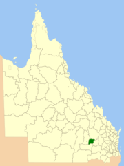 Location within Queensland | |||||||||||||
| Population | 985 (2006 census)[1] | ||||||||||||
| • Density | 0.25084/km2 (0.6497/sq mi) | ||||||||||||
| Established | 1911 | ||||||||||||
| Area | 3,926.8 km2 (1,516.1 sq mi) | ||||||||||||
| Council seat | Yuleba | ||||||||||||
|
| |||||||||||||
| |||||||||||||

The Shire of Bendemere was a local government area in the Maranoa region of Queensland, Australia, and existed from 1911 until 2008 when it amalgamated into Maranoa Region. The Shire, administered from the town of Yuleba, covered an area of 3,926.8 square kilometres (1,516.1 sq mi), and existed as a local government entity from 1911 until 2008, when it was amalgamated with the Town of Roma and the Shires of Booringa, Bungil and Warroo to form the Maranoa Region.
History
The Shire of Bendemere was established on 12 January 1911 from portions of the Shires of Bungil, Murilla and Warroo.[2][3]
In July 2007, the Local Government Reform Commission released a report recommending a number of amalgamations of local government areas in Queensland. As a result, under the Local Government (Reform Implementation) Act 2007, on 15 March 2008, the new local government area of Roma Region was created, as an amalgamation of five previous local government areas:[4]
- the Town of Roma;
- the Shire of Bendemere;
- the Shire of Booringa;
- the Shire of Bungil;
- and the Shire of Warroo.
On 26 July 2009, Roma Region was renamed Maranoa Region.[4]
Towns and localities
The Shire of Bendemere included the following settlements:
Economy
The economy of the shire is mostly based around agriculture, including cattle, sheep and grain. Natural gas also plays a part, with gas wells being found throughout the shire and a liquified petroleum gas processing plant located just south of Wallumbilla.
Chairmen
References
- ↑ Australian Bureau of Statistics (25 October 2007). "Bendemere (S) (Local Government Area)". 2006 Census QuickStats. Retrieved 5 September 2013.
- ↑ "BENDEMERE SHIRE COUNCIL.". The Brisbane Courier. National Library of Australia. 16 January 1911. p. 10. Retrieved 5 September 2013.
- ↑ "NEW SHIRE CONSTITUTED.". The Brisbane Courier. National Library of Australia. 16 January 1911. p. 10. Retrieved 5 September 2013.
- 1 2 "Agency ID11033, Maranoa Regional Council". Queensland State Archives. Retrieved 5 September 2013.
- ↑ Consolidated Index to Queensland Government Gazette 1859-1919. Queensland Family History Society. 2004. ISBN 1 876613 79 3.
- ↑ Pugh, Theophilus Parsons (1927). Pugh's Almanac for 1927. Retrieved 13 June 2014.
External links
Coordinates: 26°37′S 149°23′E / 26.617°S 149.383°E