Shire of Kingaroy
| Shire of Kingaroy Queensland | |||||||||||||
|---|---|---|---|---|---|---|---|---|---|---|---|---|---|
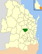 Location within Queensland | |||||||||||||
| Population | 12,285 (2006 census)[1] | ||||||||||||
| • Density | 5.07582/km2 (13.1463/sq mi) | ||||||||||||
| Established | 1912 | ||||||||||||
| Area | 2,420.3 km2 (934.5 sq mi) | ||||||||||||
| Council seat | Kingaroy | ||||||||||||
| Region | South Burnett | ||||||||||||
|
| |||||||||||||
| Website | Shire of Kingaroy | ||||||||||||
| |||||||||||||
The Shire of Kingaroy was a local government area in the South Burnett region of Queensland, Australia, about 100 kilometres (62 mi) northwest of the capital, Brisbane. The shire covered an area of 2,420.3 square kilometres (934.5 sq mi), and existed as a local government entity from 1912 until 2008, when it amalgamated with several other councils in the South Burnett area to become the South Burnett Regional Council.
The shire's name derives from the Wakka Wakka Aboriginal words "king dhu'roi", meaning "ant hungry". While land use was dominantly pastoral in the area's early European history, dairying, beef, small crops and in particular peanut farming became mainstays of Kingaroy's economy.
History
Kingaroy was originally part of the Barambah (later Nanango) Divisional Board, which was created on 11 November 1879 under the Divisional Boards Act 1879. With the passage of the Local Authorities Act 1902, Nanango became a shire council on 31 March 1903.
The town of Kingaroy started to grow after the arrival of the railway in 1904, and on 12 January 1912, the Shire of Kingaroy was proclaimed.
On 15 March 2008, under the Local Government (Reform Implementation) Act 2007 passed by the Parliament of Queensland on 10 August 2007, the Shire of Kingaroy merged with the Shires of Murgon, Nanango and Wondai to form the South Burnett Regional Council.
Towns and localities
The Shire of Kingaroy included the following settlements:
Chairmen
- 1927: R. S. Brown [2]
Other notable members of the Kingaroy Council include:
- 1946—1949: Joh Bjelke-Petersen, Premier of Queensland
Population
| Year | Population |
|---|---|
| 1933 | 6,844 |
| 1947 | 8,063 |
| 1954 | 8,059 |
| 1961 | 8,548 |
| 1966 | 8,339 |
| 1971 | 7,868 |
| 1976 | 7,801 |
| 1981 | 7,939 |
| 1986 | 9,902 |
| 1991 | 10,395 |
| 1996 | 11,141 |
| 2001 | 11,415 |
| 2006 | 12,285 |
References
- ↑ Australian Bureau of Statistics (25 October 2007). "Kingaroy (S) (Local Government Area)". 2006 Census QuickStats. Retrieved 2008-03-18.
- ↑ Pugh, Theophilus Parsons (1927). Pugh's Almanac for 1927. Retrieved 13 June 2014.
Coordinates: 26°05′08.90″S 152°14′21.52″E / 26.0858056°S 152.2393111°E