Shire of Warwick
| Shire of Warwick Queensland | |||||||||||||
|---|---|---|---|---|---|---|---|---|---|---|---|---|---|
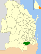 Location within Queensland | |||||||||||||
| Population | 21,417 (2006 census)[1] | ||||||||||||
| • Density | 4.84296/km2 (12.5432/sq mi) | ||||||||||||
| Established | 1994 | ||||||||||||
| Area | 4,422.3 km2 (1,707.5 sq mi) | ||||||||||||
| Council seat | Warwick | ||||||||||||
| Region | Darling Downs | ||||||||||||
|
| |||||||||||||
| Website | Shire of Warwick | ||||||||||||
| |||||||||||||
The Shire of Warwick was a local government area in the Darling Downs region of Queensland, Australia. The administrative centre and major town of the shire was the town of Warwick.
History
On 19 March 1992, the Electoral and Administrative Review Commission, created two years earlier, produced its report External Boundaries of Local Authorities, and recommended that local government boundaries in the Warwick area be rationalised into 3 new local government areas.[2] That recommendation was not implemented, but the outcome was that the City of Warwick was merged with the Shires of Allora, Glengallan and Rosenthal to form the new Shire of Warwick. The Local Government (Allora, Glengallan, Rosenthal and Warwick) Regulation 1994 was gazetted on 20 May 1994. On 25 June, an election was held for the new council, and on 1 July 1994, the Shire of Warwick was established.[3][4]
Under the local council amalgamation programme instigated by the Queensland Government in 2007, the Shires of Stanthorpe and Warwick merged in March 2008 to create the Southern Downs Region.[3][5]
Towns and localities
The Shire of Warwick included the following settlements:
|
Warwick area: |
Allora area:
|
Glengallan area:
|
Rosenthal area:
|
* - not to be confused with Willow Vale, Queensland
Population
| Year | Population |
|---|---|
| 1986 | 17,127* |
| 1991 | 18,732* |
| 1996 | 19,967 |
| 2001 | 20,694 |
| 2006 | 21,417 |
* - from time series data
Mayors
- Bruce Green
- Ron Bellingham
References
- ↑ Australian Bureau of Statistics (25 October 2007). "Warwick (S) (Local Government Area)". 2006 Census QuickStats. Retrieved 2008-03-18.
- ↑ "External Boundaries of Local Authorities" (PDF). Electoral and Administrative Review Commission. Retrieved 3 February 2014.
- 1 2 "Agency ID6067, Warwick Shire Council". Queensland State Archives. Retrieved 10 September 2013.
- ↑ Warwick Shire Council - Shire History. Retrieved 16 December 2006.
- ↑ "Agency ID11055, Southern Downs Regional Council". Queensland State Archives. Retrieved 3 February 2014.