Sisters Eagle Air Airport
| Sisters Eagle Air Airport | |||||||||||
|---|---|---|---|---|---|---|---|---|---|---|---|
 | |||||||||||
| IATA: none – ICAO: FAA: 6K5 | |||||||||||
| Summary | |||||||||||
| Airport type | Public | ||||||||||
| Operator | Sisters Eagle Air, Inc. | ||||||||||
| Location | Sisters, Oregon | ||||||||||
| Elevation AMSL | 3,168 ft / 966 m | ||||||||||
| Coordinates | 44°18′16.4160″N 121°32′21.16″W / 44.304560000°N 121.5392111°WCoordinates: 44°18′16.4160″N 121°32′21.16″W / 44.304560000°N 121.5392111°W | ||||||||||
| Runways | |||||||||||
| |||||||||||
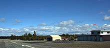
Sisters Eagle Air Airport (FAA LID: 6K5) is a public airport located one mile (1.6 km) north of Sisters in Deschutes County, Oregon, USA. There are some subdivisions with access to the airport. It is also used for wildfire aircraft support.
External links
- Resources for this airport:
- FAA airport information for 6K5
- AirNav airport information for 6K5
- FlightAware airport information and live flight tracker
- SkyVector aeronautical chart for 6K5
- Oregon Department of Aviation
- Fltplan
This article is issued from Wikipedia - version of the 8/3/2016. The text is available under the Creative Commons Attribution/Share Alike but additional terms may apply for the media files.