Ken Jernstedt Airfield
| Ken Jernstedt Airfield | |||||||||||
|---|---|---|---|---|---|---|---|---|---|---|---|
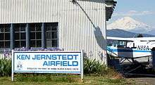 Ken Jernstedt Airfield with Mount Adams in the background. | |||||||||||
| IATA: none – ICAO: K4S2 – FAA LID: 4S2 | |||||||||||
| Summary | |||||||||||
| Airport type | Public | ||||||||||
| Operator | Port of Hood River | ||||||||||
| Location | Hood River, Oregon | ||||||||||
| Elevation AMSL | 631 ft / 192.3 m | ||||||||||
| Coordinates | 45°40′21.43″N 121°32′11.27″W / 45.6726194°N 121.5364639°WCoordinates: 45°40′21.43″N 121°32′11.27″W / 45.6726194°N 121.5364639°W | ||||||||||
| Website | |||||||||||
| Runways | |||||||||||
| |||||||||||
Ken Jernstedt Airfield (FAA LID: 4S2), is a public airport located two miles (3.2 km) south of the city of Hood River in Hood River County, Oregon, USA. The airport is named after Kenneth Jernstedt, a former state legislator, mayor of Hood River, and World War II Flying Tigers aviator.[1]
References
- ↑ Francis, Mike (February 5, 2013). "Ace pilot, father, ex-mayor and legislator Kenneth A. Jernstedt dies at 95". The Oregonian. Retrieved June 17, 2015.
External links
- Resources for this airport:
- FAA airport information for 4S2
- AirNav airport information for 4S2
- FlightAware airport information and live flight tracker
- SkyVector aeronautical chart for 4S2
This article is issued from Wikipedia - version of the 6/17/2015. The text is available under the Creative Commons Attribution/Share Alike but additional terms may apply for the media files.