Siwinqani (Potosí)
This article is about the mountain in the Potosí Department, Bolivia. For other uses, see Siwinqani.
| Siwinqani | |
|---|---|
 Siwinqani Location within Bolivia | |
| Highest point | |
| Elevation | 4,202 m (13,786 ft) [1] |
| Coordinates | 18°44′12″S 65°44′29″W / 18.73667°S 65.74139°WCoordinates: 18°44′12″S 65°44′29″W / 18.73667°S 65.74139°W |
| Geography | |
| Location |
Bolivia, Potosí Department |
| Parent range | Andes |
Siwinqani (Aymara siwinqa a kind of cactus,[2][3] -ni a suffix, "the one with the siwinqa plant", also spelled Sevengani) is a 4,202 m (13,786 ft) high mountain in the Bolivian Andes. It is located in the Potosí Department, Chayanta Province, Ocurí Municipality. It lies northwest of Lluxita, northeast of the village of Ch'aki Mayu (Chaqui Mayu).[1][4]
References
- 1 2 Bolivia IGM map 1:50,000 Ravelo 6437-I
- ↑ Radio San Gabriel, "Instituto Radiofonico de Promoción Aymara" (IRPA) 1993, Republicado por Instituto de las Lenguas y Literaturas Andinas-Amazónicas (ILLLA-A) 2011, Transcripción del Vocabulario de la Lengua Aymara, P. Ludovico Bertonio 1612 (Spanish-Aymara-Aymara-Spanish dictionary)
- ↑ "Diccionario Quechua - Aymara al español". katari.org. Retrieved April 17, 2016.
- ↑ "Ocurí". INE, Bolivia. Retrieved April 17, 2016. (note: wrong position)
Capital: Potosí | ||
| Provinces | 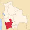 | |
| Municipalities (and seats) |
| |
This article is issued from Wikipedia - version of the 4/17/2016. The text is available under the Creative Commons Attribution/Share Alike but additional terms may apply for the media files.