Sonoita, Arizona
| Sonoita, Arizona | |
|---|---|
| Census-designated place | |
|
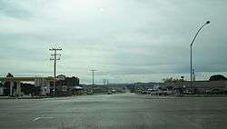
Sonoita, as seen from the main intersection in town. | |
 Location in Santa Cruz County and the state of Arizona | |
| Coordinates: 31°40′8″N 110°39′14″W / 31.66889°N 110.65389°WCoordinates: 31°40′8″N 110°39′14″W / 31.66889°N 110.65389°W | |
| Country | United States |
| State | Arizona |
| County | Santa Cruz |
| Area | |
| • Total | 10.5 sq mi (27.3 km2) |
| • Land | 10.5 sq mi (27.3 km2) |
| • Water | 0.0 sq mi (0.0 km2) |
| Elevation | 4,885 ft (1,489 m) |
| Population (2010) | |
| • Total | 818 |
| • Density | 78/sq mi (30/km2) |
| Time zone | MST (no DST) (UTC-7) |
| ZIP code | 85637 |
| Area code(s) | 520 |
| FIPS code | 04-68220 |
| GNIS feature ID | 0034635 |
Sonoita (O'odham: Ṣon ʼOidag) is a census-designated place (CDP) in Santa Cruz County, Arizona, United States. The population was 818 at the 2010 census.[1]
The origin of the name of the CDP is the O'odham Ṣon ʼOidag, which may be best translated as "spring field". (There are several places that the O'odham call Ṣon ʼOidag within 200 km of this place, all agricultural spots.) Sonoita has for many years been a popular place for wealthy Arizonans to establish vacation and retirement homes and ranches. Sonoita is experiencing significant growth.
Geography
Sonoita is located at 31°40′8″N 110°39′14″W / 31.66889°N 110.65389°W (31.668862, -110.653964).[2]
According to the United States Census Bureau, the CDP has a total area of 10.5 square miles (27.3 km2), all of it land.[1]
Demographics
As of the census[3] of 2000, there were 826 people, 358 households, and 264 families residing in the CDP. The population density was 18.1 people per square mile (7.0/km²). There were 401 housing units at an average density of 8.8 per square mile (3.4/km²). The racial makeup of the CDP was 89.59% White, 0.48% Black or African American, 0.48% Native American, 0.12% Asian, 0.24% Pacific Islander, 6.54% from other races, and 2.54% from two or more races. 16.71% of the population were Hispanic or Latino of any race.
There were 358 households out of which 20.7% had children under the age of 18 living with them, 66.2% were married couples living together, 5.9% had a female householder with no husband present, and 26.0% were non-families. 21.5% of all households were made up of individuals and 8.4% had someone living alone who was 65 years of age or older. The average household size was 2.31 and the average family size was 2.65.
In the CDP the population was spread out with 18.4% under the age of 18, 2.5% from 18 to 24, 21.2% from 25 to 44, 37.7% from 45 to 64, and 20.2% who were 65 years of age or older. The median age was 50 years. For every 100 females there were 92.5 males. For every 100 females age 18 and over, there were 90.4 males.
The median income for a household in the CDP was $51,310, and the median income for a family was $58,571. Males had a median income of $46,042 versus $26,406 for females. The per capita income for the CDP was $27,312. About 2.8% of families and 4.9% of the population were below the poverty line, including 10.1% of those under age 18 and 2.0% of those age 65 or over.
See also
- Sonoita Creek
- Sonoita AVA, Arizona wine region around Sonoita
- Empire Ranch
- Fort Buchanan, Arizona
References
- 1 2 "Geographic Identifiers: 2010 Demographic Profile Data (G001): Sonoita CDP, Arizona". U.S. Census Bureau, American Factfinder. Retrieved December 4, 2012.
- ↑ "US Gazetteer files: 2010, 2000, and 1990". United States Census Bureau. 2011-02-12. Retrieved 2011-04-23.
- ↑ "American FactFinder". United States Census Bureau. Retrieved 2008-01-31.
External links
- Sonoita at Nogales-Santa Cruz County Chamber of Commerce
- Sonoita & Elgin at Patagonia Area Business Association
- Sonoita community website
Municipalities and communities of Santa Cruz County, Arizona, United States | ||
|---|---|---|
| City |  | |
| Town | ||
| CDPs | ||
| Populated places | ||
| Ghost towns | ||