South Burlington, Vermont
| South Burlington, Vermont | ||
|---|---|---|
| City | ||
|
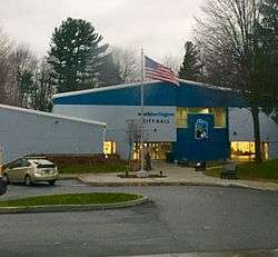
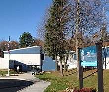
South Burlington City Hall | ||
| ||
| Nickname(s): SB | ||
| Motto: A different place altogether | ||
 Location in Chittenden County and the state of Vermont | ||
 South Burlington, Vermont Location in the United States | ||
| Coordinates: 44°27′7″N 73°10′54″W / 44.45194°N 73.18167°WCoordinates: 44°27′7″N 73°10′54″W / 44.45194°N 73.18167°W | ||
| Country | United States | |
| State | Vermont | |
| County | Chittenden | |
| Incorporated (town) | 1865 | |
| Incorporated (city) | 1971 | |
| Government | ||
| • City Manager | Kevin Dorn | |
| • City Clerk | Donna Kinville | |
| Area | ||
| • Total | 29.6 sq mi (76.6 km2) | |
| • Land | 16.5 sq mi (42.7 km2) | |
| • Water | 13.1 sq mi (33.9 km2) | |
| Elevation | 328 ft (100 m) | |
| Population (2010) | ||
| • Total | 17,904 | |
| • Estimate (2015[1]) | 18,791 | |
| • Density | 1,136/sq mi (438.8/km2) | |
| Time zone | Eastern (EST) (UTC-5) | |
| • Summer (DST) | EDT (UTC-4) | |
| ZIP code | 05403, 05407 | |
| Area code(s) | 802 | |
| FIPS code | 50-66175[2] | |
| GNIS feature ID | 1459577[3] | |
| Website |
www | |

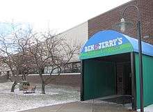
South Burlington is a city in Chittenden County, Vermont, United States.[4] It is the 2nd-most populous city in Vermont and home to the headquarters of Ben & Jerry's as well as the state's largest mall, the University Mall. It is one of the principal municipalities of the Burlington, Vermont metropolitan area.
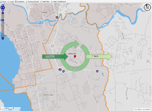
The city includes a central hub called City Center, which serves as the main business district. Residential neighborhoods surround City Center to the east and south. A mix of strip commercial and residential neighborhoods border Lake Champlain to the southwest. The city is in the planning and design phase of a redevelopment project to revitalize the City Center core.[5]
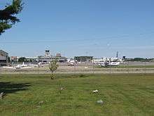
Vermont's largest airport, the Burlington International Airport, is located within the city limits, although it is owned by a neighboring municipality, the city of Burlington (Vermont's most populous city). The airport serves as the base of the Vermont Air National Guard and an Army Aviation Support Facility (AASF) of the Vermont Army National Guard.
History
The area of South Burlington was first granted by the Province of New Hampshire as part of Burlington township on June 7, 1763.[6]
The town of Burlington was organized around 1785. In 1865, the unincorporated village of Burlington was chartered as a city. The remaining area of the town came to be organized as a separate town with the name South Burlington in the same year, 1865.[7] The town of South Burlington was later incorporated as a city in 1971.
Government
The city government is a council-manager form of government. Budgets must be approved by voters.[9] The city budget for 2016 was $21,153,145.[10]
Geography
Located in western Chittenden County, South Burlington is bordered by the municipality of Burlington to the northwest, Winooski and Colchester to the north, Essex to the northeast, Williston to the east, Shelburne to the south, and Shelburne Bay on Lake Champlain to the west. A large portion of Lake Champlain west of Burlington, extending west to the New York state line, is also part of South Burlington.
According to the United States Census Bureau, the city has a total area of 29.6 square miles (76.6 km2), of which 16.5 square miles (42.7 km2) is land and 13.1 square miles (33.9 km2), or 44.25%, is water.[11]
Demographics
2010 census
U.S. Census population estimate for 2015 was 18,791.[12] As of the census[2] of 2010, The population density was 1,121.2 people per square mile (670.5/km2). There were 8,429 housing units at an average density of 507.8 per square mile (150.8/km2).
| Historical population | |||
|---|---|---|---|
| Census | Pop. | %± | |
| 1800 | 65 | — | |
| 1810 | 68 | 4.6% | |
| 1820 | 120 | 76.5% | |
| 1830 | 135 | 12.5% | |
| 1840 | 121 | −10.4% | |
| 1850 | 127 | 5.0% | |
| 1860 | 121 | −4.7% | |
| 1870 | 791 | 553.7% | |
| 1880 | 664 | −16.1% | |
| 1890 | 845 | 27.3% | |
| 1900 | 971 | 14.9% | |
| 1910 | 927 | −4.5% | |
| 1920 | 938 | 1.2% | |
| 1930 | 1,203 | 28.3% | |
| 1940 | 1,736 | 44.3% | |
| 1950 | 3,279 | 88.9% | |
| 1960 | 6,903 | 110.5% | |
| 1970 | 10,032 | 45.3% | |
| 1980 | 10,679 | 6.4% | |
| 1990 | 12,809 | 19.9% | |
| 2000 | 15,814 | 23.5% | |
| 2010 | 17,904 | 13.2% | |
| Est. 2015 | 18,791 | [13] | 5.0% |
| U.S. Decennial Census[14] | |||
Race and ethnicity as of the 2010 Census:
| White | 90.0% (88.7% non-Hispanic or Latino) |
| Black or African American | 1.9% |
| Hispanic or Latino | 1.9% |
| Asian | 5.4% |
| Native American | 0.2% |
| Pacific Islander | 0.01% |
| other races | 0.49% |
| Two or more races | 2.0% |
Economy
South Burlington has a largely service-based economy. There are 191 businesses in retail trade, mainly concentrated around City Center near Dorset St and Williston Rd. There are 131 establishments in health care and assistance and 116 in professional, scientific, and technical service industries. [15] In 2015, South Burlington was first in the state for gross retail and use sales with $1,888,484,094. [16] Real estate, rental, and leasing operations had a sales value of $86,976,000 in 2012.[17]
Some of the major employers in South Burlington are the Vermont National Guard, GE Healthcare , Ben & Jerry’s, Fairpoint Communications, and Lane Press. South Burlington is home to CommutAir, a regional airline, and is headquartered in the city by the airport.[18] Magic Hat Brewing Company, one of the nation’s larger craft breweries, is headquartered here as well.[19] Other important economic forces in South Burlington include the University Mall, Vermont’s largest mall, four grocery stores centrally located in City Center, and the Development plan for City Center.
Employment and income
| Employment Flow in South Burlington | Count | Share |
|---|---|---|
| Total jobs in South Burlington | 17,887 | 100% |
| Employed in South Burlington, lives elsewhere | 15,773 | 88.2% |
| Employed and lives in South Burlington | 2,114 | 11.8% |
- 70.9% of people 16 and older in South Burlington are in the labor force. By sector, the labor force in South Burlington is concentrated in a few main sectors:
- 34.2% empoloyed in educational services, health care, and social assistance
- 11.4% employed in manufacturing
- 9.1% employed in arts, entertainment, and recreation, and accommodation and food services
- 9.0% employed in retail
- 9.0% employed in Professional, scientific, and management, and administrative and waste management services[20]
The median household income was $67,396 in 2014 and 25.2% of families have total annual income between $100,000–$150,000. The unemployment rate in 2014 was 4.7%.[21]
City Center Initiative
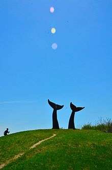
The City Center initiative is a proposal to create a walkable downtown core. Infrastructure for the project is being undertaken as a public–private partnership.[22] The site will be mixed-use for residential, commercial, and cultural spaces. The main components are a city core with a newly constructed City Hall, public library, and recreation center adjacent to a large park. Two main streets, Market Street and Garden Street, will be constructed/ reconstructed to form the central routes through City Center. These streets will be outfitted with bike/walkways, lined with trees, and include storm water infiltration surfaces. Along these streets will be mixed use buildings primarily for use by lower level retail and upper level residential units. In addition, a 7+ acre plot is to become Dumont Park, which will have walking paths, an outdoor classroom, a children's discovery area, and natural art landmarks.[23]
Parks
- Red Rocks Park is a public park and beach on the shores of Lake Champlain.
- Overlook Park is a scenic park overlooking Lake Champlain and the Adirondacks.
- Veterans Memorial Park (also known as Dorset Park) is the city's most well-known park. It has two baseball fields, one basketball court, a playground, and Cairns Arena, the high school's hockey arena, is close by.
- Jaycee Park has a playground, basketball court, and open space for people to use.
- Wheeler Nature Park, a park located just south of Veterans Memorial Park, with one hiking trail and scenic views of Mount Mansfield.
Education
Elementary schools:
- Chamberlin School
- Orchard School
- Rick Marcotte Central School
- The Schoolhouse (private)
Middle schools:
- Frederick H. Tuttle Middle School
- Vermont Commons School
High schools:
- Rice Memorial High School (private, Roman Catholic)
- South Burlington High School (the city's only public high school)
- Vermont Commons School
Transportation
Burlington International Airport provides the area with commercial service to major regional hubs and international airports. Despite its name, it is located in South Burlington, although the land it is located on is owned by the city of Burlington. It originally did not offer scheduled commercial flights to destinations outside the United States, although it now has a Customs Port of Entry.[24] The name dates to a time when it offered flights to Montreal, but in 2011, it started seasonal flights to Toronto. Bus service is provided by the Chittenden County Transportation Authority.
Major highways
-
 Interstate 89
 -
 Interstate 189
 -
 U.S. Route 2
 -
 U.S. Route 7
 -
 VT 116 (Vermont Route 116)
Interstate 89, Vermont's longest interstate highway, has two interchanges serving the city. Exit 13 merges with I-189, which ends on Shelburne Road (US Route 7). The second interchange, Exit 14, is the state of Vermont's largest highway exit and merges onto US Route 2. Exit 14E merges onto Williston Road and Dorset Street in South Burlington. Exit 14W is the main exit into Burlington and becomes Main Street in the Burlington city limits by the University of Vermont.
Interstate 189 goes east-west, connecting two of the city's main commercial roads, Shelburne Road (US Route 7) and Dorset Street.
![]() VT 116 (Vermont Route 116) runs north-south into South Burlington, and ends with a junction at US Route 2 (Williston Road).
VT 116 (Vermont Route 116) runs north-south into South Burlington, and ends with a junction at US Route 2 (Williston Road).
Media
Television
Radio
Notable people
- Kerstin Anderson, Stage actress
- Harry Bliss, cartoonist and illustrator
- Ronald Braunstein, American conductor
- Garry Davis, world citizen, peace activist, founder of the World Service Authority and creator of the World Passport
- Jack Du Brul, New York Times bestselling author
- Laura Hall, Miss Vermont 2009
- Jack Leggett, collegiate baseball coach[25]
- Mike Rochford, pitcher with the Boston Red Sox and Yakult Swallows[26]
- Martin St. Louis, right wing with the Tampa Bay Lightning and Calgary Flames, now with the New York Rangers
References
- ↑ "South Burlington city, Vermont". United States Census Bureau. Retrieved 11 June 2016.
- 1 2 "American FactFinder". United States Census Bureau. Retrieved 2008-01-31.
- ↑ "US Board on Geographic Names". United States Geological Survey. 2007-10-25. Retrieved 2008-01-31.
- ↑ "South Burlington city, Vermont". United States Census Bureau. Retrieved 11 June 2016.
- ↑ "City Center Initiative". City of South Burlington. Retrieved 23 February 2016.
- ↑ "Villages & Communities Within: South Burlington". www.rootsweb.ancestry.com. Retrieved 15 December 2015.
- ↑ "Welcome!". City of South Burlington. Retrieved 23 February 2016.
- ↑ South Burlington in 2014, City Hall.
- ↑ Buscher, Sara (May 20, 2008). Residents to vote today on budgets. Burlington Free Press.
- ↑ City of South Burlington Reports http://www.sburl.com/vertical/sites/%7BD1A8A14E-F9A2-40BE-A701-417111F9426B%7D/uploads/FY_17_City_Council_Approved_Proposed_Budget.pdf
- ↑ "Geographic Identifiers: 2010 Census Summary File 1 (G001): South Burlington city, Vermont". U.S. Census Bureau, American Factfinder. Retrieved August 11, 2015.
- ↑ U.S. Census Bureau, Population Division. http://factfinder.census.gov/faces/tableservices/jsf/pages/productview.xhtml?src=CF
- ↑ "Annual Estimates of the Resident Population for Incorporated Places: April 1, 2010 to July 1, 2015". Retrieved July 2, 2016.
- ↑ "U.S. Decennial Census". United States Census Bureau. Retrieved May 16, 2015.
- ↑ U.S. Census Bureau, 2010-2014 American Community Survey 5-Year Estimates http://factfinder.census.gov/faces/tableservices/jsf/pages/productview.xhtml?src=CF
- ↑ State of Vermont Tax Department 2015 Sales and Use Statistics. http://tax.vermont.gov/research-and-reports/statistical-data/sales-and-use/2015-sales-and-use-tax-statistical-reports
- ↑ U.S. Census Bureau, 2012 Economic Census, 2012 Economic Census of Island Areas, and 2012 Nonemployer Statistics. http://factfinder.census.gov/faces/tableservices/jsf/pages/productview.xhtml?src=CF
- ↑ "Welcome!" CommutAir. Retrieved on May 24, 2009.
- ↑ "Magic Hat Brewery Directions" . Retrieved on January 6, 2010.
- ↑ U.S. Census Bureau, 2010-2014 American Community Survey 5-Year Estimates
- ↑ U.S. Census Bureau, 2010-2014 American Community Survey 5-Year Estimates
- ↑ http://www.sburl.com/index.asp?Type=B_BASIC&SEC={6E578152-52EF-4AE4-BCC5-EE0FACD420D0}
- ↑ TIF District Plan
- ↑ Port Of Entry - Burlington International Airport
- ↑ Jack Leggett Clemson University profile
- ↑ Mike Rochford Baseball-Reference statistics
External links
| Wikivoyage has a travel guide for South Burlington. |
- South Burlington official website
- Lake Champlain Regional Chamber of Commerce
- South Burlington GIS
- Brief History of South Burlington and Mayfair Park Neighborhood
Municipalities and communities of Chittenden County, Vermont, United States | ||
|---|---|---|
| Cities | 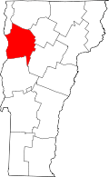 | |
| Towns | ||
| Villages | ||
| CDPs | ||
| Unincorporated communities | ||
Montpelier (capital) | |
| Regions | |
| Counties | |
| Cities | |
| Towns (pop. >5000) | |
| Festivals | |
| Topics |
|
| Society |
|