South Carrollton, Kentucky
| South Carrollton, Kentucky | |
|---|---|
| City | |
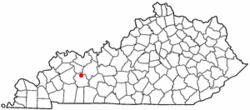 Location of South Carrollton, Kentucky | |
| Coordinates: 37°20′12″N 87°8′30″W / 37.33667°N 87.14167°WCoordinates: 37°20′12″N 87°8′30″W / 37.33667°N 87.14167°W | |
| Country | United States |
| State | Kentucky |
| County | Muhlenberg |
| Area | |
| • Total | 0.2 sq mi (0.6 km2) |
| • Land | 0.2 sq mi (0.6 km2) |
| • Water | 0.0 sq mi (0.0 km2) |
| Elevation | 449 ft (137 m) |
| Population (2000) | |
| • Total | 184 |
| • Density | 759.2/sq mi (293.1/km2) |
| Time zone | Central (CST) (UTC-6) |
| • Summer (DST) | CDT (UTC-5) |
| ZIP code | 42374 |
| Area code(s) | 270 |
| FIPS code | 21-71814 |
| GNIS feature ID | 0503897 |
South Carrollton is a city in Muhlenberg County, Kentucky, United States. The population was 184 at the 2000 census. Founded as Randolph Old Farm in 1838, an early pioneer changed the name of the city to honor his son, Carroll.[1] The name was prefixed with south in order to disambiguate the city from Carrollton, Kentucky.[2]
Geography
South Carrollton is located at 37°20′12″N 87°8′30″W / 37.33667°N 87.14167°W (37.336799, -87.141719).[3]
According to the United States Census Bureau, the city has a total area of 0.2 square miles (0.52 km2), all land.
Demographics
| Historical population | |||
|---|---|---|---|
| Census | Pop. | %± | |
| 1870 | 240 | — | |
| 1880 | 493 | 105.4% | |
| 1890 | 525 | 6.5% | |
| 1900 | 452 | −13.9% | |
| 1910 | 365 | −19.2% | |
| 1920 | 328 | −10.1% | |
| 1930 | 334 | 1.8% | |
| 1940 | 296 | −11.4% | |
| 1950 | 289 | −2.4% | |
| 1960 | 234 | −19.0% | |
| 1970 | 218 | −6.8% | |
| 1980 | 262 | 20.2% | |
| 1990 | 202 | −22.9% | |
| 2000 | 184 | −8.9% | |
| 2010 | 184 | 0.0% | |
| Est. 2015 | 182 | [4] | −1.1% |
As of the census[6] of 2000, there were 184 people, 70 households, and 53 families residing in the city. The population density was 759.2 people per square mile (296.0/km²). There were 80 housing units at an average density of 330.1 per square mile (128.7/km²). The racial makeup of the city was 97.28% White, 0.54% African American, 0.54% Native American, and 1.63% from two or more races.
There were 70 households out of which 35.7% had children under the age of 18 living with them, 60.0% were married couples living together, 12.9% had a female householder with no husband present, and 22.9% were non-families. 17.1% of all households were made up of individuals and 4.3% had someone living alone who was 65 years of age or older. The average household size was 2.63 and the average family size was 2.94.
In the city the population was spread out with 22.8% under the age of 18, 9.8% from 18 to 24, 32.1% from 25 to 44, 21.7% from 45 to 64, and 13.6% who were 65 years of age or older. The median age was 39 years. For every 100 females there were 109.1 males. For every 100 females age 18 and over, there were 118.5 males.
The median income for a household in the city was $27,500, and the median income for a family was $38,750. Males had a median income of $33,125 versus $14,375 for females. The per capita income for the city was $18,183. About 3.7% of families and 14.0% of the population were below the poverty line, including 11.5% of those under the age of eighteen and 9.7% of those sixty five or over.
References
- ↑ "Dictionary of Places: South Carrollton". Encyclopedia of Kentucky. New York, New York: Somerset Publishers. 1987. ISBN 0-403-09981-1.
- ↑ Anderson, Bobby (Sep 19, 2007). "Sandy Called These Names". Leader-News. pp. A12. Retrieved 16 May 2015.
- ↑ "US Gazetteer files: 2010, 2000, and 1990". United States Census Bureau. 2011-02-12. Retrieved 2011-04-23.
- ↑ "Annual Estimates of the Resident Population for Incorporated Places: April 1, 2010 to July 1, 2015". Retrieved July 2, 2016.
- ↑ "Census of Population and Housing". Census.gov. Retrieved June 4, 2015.
- ↑ "American FactFinder". United States Census Bureau. Retrieved 2008-01-31.
Municipalities and communities of Muhlenberg County, Kentucky, United States | ||
|---|---|---|
| Cities | 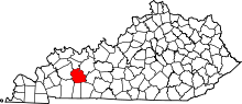 | |
| CDPs | ||
| Unincorporated communities | ||
| Ghost town | ||
| Footnotes | ‡This populated place also has portions in an adjacent county or counties | |