South Mansfield, Louisiana
| South Mansfield, Louisiana | |
| Village | |
| Country | United States |
|---|---|
| State | Louisiana |
| Parish | DeSoto |
| Elevation | 361 ft (110.0 m) |
| Coordinates | 32°01′00″N 93°43′22″W / 32.01667°N 93.72278°WCoordinates: 32°01′00″N 93°43′22″W / 32.01667°N 93.72278°W |
| Area | 0.7 sq mi (1.8 km2) |
| - land | 0.7 sq mi (2 km2) |
| - water | 0.0 sq mi (0 km2), 0% |
| Population | 346 (2010) |
| Density | 494.3/sq mi (190.9/km2) |
| Mayor | Euricka Mayweather (D) |
| Timezone | CST (UTC-6) |
| - summer (DST) | CDT (UTC-5) |
| Area code | 318 |
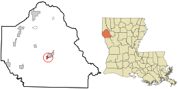 Location in DeSoto Parish and the state of Louisiana. | |
South Mansfield is a village in DeSoto Parish, Louisiana, United States. The population was 346 at the 2010 census.[1] It is part of the Shreveport–Bossier City Metropolitan Statistical Area.
Geography
South Mansfield is located in central DeSoto Parish at 32°1′0″N 93°43′22″W / 32.01667°N 93.72278°W (32.016740, -93.722903).[2] It is bordered to the north by the city of Mansfield, the parish seat.
According to the United States Census Bureau, the village has a total area of 0.69 square miles (1.8 km2), of which 0.02 square miles (0.06 km2), or 3.11%, is water.[1]
Demographics
| Historical population | |||
|---|---|---|---|
| Census | Pop. | %± | |
| 1920 | 441 | — | |
| 1930 | 462 | 4.8% | |
| 1940 | 433 | −6.3% | |
| 1950 | 276 | −36.3% | |
| 1960 | 616 | 123.2% | |
| 1970 | 439 | −28.7% | |
| 1980 | 1,463 | 233.3% | |
| 1990 | 407 | −72.2% | |
| 2000 | 352 | −13.5% | |
| 2010 | 346 | −1.7% | |
| Est. 2015 | 347 | [3] | 0.3% |
As of the census[5] of 2000, there were 352 people, 154 households, and 93 families residing in the village. The population density was 513.0 inhabitants per square mile (197.0/km²). There were 166 housing units at an average density of 241.9 per square mile (92.9/km²). The racial makeup of the village was 24.43% White, 73.86% African American, 0.57% Native American, 0.28% Asian, and 0.85% from two or more races. Hispanic or Latino of any race were 2.27% of the population.
There were 154 households out of which 29.2% had children under the age of 18 living with them, 21.4% were married couples living together, 33.1% had a female householder with no husband present, and 39.0% were non-families. 35.7% of all households were made up of individuals and 20.1% had someone living alone who was 65 years of age or older. The average household size was 2.29 and the average family size was 2.93.
In the village the population was spread out with 30.1% under the age of 18, 9.7% from 18 to 24, 22.7% from 25 to 44, 19.9% from 45 to 64, and 17.6% who were 65 years of age or older. The median age was 34 years. For every 100 females there were 62.2 males. For every 100 females age 18 and over, there were 61.8 males.
The median income for a household in the village was $12,417, and the median income for a family was $24,375. Males had a median income of $25,909 versus $14,000 for females. The per capita income for the village was $11,069. About 44.9% of families and 46.3% of the population were below the poverty line, including 52.4% of those under age 18 and 40.0% of those age 65 or over.
Municipalities and communities of DeSoto Parish, Louisiana, United States | ||
|---|---|---|
| City |  | |
| Towns | ||
| Villages | ||
| CDPs | ||
| Other unincorporated communities | ||
References
- 1 2 "Geographic Identifiers: 2010 Demographic Profile Data (G001): South Mansfield village, Louisiana". U.S. Census Bureau, American Factfinder. Retrieved October 28, 2015.
- ↑ "US Gazetteer files: 2010, 2000, and 1990". United States Census Bureau. 2011-02-12. Retrieved 2011-04-23.
- ↑ "Annual Estimates of the Resident Population for Incorporated Places: April 1, 2010 to July 1, 2015". Retrieved July 2, 2016.
- ↑ "Census of Population and Housing". Census.gov. Retrieved June 4, 2015.
- ↑ "American FactFinder". United States Census Bureau. Retrieved 2008-01-31.