Surrey Hills AONB
| Surrey Hills | |
|---|---|
| Area of Outstanding Natural Beauty | |
 | |
| Country | England |
| County | Surrey |
| Location | South-east England |
| Area | 422 km2 (163 sq mi) |
| Highest point | |
| - location | Leith Hill |
| - elevation | 294 m (965 ft) |
| Biomes | Agricultural land (42.0%), Woodland (38.9%), Scrub heathland (3.3%), Chalk grassland (0.6%) |
| Geology | North Downs, Greensand Ridge |
| Plant | Bracken, bramble |
| Animal | Adder, deer, fox, jay, magpie, whinchat, woodlark |
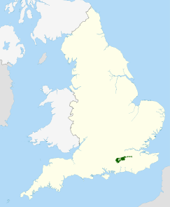 Location of the Surrey Hills AONB in the UK | |
| Website : Surrey Hills AONB | |
Surrey Hills is a 422 km2 (163 sq mi) Area of Outstanding Natural Beauty (AONB) in Surrey, England.[1] The AONB was designated in 1958 and covers one quarter of the county of Surrey.[2] Surrey Hills AONB adjoins the Kent Downs AONB to the east and the South Downs National Park in the south west.
Hill
Hill
The highest summit of the Surrey Hills AONB, Leith Hill near Coldharbour, is 294 metres (965 ft) above sea level. It is part of the Greensand Ridge, which traverses the AONB from west to east, and is the highest point in southeast England.
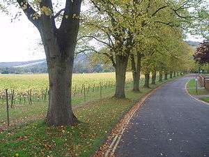
The Surrey Hills area has three long-distance walks running through it: the North Downs Way, the Greensand Way and the Pilgrims' Way. Blackheath Common is also part of this area.
The northern ridge of these hills, predominantly formed by chalk, is separated by the Vale of Holmesdale which continues into Kent from the southern ridges which are predominantly greensand. They provide a haven for rare plants and insects. Parts of the area are owned and managed by the National Trust, including Ranmore Common, Leith Hill and Box Hill.
Chiddingfold Forest, a Site of Special Scientific Interest (SSSI), lies within the area.
Surrey Hills AONB is surrounded by an Area of Great Landscape Value which covers a further 8% of the county.[3]
References
- ↑ Findlater G (2009). "The State of the Surrey Hills AONB". Surrey Hills AONB. Retrieved 21 March 2011.
- ↑ McKernan P (2007). "The cultural heritage of woodlands in the Surrey Hills AONB" (PDF). The cultural heritage of woodlands in the South East. Forestry Commission. Retrieved 26 March 2011.
- ↑ Rob Fairbanks (2008). "Area of Great Landscape Value Designation". Surrey Hills AONB. Retrieved 26 March 2011.
External links
Coordinates: 51°12′N 0°30′W / 51.2°N 0.5°W
| East of England |  | |
|---|---|---|
| East Midlands | ||
| North East | ||
| North West | ||
| South East | ||
| South West | ||
| West Midlands | ||
| Yorkshire and Humber | ||