Tablelands Region
| Tablelands Region Queensland | |||||||||||||
|---|---|---|---|---|---|---|---|---|---|---|---|---|---|
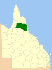 Location within Queensland, 2013, prior to de-amalgamation of Shire of Mareeba | |||||||||||||
| Population | 24,997 (2016)[1] | ||||||||||||
| • Density | 0.384575/km2 (0.996045/sq mi) | ||||||||||||
| Established | 2008 | ||||||||||||
| Area | 64,999 km2 (25,096.3 sq mi) | ||||||||||||
| Mayor | Joe Paronella | ||||||||||||
| Council seat | Atherton | ||||||||||||
| Region | Far North Queensland | ||||||||||||
| State electorate(s) | |||||||||||||
| Federal Division(s) | Kennedy | ||||||||||||
|
| |||||||||||||
| Website | Tablelands Region | ||||||||||||
| |||||||||||||
The Tablelands Region is a local government area in Far North Queensland, Australia inland from the city of Cairns. Established in 2008, it was preceded by four previous local government areas which dated back more than a century. On 1 January 2014, one of those local government areas, the Shire of Mareeba, was re-established independent of the Tablelands Region.
It has an estimated operating budget of A$62.2 million.
History
Prior to the 2008 amalgamation, the Tablelands Region consisted the entire area of four previous local government areas:
- the Shire of Atherton;
- the Shire of Eacham;
- the Shire of Herberton;
- and the Shire of Mareeba.
On 11 November 1879, when the Divisional Boards Act 1879 came into effect proclaiming 74 divisions around Queensland, the nature and distribution of the population in the Tablelands region was vastly different today. Most of the area was divided between the Hinchinbrook and Woothakata divisions. On 3 September 1881, Tinaroo Division was proclaimed from part of Hinchinbrook, making the mining towns of Tinaroo and Thornborough the administrative centres of the region.
A number of changes occurred from that point:
- 15 September 1888 – Formation of the Borough of Herberton to manage the town of Herberton
- 14 May 1889 – Walsh Division (Irvinebank) separated from Woothakata
- 20 December 1890 – Barron Division separated from Tinaroo
- 11 May 1895 – Herberton Division separated from Tinaroo; amalgamated the Borough
- 31 March 1903 – Under the Local Authorities Act 1902, Barron, Herberton, Tinaroo, Walsh and Woothakata became Shires.
- 16 December 1908 – Shire of Chillagoe formed from part of Woothakata
- 18 November 1910 – Shire of Eacham formed from part of Tinaroo
- 20 December 1919 – Shire of Barron abolished and divided between Mulgrave and Woothakata
- 1933 – Shires of Walsh and Chillagoe amalgamated into Woothakata
- 1935 – Shire of Tinaroo renamed Shire of Atherton
- 20 December 1947 – Shire of Woothakata renamed Shire of Mareeba
In July 2007, the Local Government Reform Commission released its report and recommended that the four areas amalgamate. Amongst its reasons given for this recommendation were that a community of interest revolved around the towns of Mareeba and Atherton, with residents travelling to Cairns for services not offered in the region. The opportunity for tourism and leisure promotion under a single banner, the close proximity of most major towns, the lack of natural barriers and similar economic interests including beef, dairy, fruit and sugar production. All councils opposed the amalgamation, although Atherton, Herberton and Eacham were willing to consider shared service delivery.[2] On 15 March 2008, the Shires formally ceased to exist, and elections were held on the same day to elect councillors and a to the Regional Council.
In 2012, a proposal was made to de-amalgamate the Shire of Mareeba from the Tablelands Region.[3] On 9 March 2013, the citizens of the former Mareeba shire voted in a referendum to de-amalgamate.[4] The Shire of Mareeba was re-established on 1 January 2014.[5][6]
Wards and councillors
Tablelands Regional Council consists of:[7][8][9]
- Joe Paronella
- Division 1 Councillor: Kate Eden
- Division 2 Councillor: Annette Haydon
- Division 3 Councillor: Anthony Ball
- Division 4 Councillor: Samantha Banks
- Division 5 Councillor: Katrina Spies
- Division 6 Councillor: Bronwyn Voyce
Towns and localities
The Tablelands Region includes the following settlements:
|
Atherton area: |
Eacham area:
|
Herberton area:
|
Others:
|
1 - shared with Cassowary Coast Region
2 - shared with Cairns Region and Cassowary Coast Region
Population
The populations given relate to the component entities prior to 2008. The next census, due in 2011, will be the first for the new Region.
| Year | Population (Region total) |
Population (Mareeba) |
Population (Atherton) |
Population (Herberton) |
Population (Eacham) |
|---|---|---|---|---|---|
| 1933 | 19,386 | 8,248 | 3,962 | 2,852 | 4,324 |
| 1947 | 17,585 | 6,312 | 4,335 | 3,198 | 3,740 |
| 1954 | 20,917 | 7,595 | 5,401 | 4,150 | 3,771 |
| 1961 | 23,675 | 10,212 | 5,806 | 3,815 | 3,842 |
| 1966 | 23,332 | 10,789 | 5,311 | 3,634 | 3,598 |
| 1971 | 24,367 | 11,676 | 5,638 | 3,726 | 3,327 |
| 1976 | 25,488 | 12,136 | 6,240 | 3,679 | 3,433 |
| 1981 | 29,329 | 14,003 | 7,501 | 3,688 | 4,137 |
| 1986 | 33,426 | 15,563 | 8,518 | 4,210 | 5,135 |
| 1991 | 36,816 | 17,129 | 9,518 | 4,560 | 5,609 |
| 1996 | 39,350 | 18,044 | 10,119 | 5,113 | 6,074 |
| 2001 | 39,629 | 17,961 | 10,509 | 5,083 | 6,076 |
| 2006 | 40,906 | 18,212 | 10,912 | 5,423 | 6,359 |
References
- ↑ "3218.0 – Regional Population Growth, Australia, 2014–15". Australian Bureau of Statistics. Retrieved 29 September 2016.
- ↑ Queensland Local Government Reform Commission (July 2007). Report of the Local Government Reform Commission (PDF). 2. pp. 310–314. ISBN 1-921057-11-4. Retrieved 3 June 2010.
- ↑ "Proposal to de-amalgamate Mareeba from the combined Tablelands Regional Council" (PDF). Retrieved 14 August 2013.
- ↑ "Mareeba Area De-amalgamation Poll – Mareeba – Poll Area Summary". Electoral Commission Queensland. Retrieved 14 August 2013.
- ↑ "De-amalgamation". Queensland Government. Retrieved 14 August 2013.
- ↑ "Local Government (De-amalgamation Implementation) Regulation 2013" (PDF). Local Government Act 2009. Queensland Government. Retrieved 14 August 2013.
- ↑ "Councillors - TRC - Tablelands Regional Council". TRC - Tablelands Regional Council. Retrieved 1 November 2016.
- ↑ "2016 Tablelands Regional Council - Mayoral Election - Election Summary". results.ecq.qld.gov.au. Retrieved 12 April 2016.
- ↑ "2016 Tablelands Regional Council - Councillor Election - Election Summary". results.ecq.qld.gov.au. Retrieved 12 April 2016.
Coordinates: 16°59′48″S 145°23′59″E / 16.99667°S 145.39972°E