Herberton, Queensland
| Herberton Queensland | |||||||||||||
|---|---|---|---|---|---|---|---|---|---|---|---|---|---|
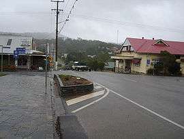 The main street of Herberton | |||||||||||||
 Herberton | |||||||||||||
| Coordinates | 17°23′S 145°23′E / 17.383°S 145.383°ECoordinates: 17°23′S 145°23′E / 17.383°S 145.383°E | ||||||||||||
| Population | 934 (2011 census)[1] | ||||||||||||
| Established | 1880 | ||||||||||||
| Postcode(s) | 4887 | ||||||||||||
| Elevation | 918 m (3,012 ft) | ||||||||||||
| LGA(s) | Tablelands Region | ||||||||||||
| State electorate(s) | Dalrymple | ||||||||||||
| Federal Division(s) | Kennedy | ||||||||||||
| |||||||||||||
| |||||||||||||
Herberton is a town and locality on the Atherton Tableland in Far North Queensland, Australia.[2][3] In the 2011 census, Herberton had a population of 934 people.[1]
History
The first European exploration of this area was undertaken in 1875 by James Venture Mulligan. Mulligan was prospecting for gold, but instead found tin . The town of Herberton was established on 19 April 1880 by John Newell to exploit the tin find, and mining began on 9 May. By the September of that year, Herberton had a population of 300 men and 27 women. Herberton Post Office opened on 22 November 1880.[4] In December 1881 a State School was established.

In the late 19th century the Mulligan Highway was carved through the hills from Herberton and passed through what is now Main Street, Atherton, before continuing down to Port Douglas. This road was used by the coaches of Cobb and Co to access Western Queensland.
At its apogee, Herberton was the richest tin mining field in Australia, and was home to 17 pubs, 2 local newspapers and a brewery.
Tin mining ceased in Herberton in 1978.
At the 2006 census, Herberton had a population of 974.[5]
Heritage listings
Herberton has a number of heritage-listed sites, including:
- 38 Broadway Street: Holy Trinity Anglican Church[6]
- Grace Street: Jack & Newell General Store[7]
- 61 Grace Street: Herberton School of Arts[8]
- off Jacks Road: Great Northern Mine[9]
- 2-4 Lillian Street: Herberton Uniting Church[10]
- Myers Street: Herberton War Memorial[11]
Geography and climate
Herberton is situated 918 m (3,012 ft) high on the Great Dividing Range south-west of Atherton. Vegetation ranges from tropical rainforest to the east, wet schlerophyl forests to the north and east and open schleorphyl forests and woodlands to the north and west.
Herberton is notably drier than the area around Atherton with average rainfall for Herberton of 1,155 mm (45.5 in).[12] Herberton is the most northerly location in Australia to have recorded a temperature at or below −5 °C (23 °F), and also the only location in Tropical North Queensland to have done so. The average minimum temperature ranges from 10 °C (50 °F) in winter to 18 °C (64 °F) in summer, while maximums range from 21 to 29 °C (70 to 84 °F).
| Climate data for Herberton | |||||||||||||
|---|---|---|---|---|---|---|---|---|---|---|---|---|---|
| Month | Jan | Feb | Mar | Apr | May | Jun | Jul | Aug | Sep | Oct | Nov | Dec | Year |
| Record high °C (°F) | 35.2 (95.4) |
35.2 (95.4) |
32.8 (91) |
33.0 (91.4) |
30.6 (87.1) |
31.1 (88) |
28.3 (82.9) |
31.7 (89.1) |
33.3 (91.9) |
35.7 (96.3) |
38.1 (100.6) |
36.7 (98.1) |
38.1 (100.6) |
| Average high °C (°F) | 28.0 (82.4) |
27.3 (81.1) |
26.3 (79.3) |
24.6 (76.3) |
22.9 (73.2) |
21.5 (70.7) |
21.4 (70.5) |
22.7 (72.9) |
24.9 (76.8) |
27.5 (81.5) |
28.6 (83.5) |
28.9 (84) |
25.4 (77.7) |
| Average low °C (°F) | 18.2 (64.8) |
18.3 (64.9) |
17.5 (63.5) |
15.6 (60.1) |
13.2 (55.8) |
10.6 (51.1) |
9.7 (49.5) |
10.1 (50.2) |
12.0 (53.6) |
14.3 (57.7) |
16.2 (61.2) |
17.5 (63.5) |
14.4 (57.9) |
| Record low °C (°F) | 9.5 (49.1) |
10.2 (50.4) |
8.9 (48) |
7.2 (45) |
−1.1 (30) |
−3.3 (26.1) |
−5.0 (23) |
−2.2 (28) |
0.6 (33.1) |
3.4 (38.1) |
8.3 (46.9) |
9.4 (48.9) |
−5.0 (23) |
| Average rainfall mm (inches) | 241.5 (9.508) |
233.2 (9.181) |
213.4 (8.402) |
83.4 (3.283) |
46.3 (1.823) |
32.9 (1.295) |
22.3 (0.878) |
17.8 (0.701) |
16.3 (0.642) |
26.6 (1.047) |
79.4 (3.126) |
139.6 (5.496) |
1,152.7 (45.382) |
| Average rainy days (≥ 0.2 mm) | 16.5 | 16.5 | 16.6 | 13.9 | 11.9 | 8.5 | 7.0 | 5.4 | 4.7 | 5.2 | 8.4 | 11.7 | 126.3 |
| Source: Bureau of Meteorology[13] | |||||||||||||
Industries
Several crops are grown around Herberton, and it is the location of Queensland's only tropical vineyard. Herberton is a mini salad bowl with crops including avocados, lettuce, tomatoes, maize and pumpkins . Poultry and beef industries are also present. Herberton's public hospital and the private school, Mt Saint Bernard residential college, are other major employers in the town.
Tourism and attractions
The Herberton Mining Museum and Visitor Information Centre [14] opened in 2005, and caters to the needs of the tourism industry. There are several caravan parks, hotels, motels and B&Bs located in the town. Herberton is the oldest town on the Atherton Tablelands and is often referred to as the Village in the Hills.
A Heritage Walk for tourists that takes in some of the old buildings and historical features of the town is a popular attraction. Herberton Historical Village is a 16-acre, re-creation of the town during the tin mining era, with exhibits such as vintage machinery, cars and Australian antiques. It has more than 50 restored period buildings.[15]
The Spy and Camera Museum houses antique spy cameras, a photographic gallery and photographic memorabilia with guided tours through the museum and a working photographer and photographic studio.
Most recently, a Railway Museum has been established by volunteers in the former Herberton Railway Station building. This is operated by volunteers and only open part-time.
The Tepon Equestrian Grounds [16] just out of Herberton have recently been upgraded with a large undercover pavilion for equestrian and other sporting events such as cycling and mountain biking. Local markets are held on the 3rd Sunday of every month at the Wondecla Oval.
Notable people
Notable people associated with Herberton include:
- Bunny Adair, Member of the Queensland Legislative Assembly for Cook who attended Herberton State School
References
- 1 2 Australian Bureau of Statistics (31 October 2012). "Herberton (SSC)". 2011 Census QuickStats. Retrieved 7 June 2016.
- ↑ "Herberton - town (entry 15767)". Queensland Place Names. Queensland Government. Retrieved 7 June 2016.
- ↑ "Herberton - locality (entry 48668)". Queensland Place Names. Queensland Government. Retrieved 7 June 2016.
- ↑ Premier Postal History. "Post Office List". Premier Postal Auctions. Retrieved 10 May 2014.
- ↑ Australian Bureau of Statistics (25 October 2007). "Herberton (L) (Urban Centre/Locality)". 2006 Census QuickStats. Retrieved 24 May 2011.
- ↑ "Holy Trinity Anglican Church (entry 600538)". Queensland Heritage Register. Queensland Heritage Council. Retrieved 14 July 2013.
- ↑ "Jack & Newell General Store & Petrol Bowser (former) (entry 600539)". Queensland Heritage Register. Queensland Heritage Council. Retrieved 14 July 2013.
- ↑ "Herberton School of Arts (entry 600540)". Queensland Heritage Register. Queensland Heritage Council. Retrieved 14 July 2013.
- ↑ "Great Northern Mine (Herberton) (entry 600542)". Queensland Heritage Register. Queensland Heritage Council. Retrieved 14 July 2013.
- ↑ "Herberton Uniting Church (entry 601788)". Queensland Heritage Register. Queensland Heritage Council. Retrieved 14 July 2013.
- ↑ "Herberton War Memorial (entry 600541)". Queensland Heritage Register. Queensland Heritage Council. Retrieved 14 July 2013.
- ↑ "Climate statistics for Australian locations".
- ↑ "HERBERTON MOWBRAY RD". Climate statistics for Australian locations. Bureau of Meteorology. March 2013. Retrieved 3 April 2013.
- ↑ "Mining Museum - Herberton". Archived from the original on 25 January 2014. Retrieved 7 June 2016.
- ↑ "Historic Village, Herberton". Herberton Historic Village. Retrieved 2 February 2014.
- ↑ "Tepon Equestrian Park". Retrieved 7 June 2016.